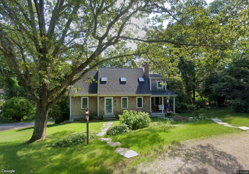
148 Kettle Hole Rd West Barnstable, MA 02668
West Barnstable NeighborhoodEstimated Value: $747,345 - $811,000
3
Beds
3
Baths
1,962
Sq Ft
$393/Sq Ft
Est. Value
About This Home
This home is located at 148 Kettle Hole Rd, West Barnstable, MA 02668 and is currently estimated at $770,336, approximately $392 per square foot. 148 Kettle Hole Rd is a home located in Barnstable County with nearby schools including West Barnstable Elementary School, Barnstable United Elementary School, and Barnstable Intermediate School.
Ownership History
Date
Name
Owned For
Owner Type
Purchase Details
Closed on
May 3, 2018
Sold by
Mcclelland-Nickerson M
Bought by
Bucell Michael R
Current Estimated Value
Home Financials for this Owner
Home Financials are based on the most recent Mortgage that was taken out on this home.
Original Mortgage
$75,000
Outstanding Balance
$54,821
Interest Rate
4.45%
Mortgage Type
Unknown
Estimated Equity
$715,515
Purchase Details
Closed on
Apr 19, 2016
Sold by
Nickerson Todd W and Nickerson Mcclelland-Nickerson M
Bought by
Mcclelland-Nickerson M
Home Financials for this Owner
Home Financials are based on the most recent Mortgage that was taken out on this home.
Original Mortgage
$285,000
Interest Rate
3.64%
Mortgage Type
New Conventional
Purchase Details
Closed on
Apr 20, 2001
Sold by
Ellis David R
Bought by
Mcclelland Megan
Purchase Details
Closed on
Sep 13, 1995
Sold by
Kabawat Salim E and Oconnell Ann E
Bought by
Ellis David R
Create a Home Valuation Report for This Property
The Home Valuation Report is an in-depth analysis detailing your home's value as well as a comparison with similar homes in the area
Home Values in the Area
Average Home Value in this Area
Purchase History
| Date | Buyer | Sale Price | Title Company |
|---|---|---|---|
| Bucell Michael R | -- | -- | |
| Mcclelland-Nickerson M | -- | -- | |
| Mcclelland Megan | $270,000 | -- | |
| Ellis David R | $130,000 | -- |
Source: Public Records
Mortgage History
| Date | Status | Borrower | Loan Amount |
|---|---|---|---|
| Open | Bucell Michael R | $75,000 | |
| Previous Owner | Mcclelland-Nickerson M | $285,000 | |
| Previous Owner | Ellis David R | $294,400 | |
| Previous Owner | Ellis David R | $10,000 |
Source: Public Records
Tax History Compared to Growth
Tax History
| Year | Tax Paid | Tax Assessment Tax Assessment Total Assessment is a certain percentage of the fair market value that is determined by local assessors to be the total taxable value of land and additions on the property. | Land | Improvement |
|---|---|---|---|---|
| 2025 | $5,971 | $639,300 | $205,300 | $434,000 |
| 2024 | $5,242 | $610,900 | $205,300 | $405,600 |
| 2023 | $5,123 | $562,400 | $203,100 | $359,300 |
| 2022 | $4,995 | $449,600 | $145,100 | $304,500 |
| 2021 | $4,776 | $407,500 | $145,100 | $262,400 |
| 2020 | $4,933 | $407,000 | $155,800 | $251,200 |
| 2019 | $4,648 | $378,500 | $155,800 | $222,700 |
| 2018 | $4,516 | $364,500 | $170,900 | $193,600 |
| 2017 | $4,348 | $355,200 | $170,900 | $184,300 |
| 2016 | $4,079 | $340,200 | $155,900 | $184,300 |
| 2015 | $4,033 | $337,200 | $154,800 | $182,400 |
Source: Public Records
Map
Nearby Homes
- 132 Kettle Hole Rd
- 164 Kettle Hole Rd
- 145 Kettle Hole Rd
- 131 Kettle Hole Rd
- 161 Kettle Hole Rd
- 114 Kettle Hole Rd
- 180 Kettle Hole Rd
- 180 Kettlehole Rd
- 113 Kettle Hole Rd
- 187 Kettle Hole Rd
- 57 Crocker Rd
- 97 Kettle Hole Rd
- 41 Crocker Rd
- 98 Kettle Hole Rd
- 196 Kettle Hole Rd
- 99 Crocker Rd
- 139 Crocker Rd
- 81 Kettle Hole Rd
- 21 Crocker Rd
- 82 Kettle Hole Rd