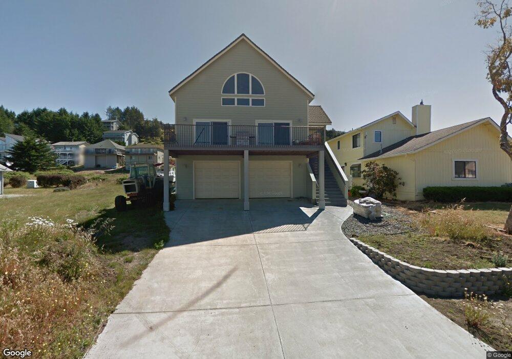
148 Sea View Rd Whitethorn, CA 95589
Shelter Cove NeighborhoodEstimated Value: $365,000 - $441,000
--
Bed
--
Bath
--
Sq Ft
5,576
Sq Ft Lot
About This Home
This home is located at 148 Sea View Rd, Whitethorn, CA 95589 and is currently estimated at $407,486. 148 Sea View Rd is a home located in Humboldt County.
Ownership History
Date
Name
Owned For
Owner Type
Purchase Details
Closed on
Sep 28, 2022
Sold by
Mann Joel and Mann Carlene C
Bought by
Mann Family Trust
Current Estimated Value
Purchase Details
Closed on
Apr 27, 2004
Sold by
Baker Kris V and Baker Mary E
Bought by
Mann Joel and Mann Carlene C
Purchase Details
Closed on
Oct 8, 2002
Sold by
Platt Alan D and Platt Janine
Bought by
Baker Kris V and Baker Mary E
Home Financials for this Owner
Home Financials are based on the most recent Mortgage that was taken out on this home.
Original Mortgage
$35,700
Interest Rate
5.95%
Mortgage Type
Seller Take Back
Purchase Details
Closed on
Oct 25, 2001
Sold by
Sorensen Dewey L and Sorensen Lola J
Bought by
Platt Alan D and Platt Janine
Purchase Details
Closed on
Dec 9, 1996
Sold by
Constant William L and Constant Virginia
Bought by
Sorensen Dewey L and Sorensen Lola J
Create a Home Valuation Report for This Property
The Home Valuation Report is an in-depth analysis detailing your home's value as well as a comparison with similar homes in the area
Home Values in the Area
Average Home Value in this Area
Purchase History
| Date | Buyer | Sale Price | Title Company |
|---|---|---|---|
| Mann Family Trust | -- | -- | |
| Mann Joel | $69,500 | Humboldt Land Title Company | |
| Baker Kris V | $42,000 | First American Title Ins Co | |
| Platt Alan D | $25,000 | Humboldt Land Title Company | |
| Sorensen Dewey L | $24,000 | -- |
Source: Public Records
Mortgage History
| Date | Status | Borrower | Loan Amount |
|---|---|---|---|
| Previous Owner | Baker Kris V | $35,700 |
Source: Public Records
Tax History Compared to Growth
Tax History
| Year | Tax Paid | Tax Assessment Tax Assessment Total Assessment is a certain percentage of the fair market value that is determined by local assessors to be the total taxable value of land and additions on the property. | Land | Improvement |
|---|---|---|---|---|
| 2025 | $4,119 | $361,217 | $98,804 | $262,413 |
| 2024 | $4,119 | $354,135 | $96,867 | $257,268 |
| 2023 | $4,135 | $347,192 | $94,968 | $252,224 |
| 2022 | $4,074 | $340,385 | $93,106 | $247,279 |
| 2021 | $3,927 | $333,712 | $91,281 | $242,431 |
| 2020 | $3,950 | $330,292 | $90,346 | $239,946 |
| 2019 | $3,856 | $323,817 | $88,575 | $235,242 |
| 2018 | $3,794 | $317,469 | $86,839 | $230,630 |
| 2017 | $3,626 | $311,245 | $85,137 | $226,108 |
| 2016 | $3,605 | $305,143 | $83,468 | $221,675 |
| 2015 | $3,587 | $300,561 | $82,215 | $218,346 |
| 2014 | $3,380 | $294,674 | $80,605 | $214,069 |
Source: Public Records
Map
Nearby Homes
- 235 Sea View Rd
- 371 Upper Pacific Dr
- 134 Sea View Rd
- 88 Shaker Rd
- 104 Sea View Rd
- 60 Spruce Rd
- 156 Shaker Rd
- 190 Shaker Rd
- 79 Sea View Rd
- 112 Seafoam Rd
- 1325&1335 Upper Pacific Dr
- 26 Rd
- 680 Lower Pacific Dr
- 58 Lower Pacific Dr
- 806 Lower Pacific Dr
- 16 Bambi Dr
- 76 Lower Pacific Dr
- 36 Bambi Dr
- 11 Sail Ct
- 37 Spur Ct
- 152 Sea View Rd
- 1115 Upper Pacific Dr
- 1141 Upper Pacific Dr
- 186 Sea View Rd
- 163 Sea View Rd
- 153 Sea View Rd
- 1105 Upper Pacific Dr
- 124 Sea View Rd
- 1133 Upper Pacific Dr
- 143 Sea View Rd
- 173 Sea View Rd
- 1151 Upper Pacific Dr
- 135 Sea View Rd
- 181 Sea View Rd
- 1181 Upper Pacific Dr
- 114 Sea View Rd
- 123 Sea View Rd
- 208 Sea View Rd
- 197 Sea View Rd
- 1077 Upper Pacific Dr