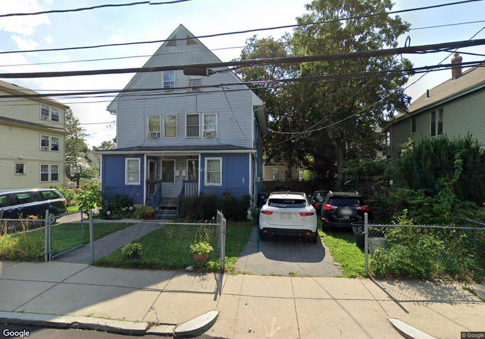
148 Whitfield St Dorchester Center, MA 02124
Codman Square NeighborhoodEstimated Value: $541,000 - $711,000
3
Beds
2
Baths
1,321
Sq Ft
$472/Sq Ft
Est. Value
About This Home
This home is located at 148 Whitfield St, Dorchester Center, MA 02124 and is currently estimated at $623,191, approximately $471 per square foot. 148 Whitfield St is a home located in Suffolk County with nearby schools including UP Academy Charter School of Dorchester and Codman Academy Charter Public School.
Ownership History
Date
Name
Owned For
Owner Type
Purchase Details
Closed on
Nov 4, 1991
Sold by
C & N Contracting Dev
Bought by
Olotu Eunice O
Current Estimated Value
Home Financials for this Owner
Home Financials are based on the most recent Mortgage that was taken out on this home.
Original Mortgage
$73,625
Interest Rate
8.9%
Mortgage Type
Purchase Money Mortgage
Create a Home Valuation Report for This Property
The Home Valuation Report is an in-depth analysis detailing your home's value as well as a comparison with similar homes in the area
Home Values in the Area
Average Home Value in this Area
Purchase History
| Date | Buyer | Sale Price | Title Company |
|---|---|---|---|
| Olotu Eunice O | $77,500 | -- |
Source: Public Records
Mortgage History
| Date | Status | Borrower | Loan Amount |
|---|---|---|---|
| Open | Olotu Eunice O | $100,000 | |
| Closed | Olotu Eunice O | $50,000 | |
| Closed | Olotu Eunice O | $101,500 | |
| Closed | Olotu Eunice O | $73,625 | |
| Closed | Olotu Eunice O | $12,662 |
Source: Public Records
Tax History Compared to Growth
Tax History
| Year | Tax Paid | Tax Assessment Tax Assessment Total Assessment is a certain percentage of the fair market value that is determined by local assessors to be the total taxable value of land and additions on the property. | Land | Improvement |
|---|---|---|---|---|
| 2025 | $7,510 | $648,500 | $171,400 | $477,100 |
| 2024 | $3,836 | $351,900 | $95,013 | $256,887 |
| 2023 | $3,599 | $335,100 | $90,477 | $244,623 |
| 2022 | $3,472 | $319,100 | $86,157 | $232,943 |
| 2021 | $3,243 | $303,900 | $0 | $303,900 |
| 2020 | $3,056 | $289,400 | $0 | $289,400 |
| 2019 | $2,905 | $275,600 | $84,400 | $191,200 |
| 2018 | $2,751 | $262,500 | $84,400 | $178,100 |
| 2017 | $2,648 | $250,000 | $84,400 | $165,600 |
| 2016 | $2,619 | $238,100 | $84,400 | $153,700 |
| 2015 | $2,747 | $226,800 | $83,300 | $143,500 |
| 2014 | $2,717 | $216,000 | $83,300 | $132,700 |
Source: Public Records
Map
Nearby Homes
- 92 Spencer St
- 146 Spencer St
- 10 Westcott St Unit 3
- 10 Westcott St Unit 1
- 45-45A Spencer St
- 23 Dunlap St
- 33 Kenberma Rd Unit 3
- 12 Spencer St
- 10 School St
- 19 Elmhurst St
- 15 Nightingale St
- 407 Washington St Unit 5
- 19 Nightingale St
- 72 Kingsdale St
- 10 Gaylord St
- 81 Kingsdale St
- 40 Elmont St Unit 2
- 61 Lyndhurst St Unit A
- 88 Wales St Unit 3
- 28 Melville Ave
- 144 Whitfield St
- 152 Whitfield St Unit 154
- 142 Whitfield St
- 158 Whitfield St
- 84 Spencer St
- 84 Spencer St Unit 2
- 80 Spencer St
- 140 Whitfield St
- 86 Spencer St Unit 2
- 88 Spencer St
- 145 Whitfield St
- 145 Whitfield St Unit 2
- 145 Whitfield St Unit 1
- 145 Whitfield St Unit 3
- 133-135 Whitfield St
- 133-135 Whitfield St Unit 1
- 133 Whitfield St Unit 135
- 78 Spencer St
- 139 Whitfield St
- 129 Whitfield St