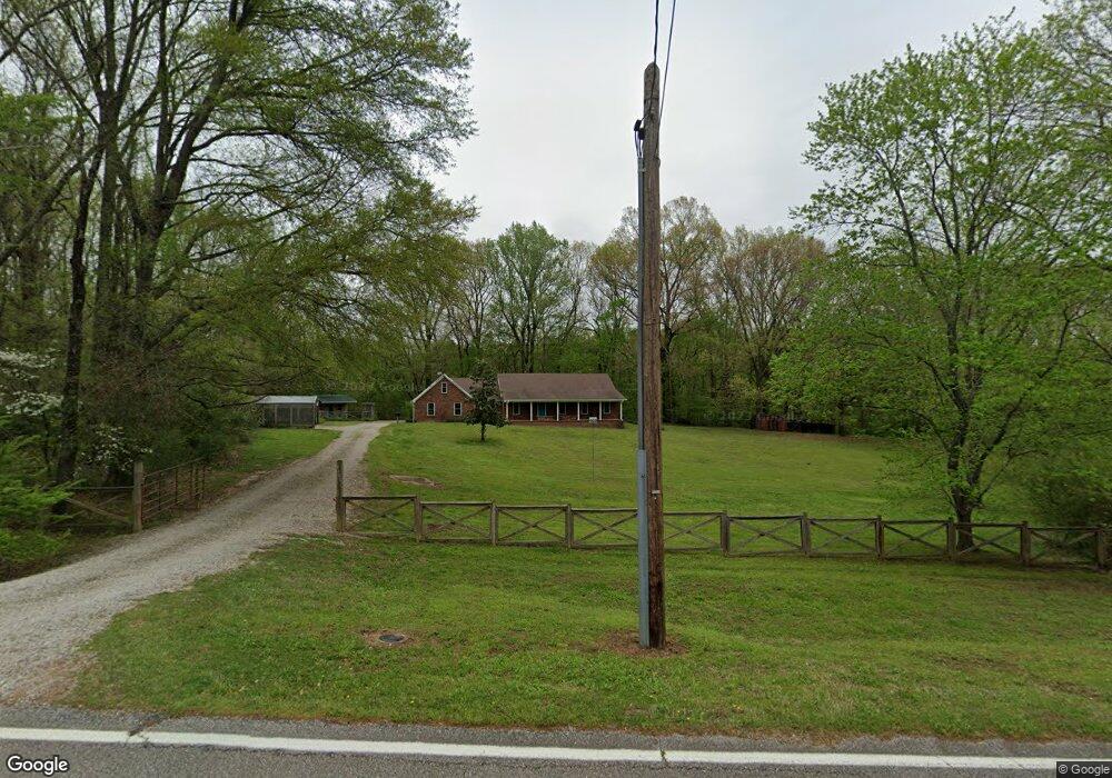
1480 Locke Rd Millington, TN 38053
Estimated Value: $366,000 - $412,000
3
Beds
2
Baths
2,476
Sq Ft
$155/Sq Ft
Est. Value
About This Home
This home is located at 1480 Locke Rd, Millington, TN 38053 and is currently estimated at $383,737, approximately $154 per square foot. 1480 Locke Rd is a home located in Shelby County with nearby schools including E.E. Jeter Elementary School and Trezevant High School.
Ownership History
Date
Name
Owned For
Owner Type
Purchase Details
Closed on
Oct 16, 2000
Sold by
Gingery Lee S and Gingery Janet A
Bought by
Berry Albert A and Berry Jo Ann
Current Estimated Value
Purchase Details
Closed on
Sep 30, 1997
Sold by
Cantrell Ray H and Cantrell Joan A
Bought by
Gingery Lee S and Gingery Janet A
Home Financials for this Owner
Home Financials are based on the most recent Mortgage that was taken out on this home.
Original Mortgage
$138,700
Interest Rate
4.75%
Create a Home Valuation Report for This Property
The Home Valuation Report is an in-depth analysis detailing your home's value as well as a comparison with similar homes in the area
Home Values in the Area
Average Home Value in this Area
Purchase History
| Date | Buyer | Sale Price | Title Company |
|---|---|---|---|
| Berry Albert A | $175,000 | -- | |
| Gingery Lee S | $146,000 | -- |
Source: Public Records
Mortgage History
| Date | Status | Borrower | Loan Amount |
|---|---|---|---|
| Previous Owner | Gingery Lee S | $138,700 |
Source: Public Records
Tax History Compared to Growth
Tax History
| Year | Tax Paid | Tax Assessment Tax Assessment Total Assessment is a certain percentage of the fair market value that is determined by local assessors to be the total taxable value of land and additions on the property. | Land | Improvement |
|---|---|---|---|---|
| 2025 | -- | $99,375 | $17,325 | $82,050 |
| 2024 | $2,449 | $72,250 | $15,200 | $57,050 |
| 2023 | $2,449 | $72,250 | $15,200 | $57,050 |
| 2022 | $2,449 | $72,250 | $15,200 | $57,050 |
| 2021 | $2,493 | $72,250 | $15,200 | $57,050 |
| 2020 | $2,077 | $51,275 | $13,825 | $37,450 |
| 2019 | $2,077 | $51,275 | $13,825 | $37,450 |
| 2018 | $2,077 | $51,275 | $13,825 | $37,450 |
| 2017 | $2,107 | $51,275 | $13,825 | $37,450 |
| 2016 | $2,111 | $48,300 | $0 | $0 |
| 2014 | $2,111 | $48,300 | $0 | $0 |
Source: Public Records
Map
Nearby Homes
- 0 N Watkins Unit 10203950
- 0 N Watkins Unit 10193620
- 6525 N Watkins Rd
- 1 Walsh Rd
- 1435 Walsh Cove
- 6770 Camp John Rd
- 1907 Campbell Rd
- 6234 Woodstock Cuba Rd
- 7441 Walsh Rd
- 6007 Island Forty Rd
- 6224 Benjestown Rd
- 6621 Benjestown Rd
- 5921 Benjestown Rd
- 7550 Woodstock Cuba Rd
- 2714 Moonview Rd
- 7265 Ward Rd
- 5387 Cornstalk Cove
- 5423 Breckenwood Dr
- 5371 Cedar Bluff Dr
- 7790 Deer Lake Dr
- 1450 Locke Rd
- 1446 Locke Rd
- 1485 Locke Rd
- 1461 Locke Rd
- 1426 Locke Rd
- 1515 Locke Rd
- 1415 Locke Rd
- 1398 Locke Rd
- 1421 Locke Rd
- 1521 Locke Rd
- 1395 Locke Rd
- 1527 Locke Rd
- 0 Locke Rd Unit 3140413
- 0 Locke Rd Unit 3238158
- 0 Locke Rd Unit 3259063
- 0 Locke Rd Unit 3280184
- 1380 Locke Rd
- 6590 N Watkins Rd
- 6550 N Watkins Rd
- 6520 N Watkins Rd