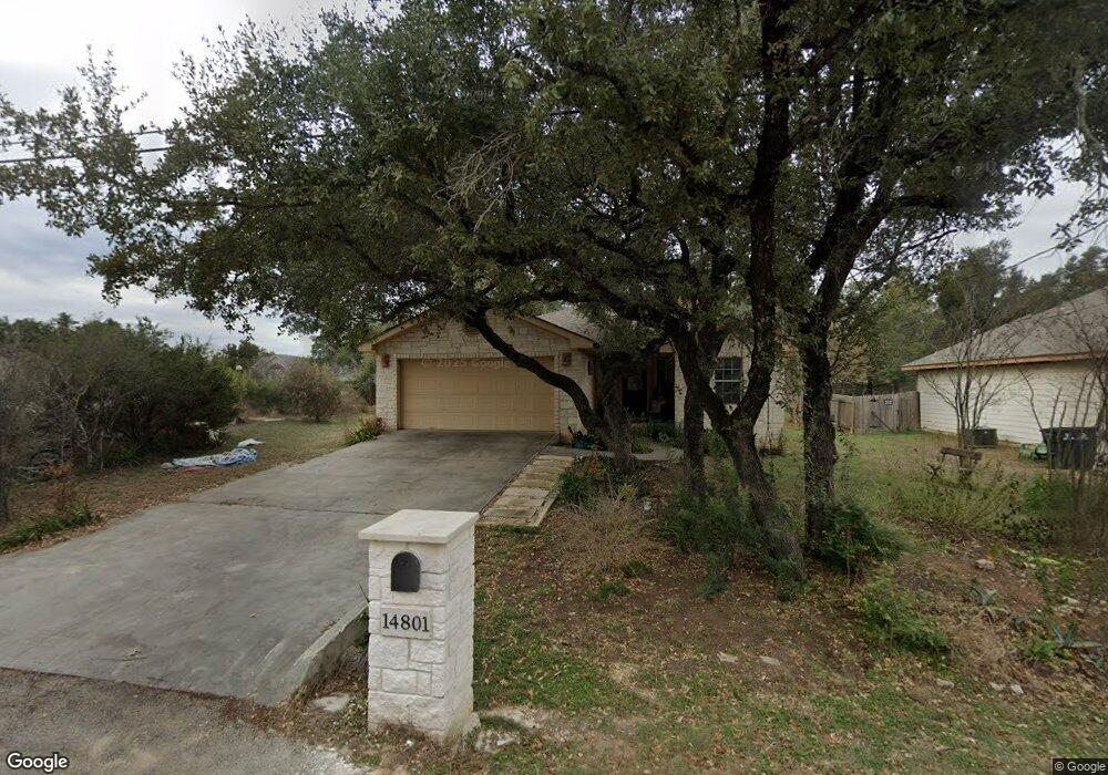
14801 Longbranch Dr Austin, TX 78734
Apache Shores NeighborhoodEstimated Value: $411,841 - $505,000
3
Beds
2
Baths
1,436
Sq Ft
$323/Sq Ft
Est. Value
About This Home
This home is located at 14801 Longbranch Dr, Austin, TX 78734 and is currently estimated at $463,460, approximately $322 per square foot. 14801 Longbranch Dr is a home located in Travis County with nearby schools including Lake Travis Elementary School, Hudson Bend Middle School, and Lake Travis High School.
Ownership History
Date
Name
Owned For
Owner Type
Purchase Details
Closed on
Apr 29, 2022
Sold by
Kellye Greene
Bought by
Scallon John Ferguson
Current Estimated Value
Home Financials for this Owner
Home Financials are based on the most recent Mortgage that was taken out on this home.
Original Mortgage
$245,000
Outstanding Balance
$232,429
Interest Rate
5.1%
Mortgage Type
Credit Line Revolving
Estimated Equity
$231,031
Purchase Details
Closed on
Aug 6, 2004
Sold by
Canyon Creek Homes Management Llc
Bought by
Green Kellye
Home Financials for this Owner
Home Financials are based on the most recent Mortgage that was taken out on this home.
Original Mortgage
$142,300
Interest Rate
6.26%
Mortgage Type
Purchase Money Mortgage
Purchase Details
Closed on
Mar 18, 2004
Sold by
Aus Tex Parts & Service Ltd
Bought by
Canyon Creek Homes Inc
Create a Home Valuation Report for This Property
The Home Valuation Report is an in-depth analysis detailing your home's value as well as a comparison with similar homes in the area
Home Values in the Area
Average Home Value in this Area
Purchase History
| Date | Buyer | Sale Price | Title Company |
|---|---|---|---|
| Scallon John Ferguson | -- | None Listed On Document | |
| Green Kellye | -- | Atc | |
| Canyon Creek Homes Inc | -- | Gracy Title |
Source: Public Records
Mortgage History
| Date | Status | Borrower | Loan Amount |
|---|---|---|---|
| Open | Scallon John Ferguson | $245,000 | |
| Previous Owner | Green Kellye | $142,300 |
Source: Public Records
Tax History Compared to Growth
Tax History
| Year | Tax Paid | Tax Assessment Tax Assessment Total Assessment is a certain percentage of the fair market value that is determined by local assessors to be the total taxable value of land and additions on the property. | Land | Improvement |
|---|---|---|---|---|
| 2025 | $3,963 | $400,200 | $154,743 | $245,457 |
| 2023 | $7,365 | $471,351 | $125,000 | $346,351 |
| 2022 | $5,477 | $319,208 | $0 | $0 |
| 2021 | $5,221 | $290,189 | $50,000 | $265,759 |
| 2020 | $5,045 | $263,808 | $30,000 | $233,808 |
| 2018 | $5,449 | $274,654 | $30,000 | $258,413 |
| 2017 | $4,998 | $249,685 | $30,000 | $221,001 |
| 2016 | $4,544 | $226,986 | $30,000 | $197,600 |
| 2015 | $2,997 | $206,351 | $52,500 | $153,851 |
| 2014 | $2,997 | $189,579 | $26,000 | $163,579 |
Source: Public Records
Map
Nearby Homes
- 14911 Longbranch Dr
- 1 Red Fox Rd
- 1400 Shawnee Cir
- 14603 Debba Dr
- 1401 Sharps Rd
- 14406 Tucumcari Trail
- 1505 Lance Rd
- 15101 Foy Dr
- 1201 Socorro Dr
- 14606 Branding Iron Pass
- 1809 Westward ho Trail
- 1809 Barney Dr
- 14208 Fort Smith Trail
- 14422 Tuscola Cir
- 14424 Tuscola Cir
- 14210 Fort Smith Trail
- 1608 Susan Dr
- 15202 Cavalier Canyon Dr
- 2012 Indian Creek Rd
- 1903 Red Fox Rd
- 14803 Longbranch Dr
- 14800 Foy Dr
- 14713 Longbranch Dr
- 14712 Foy Dr
- 14802 Foy Dr
- 14800 Longbranch Dr
- 14718 Longbranch Dr
- 14708 Foy Dr
- 14802 Longbranch Dr
- 14711 Longbranch Dr
- 14714 Longbranch Dr
- 0 Westward ho Trail Unit 8375634
- 14804 Longbranch Dr
- 14806 Longbranch Dr
- 14712 Longbranch Dr
- 14808 Foy Dr
- 14706 Foy Dr
- 14803 Debba Dr
- 14801 Debba Dr
- 14808 Longbranch Dr