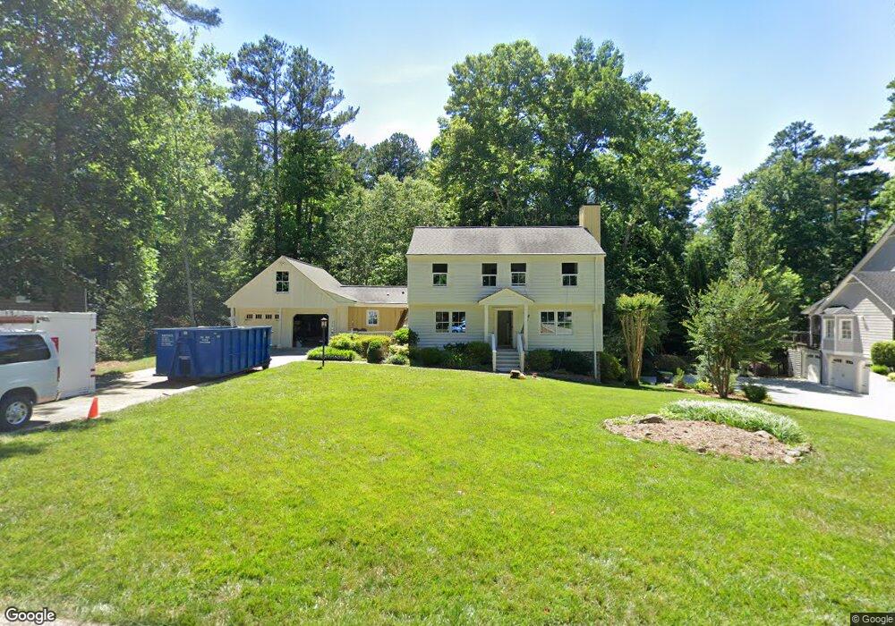
1481 E Bank Dr Unit 1 Marietta, GA 30068
Southeast Cobb NeighborhoodEstimated Value: $653,908 - $779,000
4
Beds
4
Baths
2,253
Sq Ft
$328/Sq Ft
Est. Value
About This Home
This home is located at 1481 E Bank Dr Unit 1, Marietta, GA 30068 and is currently estimated at $737,977, approximately $327 per square foot. 1481 E Bank Dr Unit 1 is a home located in Cobb County with nearby schools including Mount Bethel Elementary School, Dickerson Middle School, and Walton High School.
Ownership History
Date
Name
Owned For
Owner Type
Purchase Details
Closed on
Nov 15, 2002
Sold by
Moran Edward P and Moran Keelin M
Bought by
Davenport Jason C and Davenport Samantha S
Current Estimated Value
Home Financials for this Owner
Home Financials are based on the most recent Mortgage that was taken out on this home.
Original Mortgage
$238,500
Outstanding Balance
$101,012
Interest Rate
6.3%
Mortgage Type
New Conventional
Estimated Equity
$636,965
Purchase Details
Closed on
Dec 28, 1998
Sold by
Moran Edward P
Bought by
Moran Edward P
Home Financials for this Owner
Home Financials are based on the most recent Mortgage that was taken out on this home.
Original Mortgage
$144,000
Interest Rate
6.72%
Mortgage Type
New Conventional
Purchase Details
Closed on
Feb 27, 1996
Sold by
Mccullough Burton E Sarah A
Bought by
Maron Edward P and Bryne Keelin M
Create a Home Valuation Report for This Property
The Home Valuation Report is an in-depth analysis detailing your home's value as well as a comparison with similar homes in the area
Home Values in the Area
Average Home Value in this Area
Purchase History
| Date | Buyer | Sale Price | Title Company |
|---|---|---|---|
| Davenport Jason C | $299,000 | -- | |
| Moran Edward P | -- | -- | |
| Maron Edward P | $161,500 | -- |
Source: Public Records
Mortgage History
| Date | Status | Borrower | Loan Amount |
|---|---|---|---|
| Open | Davenport Jason C | $238,500 | |
| Previous Owner | Moran Edward P | $144,000 | |
| Closed | Maron Edward P | $0 |
Source: Public Records
Tax History Compared to Growth
Tax History
| Year | Tax Paid | Tax Assessment Tax Assessment Total Assessment is a certain percentage of the fair market value that is determined by local assessors to be the total taxable value of land and additions on the property. | Land | Improvement |
|---|---|---|---|---|
| 2025 | $6,103 | $262,292 | $60,000 | $202,292 |
| 2024 | $5,036 | $212,880 | $50,000 | $162,880 |
| 2023 | $4,183 | $198,552 | $42,000 | $156,552 |
| 2022 | $4,356 | $179,956 | $40,000 | $139,956 |
| 2021 | $3,890 | $158,660 | $36,000 | $122,660 |
| 2020 | $3,957 | $161,736 | $33,200 | $128,536 |
| 2019 | $3,957 | $161,736 | $33,200 | $128,536 |
| 2018 | $3,577 | $144,376 | $29,600 | $114,776 |
| 2017 | $3,470 | $144,376 | $29,600 | $114,776 |
| 2016 | $2,634 | $106,220 | $33,600 | $72,620 |
| 2015 | $2,694 | $106,220 | $33,600 | $72,620 |
| 2014 | $2,713 | $106,220 | $0 | $0 |
Source: Public Records
Map
Nearby Homes
- 1382 Huntingford Dr Unit 2
- 5184 Deering Trail Unit 2
- 5617 Asheforde Ln
- 889 Waterford Green
- 5473 Heyward Square Place
- 1731 E Bank Dr
- 5157 Forest Brook Pkwy
- 1720 Little Willeo Rd
- 5122 Sapphire Dr
- 1808 Jacksons Creek Dr
- 5140 Timber Ridge Rd
- 5122 Timber Ridge Rd
- 1500 Landeveis End
- 5228 Forest Brook Pkwy
- 1279 Colony Place
- 220 High Branch Way
- 1804 Shelburne Ridge
- 1487 E Bank Dr
- 1471 E Bank Dr Unit 1
- 1486 Waterford Ct Unit 46
- 1486 Waterford Ct
- 1486 Waterford Ct Unit 2
- 1461 E Bank Dr
- 1480 Waterford Ct
- 1493 E Bank Dr
- 1472 E Bank Dr Unit 1
- 1470 Waterford Ct Unit 2
- 1470 Waterford Ct
- 1490 Waterford Ct
- 1490 E Bank Dr
- 1451 E Bank Dr
- 1460 Waterford Ct
- 1500 Waterford Ct
- 1499 E Bank Dr
- 0 Waterford Ct Unit 8098890
- 0 Waterford Ct Unit 7304377
- 0 Waterford Ct Unit 9014791