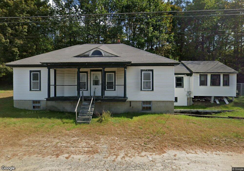
1481 Us Route 4 Danbury, NH 03230
Estimated Value: $253,511 - $365,000
3
Beds
1
Bath
1,275
Sq Ft
$249/Sq Ft
Est. Value
About This Home
This home is located at 1481 Us Route 4, Danbury, NH 03230 and is currently estimated at $316,878, approximately $248 per square foot. 1481 Us Route 4 is a home located in Merrimack County with nearby schools including Danbury Elementary School.
Ownership History
Date
Name
Owned For
Owner Type
Purchase Details
Closed on
Jan 12, 2021
Sold by
Michaud Alannah J and Michaud Jeffrey L
Bought by
Michaud Alannah J and Michaud Jeffrey L
Current Estimated Value
Home Financials for this Owner
Home Financials are based on the most recent Mortgage that was taken out on this home.
Original Mortgage
$154,052
Interest Rate
2.8%
Mortgage Type
FHA
Purchase Details
Closed on
May 3, 2004
Sold by
Powers Forrest W
Bought by
Michaud Jeffrey L and Michaud Kelleigh A
Home Financials for this Owner
Home Financials are based on the most recent Mortgage that was taken out on this home.
Original Mortgage
$139,850
Interest Rate
5.36%
Mortgage Type
Purchase Money Mortgage
Create a Home Valuation Report for This Property
The Home Valuation Report is an in-depth analysis detailing your home's value as well as a comparison with similar homes in the area
Home Values in the Area
Average Home Value in this Area
Purchase History
| Date | Buyer | Sale Price | Title Company |
|---|---|---|---|
| Michaud Alannah J | -- | None Available | |
| Michaud Alannah J | -- | None Available | |
| Michaud Jeffrey L | $141,000 | -- | |
| Michaud Jeffrey L | $141,000 | -- |
Source: Public Records
Mortgage History
| Date | Status | Borrower | Loan Amount |
|---|---|---|---|
| Previous Owner | Michaud Alannah J | $154,052 | |
| Previous Owner | Michaud Jeffrey L | $178,854 | |
| Previous Owner | Michaud Jeffrey L | $176,211 | |
| Previous Owner | Michaud Jeffrey L | $172,550 | |
| Previous Owner | Michaud Jeffrey L | $139,850 |
Source: Public Records
Tax History Compared to Growth
Tax History
| Year | Tax Paid | Tax Assessment Tax Assessment Total Assessment is a certain percentage of the fair market value that is determined by local assessors to be the total taxable value of land and additions on the property. | Land | Improvement |
|---|---|---|---|---|
| 2024 | $3,254 | $147,900 | $53,000 | $94,900 |
| 2023 | $2,958 | $147,900 | $53,000 | $94,900 |
| 2022 | $2,588 | $147,900 | $53,000 | $94,900 |
| 2021 | $2,662 | $147,900 | $53,000 | $94,900 |
| 2020 | $2,640 | $110,000 | $34,700 | $75,300 |
| 2019 | $2,640 | $110,000 | $34,700 | $75,300 |
| 2018 | $2,594 | $109,200 | $34,700 | $74,500 |
| 2016 | $2,512 | $109,200 | $34,700 | $74,500 |
| 2015 | $2,600 | $113,047 | $38,540 | $74,507 |
| 2010 | $2,861 | $152,570 | $75,240 | $77,330 |
Source: Public Records
Map
Nearby Homes
- 00 New Canada Rd Unit 7
- 375 New Canada Rd
- 658 N Wilmot Rd
- 62 Patterson Rd
- 0 Juniper Meadow Rd Unit 26
- 133 Nh Route 4a
- Lot 3 Kimpton Brook Rd
- 303 Route 4a
- 66 Phelps Ln
- 309 Waukeena Lake Rd
- 00 Ragged Mountain Rd Unit 3
- 221 Campground Rd
- Lot 16 Granite Hill Rd
- 18 Cilleyville Rd
- 20 Elmwood Trailer Park Rd
- 34 Courtland Dr
- Lot 8 Stone Bridge Rd
- 163 Quaker Path Rd
- 167 School Pond Rd
- 19 Ives
- 1493 Us Route 4
- 1493 Us Route 4
- 1477 Us Route 4
- 1480 Us Route 4
- 1510 Us Route 4
- 1510 Route 4
- 1510 Us Route 4
- 1445 Us Route 4
- 0 US Route 4 Unit Lots 33 & 41 4713026
- 0 US Route 4
- 0 US Route 4 Unit Lots 41 and 33
- 0 US Route 4 Unit 4423443
- 0 US Route 4 Unit 4229883
- 1516 Us Route 4
- 1438 Us Route 4
- 1438 Us Route 4
- 1438 Us Route 4
- 1438 U S 4
- 15 Challenge Hill Rd
- 38 Challenge Hill Rd