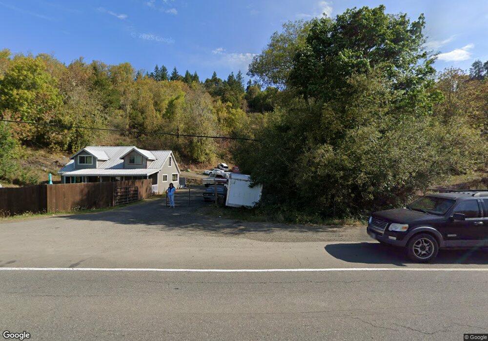
14821 Highway 42 Myrtle Point, OR 97458
Estimated Value: $453,000
3
Beds
2
Baths
1,240
Sq Ft
$365/Sq Ft
Est. Value
About This Home
This home is located at 14821 Highway 42, Myrtle Point, OR 97458 and is currently estimated at $453,000, approximately $365 per square foot. 14821 Highway 42 is a home located in Coos County with nearby schools including Myrtle Crest School and Myrtle Point High School.
Ownership History
Date
Name
Owned For
Owner Type
Purchase Details
Closed on
Jun 6, 2013
Sold by
U S Bank National Association
Bought by
Woodall Ryan S
Current Estimated Value
Home Financials for this Owner
Home Financials are based on the most recent Mortgage that was taken out on this home.
Original Mortgage
$98,265
Outstanding Balance
$69,047
Interest Rate
3.37%
Mortgage Type
New Conventional
Estimated Equity
$383,953
Purchase Details
Closed on
Mar 7, 2008
Sold by
Haworth Sonya Jolene
Bought by
Haworth Sonya J and Sanders Kari L
Home Financials for this Owner
Home Financials are based on the most recent Mortgage that was taken out on this home.
Original Mortgage
$193,800
Interest Rate
5.72%
Mortgage Type
New Conventional
Create a Home Valuation Report for This Property
The Home Valuation Report is an in-depth analysis detailing your home's value as well as a comparison with similar homes in the area
Home Values in the Area
Average Home Value in this Area
Purchase History
| Date | Buyer | Sale Price | Title Company |
|---|---|---|---|
| Woodall Ryan S | $96,300 | First American Title | |
| Haworth Sonya J | -- | None Available |
Source: Public Records
Mortgage History
| Date | Status | Borrower | Loan Amount |
|---|---|---|---|
| Open | Woodall Ryan S | $98,265 | |
| Previous Owner | Haworth Sonya J | $193,800 |
Source: Public Records
Tax History Compared to Growth
Tax History
| Year | Tax Paid | Tax Assessment Tax Assessment Total Assessment is a certain percentage of the fair market value that is determined by local assessors to be the total taxable value of land and additions on the property. | Land | Improvement |
|---|---|---|---|---|
| 2025 | $1,424 | $139,900 | -- | -- |
| 2024 | $1,403 | $135,830 | -- | -- |
| 2023 | $1,325 | $131,880 | $0 | $0 |
| 2022 | $1,318 | $128,040 | $0 | $0 |
| 2021 | $1,289 | $124,320 | $0 | $0 |
| 2020 | $1,256 | $124,320 | $0 | $0 |
| 2019 | $1,192 | $117,190 | $0 | $0 |
| 2018 | $1,176 | $113,780 | $0 | $0 |
| 2017 | $1,150 | $110,470 | $0 | $0 |
| 2016 | $1,119 | $107,260 | $0 | $0 |
| 2015 | $948 | $104,140 | $0 | $0 |
| 2014 | $948 | $101,110 | $0 | $0 |
Source: Public Records
Map
Nearby Homes
- 1985 Roseburg Rd
- 1753 20th St
- 1715 20th St
- 2047 Roseburg Rd
- 1893 Sunset Ln
- 1861 View St
- 1783 View St
- 1938 Maryland Ave
- 15779 Oregon 42
- 1434 Maryland Ave
- 1873 E Cedar St
- 1314 Bothwick St
- 1404 Harris St
- 92433 Ward Creek Ln
- 1829 E Willow St
- 805 C St
- 1713 Maple St
- 1627 Maple St
- 1311 Willow St
- 655 6th St
- 14821 Highway 42
- 14821 Highway 42
- 14821 Highway 42
- 14980 Oregon 42
- 95601 Guerin Ln
- 95623 Guerin Ln
- 14982 Oregon 42
- 14982 Highway 42
- 53030 Old Broadbent Rd
- 52887 Old Broadbent Rd
- 52962 Old Broadbent Rd
- 52906 Old Broadbent Rd
- 52904 Old Broadbent Rd
- 52842 Old Broadbent Rd
- 51476 Hwy 242
- 52816 Old Broadbent Rd
- 2127 Roseburg Rd
- 2520 Kincheloe Ln
- 2121 Roseburg Rd
- 2119 Roseburg Rd