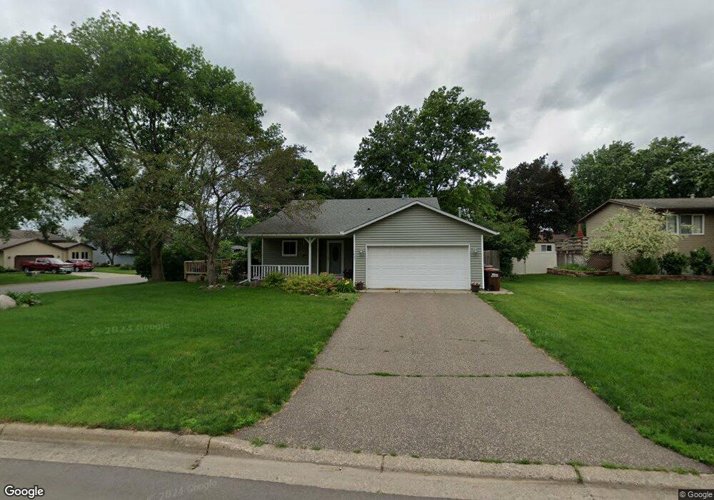
1483 Laurel Ave Saint Paul Park, MN 55071
Estimated Value: $320,885 - $356,000
3
Beds
2
Baths
1,416
Sq Ft
$241/Sq Ft
Est. Value
About This Home
This home is located at 1483 Laurel Ave, Saint Paul Park, MN 55071 and is currently estimated at $340,721, approximately $240 per square foot. 1483 Laurel Ave is a home located in Washington County with nearby schools including Pullman Elementary School, Oltman Middle School, and Park Senior High School.
Ownership History
Date
Name
Owned For
Owner Type
Purchase Details
Closed on
Jul 27, 2020
Sold by
Pierce Douglas Lane
Bought by
Pierce Douglas Lane and Linton Melissa Jane
Current Estimated Value
Purchase Details
Closed on
Jan 8, 2016
Sold by
Lee Matthew C and Lee Lisa L
Bought by
Pierce Douglas
Home Financials for this Owner
Home Financials are based on the most recent Mortgage that was taken out on this home.
Original Mortgage
$164,000
Outstanding Balance
$67,311
Interest Rate
3.14%
Mortgage Type
New Conventional
Estimated Equity
$273,410
Purchase Details
Closed on
Jun 16, 2006
Sold by
Schlicht Jason R and Schlicht Erika L
Bought by
Lee Matthew C and Noble Lisa L
Purchase Details
Closed on
Jun 29, 2000
Sold by
Christensen Paul E and Christensen Kelly J
Bought by
Schlicht Jason R and Schlicht Erika L
Create a Home Valuation Report for This Property
The Home Valuation Report is an in-depth analysis detailing your home's value as well as a comparison with similar homes in the area
Home Values in the Area
Average Home Value in this Area
Purchase History
| Date | Buyer | Sale Price | Title Company |
|---|---|---|---|
| Pierce Douglas Lane | -- | None Available | |
| Pierce Douglas | $205,000 | Partners Title | |
| Lee Matthew C | $224,900 | -- | |
| Schlicht Jason R | $152,000 | -- |
Source: Public Records
Mortgage History
| Date | Status | Borrower | Loan Amount |
|---|---|---|---|
| Open | Pierce Douglas | $164,000 |
Source: Public Records
Tax History
| Year | Tax Paid | Tax Assessment Tax Assessment Total Assessment is a certain percentage of the fair market value that is determined by local assessors to be the total taxable value of land and additions on the property. | Land | Improvement |
|---|---|---|---|---|
| 2024 | $4,402 | $307,800 | $90,000 | $217,800 |
| 2023 | $4,176 | $310,400 | $98,000 | $212,400 |
| 2022 | $3,338 | $297,200 | $97,900 | $199,300 |
| 2021 | $3,162 | $247,400 | $81,500 | $165,900 |
| 2020 | $3,060 | $239,100 | $81,500 | $157,600 |
| 2019 | $2,964 | $229,100 | $68,000 | $161,100 |
| 2018 | $2,928 | $210,600 | $63,000 | $147,600 |
| 2017 | $2,722 | $207,900 | $73,000 | $134,900 |
| 2016 | $2,558 | $198,900 | $65,000 | $133,900 |
| 2015 | $2,370 | $165,600 | $48,900 | $116,700 |
| 2013 | -- | $134,800 | $38,800 | $96,000 |
Source: Public Records
Map
Nearby Homes
- 1249 Gary Dr
- 1455 Dixon Dr
- 1118 Selby Ave
- 8382 Granada Ave S
- 1144 Marshall Ave
- 10520 Goodview Ave S
- 10538 Goodview Ave S
- 8622 Granada Ave S
- 1120 3rd St
- 900 Laurel Ave
- 8603 Greystone Ave S
- 8735 Greystone Ave S
- 801 Summit Ave
- 26 River Woods Dr W
- 201 9th Ave
- 932 Main St
- 9176 Granada Ave S
- 6815 91st St S
- 6935 91st Cove S
- TBD Broadway Ave
- 1477 Laurel Ave
- 1484 Ashland Ave
- 1478 Ashland Ave
- 1471 Laurel Ave
- 1132 Gary Dr
- 1116 Gary Dr
- 1148 Gary Dr
- 1484 Laurel Ave
- 1472 Ashland Ave
- 1478 Laurel Ave
- 1100 Gary Dr
- 1100 Gary Dr
- 1164 Gary Dr
- 1465 Laurel Ave
- 1472 Laurel Ave
- 1466 Ashland Ave
- 1155 Lincoln Ct
- 1180 Gary Dr
- 1483 Ashland Ave
- 1510 Ashland Ave
Your Personal Tour Guide
Ask me questions while you tour the home.