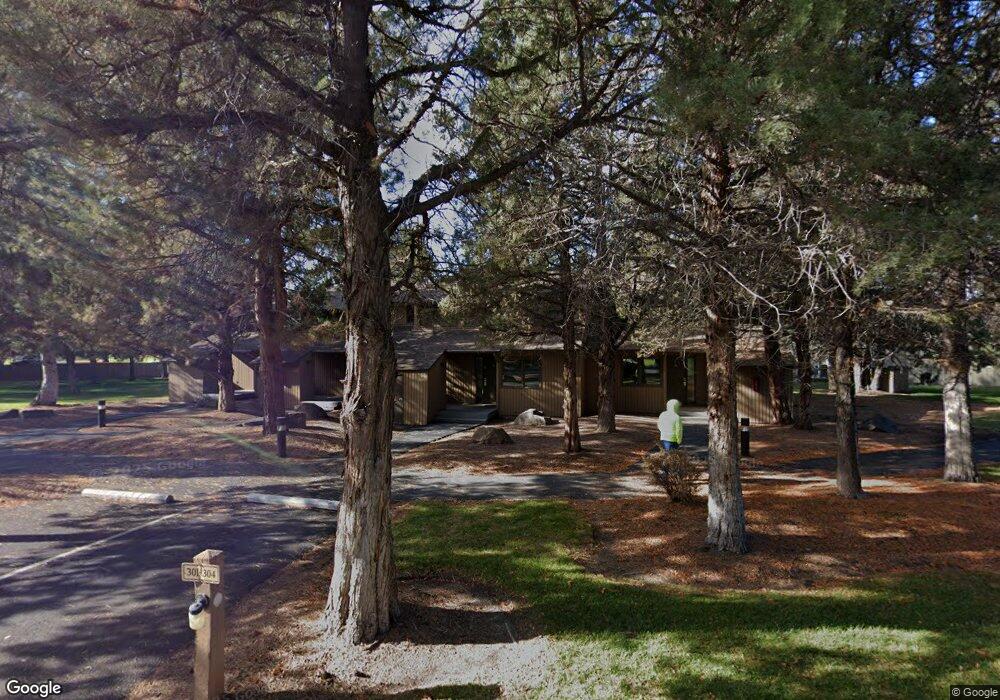
1483 Swallow Ln Redmond, OR 97756
Estimated Value: $466,000 - $1,058,000
2
Beds
2
Baths
1,168
Sq Ft
$652/Sq Ft
Est. Value
About This Home
This home is located at 1483 Swallow Ln, Redmond, OR 97756 and is currently estimated at $762,000, approximately $652 per square foot. 1483 Swallow Ln is a home located in Deschutes County with nearby schools including Tumalo Community School, Obsidian Middle School, and Ridgeview High School.
Ownership History
Date
Name
Owned For
Owner Type
Purchase Details
Closed on
Jul 2, 2025
Sold by
Arkin Lisa Codman and Codman Karen
Bought by
Lisa C Arkin Trust and Arkin
Current Estimated Value
Purchase Details
Closed on
Oct 18, 2018
Sold by
Jabusch Steven and Jabusch Lillian
Bought by
Jabusch Steven E and Jabusch Lillian P
Purchase Details
Closed on
Sep 17, 2018
Sold by
Simmons Jerald N and Simmons Verlinda
Bought by
Simmons Jerald N and Simmons Verlinda
Purchase Details
Closed on
May 29, 2018
Sold by
Carpenter Ronald G and Carpenter Marilyn M
Bought by
Marilyn Carpenter Family Trust and Carpenter Ronald Gene
Purchase Details
Closed on
Sep 26, 2012
Sold by
Tabler James L and Tabler Brenda J
Bought by
Maul Jerry Lee and Maul Sonja Tabler
Purchase Details
Closed on
Jan 7, 2011
Sold by
Chilcote Ann C
Bought by
Chilcote Ann C and Chilcote Revocable Living Trust
Purchase Details
Closed on
Mar 4, 2004
Sold by
Eberhard Creamery Inc
Bought by
Nol Chem Corp
Create a Home Valuation Report for This Property
The Home Valuation Report is an in-depth analysis detailing your home's value as well as a comparison with similar homes in the area
Home Values in the Area
Average Home Value in this Area
Purchase History
| Date | Buyer | Sale Price | Title Company |
|---|---|---|---|
| Lisa C Arkin Trust | -- | None Listed On Document | |
| Jabusch Steven E | -- | None Available | |
| Simmons Jerald N | -- | None Available | |
| Marilyn Carpenter Family Trust | -- | None Available | |
| Maul Jerry Lee | -- | None Available | |
| Chilcote Ann C | -- | None Available | |
| Nol Chem Corp | $2,500 | Amerititle |
Source: Public Records
Tax History Compared to Growth
Tax History
| Year | Tax Paid | Tax Assessment Tax Assessment Total Assessment is a certain percentage of the fair market value that is determined by local assessors to be the total taxable value of land and additions on the property. | Land | Improvement |
|---|---|---|---|---|
| 2025 | $15,927 | $941,830 | -- | -- |
| 2024 | $15,225 | $914,400 | -- | -- |
| 2023 | $14,513 | $887,770 | $0 | $0 |
| 2022 | $13,321 | $836,820 | $0 | $0 |
| 2021 | $12,919 | $812,450 | $0 | $0 |
| 2020 | $12,293 | $812,450 | $0 | $0 |
| 2019 | $11,720 | $788,790 | $0 | $0 |
| 2018 | $11,438 | $765,820 | $0 | $0 |
| 2017 | $10,698 | $743,520 | $0 | $0 |
| 2016 | $10,516 | $721,870 | $0 | $0 |
| 2015 | $9,089 | $625,280 | $0 | $0 |
| 2014 | $8,699 | $596,530 | $0 | $0 |
Source: Public Records
Map
Nearby Homes
- 1824 Redtail Hawk Dr Unit RV61F
- 1830 Redtail Hawk Dr Unit RV59J
- 1830 Redtail Hawk Dr Unit RV59E
- 1836 Redtail Hawk Dr Unit RV57G
- 1850 Redtail Hawk Dr Unit RV53K
- 1850 Redtail Hawk Dr Unit RV53B
- 1856 Redtail Hawk Dr Unit RVVE 51-H
- 1916 Redtail Hawk Dr Unit RV45B
- 1936 Redtail Hawk Dr Unit RV39A
- 1930 Redtail Hawk Dr Unit 41-J
- 6822 Thunderbird Ct
- 1974 Redtail Hawk Dr Unit RV23C
- 1978 Redtail Hawk Dr Unit 21 I
- 1987 Redtail Hawk Dr Unit RV16C
- 1986 Redtail Hawk Dr Unit RV 17-I
- 1990 Redtail Hawk Dr Unit RV15E
- 2200 Snowgoose Dr Unit RV1E
- 2250 Snowgoose Dr Unit RV4E
- 1927 Mountain Quail Dr
- 5755 SW Obsidian Ave
- 0 Blue Heron Dr
- 1570 Blue Heron Dr
- 1673 Red Tail Hawk Dr
- 1620 Blue Heron Dr
- 1620 NW Blue Heron
- 1701 Redtail Hawk Dr
- 1730 Blue Heron Dr
- 1270 Blue Heron Dr
- 1094 Redtail Hawk Dr Unit RV49F
- 1250 Blue Heron Dr
- 6890 Robin Ct
- 6888 Robin Ct
- 6888 Robin Ct Unit 14
- 6886 Robin Ct
- 1170 Swallow Ln Unit 1605
- 1170 Swallow Ln
- 6884 Robin Ct Unit 16D5
- 6884 Robin Ct Unit 16
- 6901 Robin Ct Unit 12
- 6901 Robin Ct