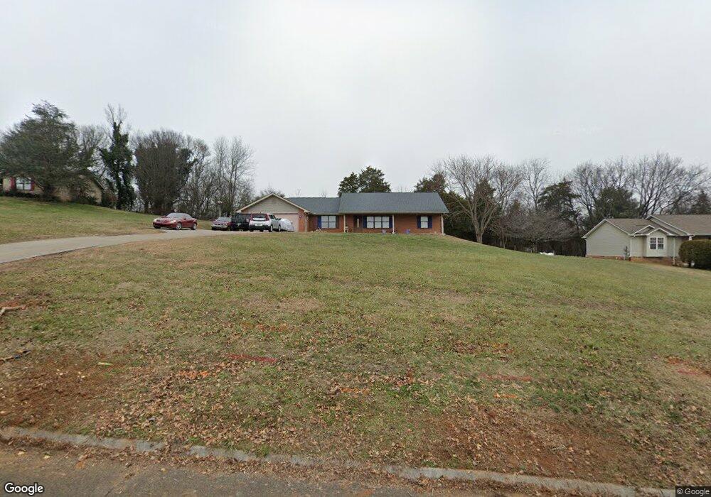
1485 Double d Dr Sevierville, TN 37876
Estimated Value: $359,583 - $400,000
--
Bed
2
Baths
1,675
Sq Ft
$227/Sq Ft
Est. Value
About This Home
This home is located at 1485 Double d Dr, Sevierville, TN 37876 and is currently estimated at $379,792, approximately $226 per square foot. 1485 Double d Dr is a home located in Sevier County with nearby schools including Northview Elementary School, Catons Chapel Elementary School, and Jones Cove Elementary School.
Ownership History
Date
Name
Owned For
Owner Type
Purchase Details
Closed on
Feb 24, 2014
Sold by
Parsons John A
Bought by
Parsons John
Current Estimated Value
Home Financials for this Owner
Home Financials are based on the most recent Mortgage that was taken out on this home.
Original Mortgage
$146,000
Outstanding Balance
$111,040
Interest Rate
4.43%
Mortgage Type
New Conventional
Estimated Equity
$268,752
Purchase Details
Closed on
Aug 12, 2003
Sold by
Herschend Family Entertain
Bought by
Parsons John A
Home Financials for this Owner
Home Financials are based on the most recent Mortgage that was taken out on this home.
Original Mortgage
$147,750
Interest Rate
5.52%
Purchase Details
Closed on
May 15, 2003
Sold by
Gunnels Michael D
Bought by
Herschend Family Entertainment
Purchase Details
Closed on
Sep 25, 1997
Sold by
Bill Wolar and Bill Terry D
Bought by
Gunnels Michael D
Purchase Details
Closed on
Mar 11, 1996
Bought by
Wolar Bill and Wolar Terry D
Create a Home Valuation Report for This Property
The Home Valuation Report is an in-depth analysis detailing your home's value as well as a comparison with similar homes in the area
Home Values in the Area
Average Home Value in this Area
Purchase History
| Date | Buyer | Sale Price | Title Company |
|---|---|---|---|
| Parsons John | -- | -- | |
| Parsons John A | $155,578 | -- | |
| Herschend Family Entertainment | $151,512 | -- | |
| Gunnels Michael D | $122,500 | -- | |
| Wolar Bill | $23,500 | -- |
Source: Public Records
Mortgage History
| Date | Status | Borrower | Loan Amount |
|---|---|---|---|
| Open | Parsons John | $146,000 | |
| Previous Owner | Wolar Bill | $147,750 |
Source: Public Records
Tax History Compared to Growth
Tax History
| Year | Tax Paid | Tax Assessment Tax Assessment Total Assessment is a certain percentage of the fair market value that is determined by local assessors to be the total taxable value of land and additions on the property. | Land | Improvement |
|---|---|---|---|---|
| 2025 | $821 | $55,475 | $8,750 | $46,725 |
| 2024 | $821 | $55,475 | $8,750 | $46,725 |
| 2023 | $821 | $55,475 | $0 | $0 |
| 2022 | $821 | $55,475 | $8,750 | $46,725 |
| 2021 | $821 | $55,475 | $8,750 | $46,725 |
| 2020 | $837 | $55,475 | $8,750 | $46,725 |
| 2019 | $837 | $44,975 | $8,750 | $36,225 |
| 2018 | $837 | $44,975 | $8,750 | $36,225 |
| 2017 | $837 | $44,975 | $8,750 | $36,225 |
| 2016 | $837 | $44,975 | $8,750 | $36,225 |
| 2015 | -- | $45,725 | $0 | $0 |
| 2014 | $745 | $45,733 | $0 | $0 |
Source: Public Records
Map
Nearby Homes
- 2115 Bradley Ln
- 1912 Smokey High Ln
- 1474 Broadview Cir
- 1923 Big Chiefs Skyview Dr
- Lot 14A Audley Dr
- 2102 Kings View Loop
- 2050 Kings View Loop
- 0 Highpoint Dr Unit 1250528
- 2067 Highpoint Ln
- 2045 Kings View Loop
- 1870 Big Buck Ln
- 1861 Big Buck Ln
- 1761 Rays Gap Rd
- 2216 French Broad River Rd
- 2159 Frewin Ct
- 1418 Rippling Waters Cir
- 1283 Lori Ellen Ct
- 1283 Lori Ellen Ct Unit 21
- 2634 Hawthorne Dr
- 0 Bobbie Jean Ln Unit 1303758
- 1489 Double d Dr
- 1481 Double d Dr
- 1486 Double d Dr
- 1490 Double d Dr
- 1501 Double d Dr
- 1478 Double d Dr
- 1477 Double d Dr
- 1470 Double d Dr
- 1473 Double d Dr
- 2139 Bradley Ln
- 1509 Double d Dr
- 2148 Bradley Ln
- 2129 Bradley Ln
- 1469 Double d Dr
- 1464 Double d Dr
- 2127 Bradley Ln
- 1515 Double d Dr
- 1465 Double d Dr
- 2230 Linn View Dr
- 2138 Bradley Ln