1485 Maxwell Ct Lansdale, PA 19446
Estimated Value: $826,515 - $1,036,000
4
Beds
3
Baths
3,964
Sq Ft
$230/Sq Ft
Est. Value
About This Home
This home is located at 1485 Maxwell Ct, Lansdale, PA 19446 and is currently estimated at $910,629, approximately $229 per square foot. 1485 Maxwell Ct is a home located in Montgomery County with nearby schools including Walton Farm El School, Pennfield Middle School, and North Penn Senior High School.
Ownership History
Date
Name
Owned For
Owner Type
Purchase Details
Closed on
Aug 8, 2008
Sold by
Nv Homes
Bought by
Chandy Betty and Mathew Leny
Current Estimated Value
Home Financials for this Owner
Home Financials are based on the most recent Mortgage that was taken out on this home.
Original Mortgage
$75,000
Interest Rate
6.4%
Purchase Details
Closed on
Apr 23, 2008
Sold by
Heckler John
Bought by
Nvhomes and Nvr Inc
Create a Home Valuation Report for This Property
The Home Valuation Report is an in-depth analysis detailing your home's value as well as a comparison with similar homes in the area
Home Values in the Area
Average Home Value in this Area
Purchase History
| Date | Buyer | Sale Price | Title Company |
|---|---|---|---|
| Chandy Betty | $644,450 | None Available | |
| Nvhomes | $156,729 | None Available |
Source: Public Records
Mortgage History
| Date | Status | Borrower | Loan Amount |
|---|---|---|---|
| Open | Mathew Leny | $200,000 | |
| Closed | Mathew Mean Leny | $200,000 | |
| Closed | Mathew Leny | $200,000 | |
| Closed | Mathew Leny | $150,000 | |
| Closed | Chandy Betty | $75,000 |
Source: Public Records
Tax History Compared to Growth
Tax History
| Year | Tax Paid | Tax Assessment Tax Assessment Total Assessment is a certain percentage of the fair market value that is determined by local assessors to be the total taxable value of land and additions on the property. | Land | Improvement |
|---|---|---|---|---|
| 2024 | $11,756 | $290,250 | -- | -- |
| 2023 | $11,258 | $290,250 | $0 | $0 |
| 2022 | $10,567 | $290,250 | $0 | $0 |
| 2021 | $10,262 | $290,250 | $0 | $0 |
| 2020 | $9,797 | $290,250 | $0 | $0 |
| 2019 | $9,626 | $290,250 | $0 | $0 |
| 2018 | $2,051 | $290,250 | $0 | $0 |
| 2017 | $9,243 | $290,250 | $0 | $0 |
| 2016 | $9,130 | $290,250 | $0 | $0 |
| 2015 | $8,749 | $290,250 | $0 | $0 |
| 2014 | $8,749 | $290,250 | $0 | $0 |
Source: Public Records
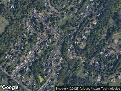
Map
Nearby Homes
- 1489 Maxwell Ct
- 1620 Quarry Rd
- 1505 Fairview Way
- 720 Springhouse Ct
- 721 Springhouse Ct
- 1001 Winfield Ct
- 1903 Nashmont Ct
- 205 Brunswick Ct
- 900 Buckboard Way
- 805 Keeler Rd
- 432 Candlewood Way
- 113 Winchester Way
- 12 Wildbriar Ct
- 33 Longwood Ct E
- 218 Candlewood Way
- 1895 Rampart Ln
- 14 Juniper Ct W
- 1290 Stonybrook Ln
- 1900 Rampart Ln
- 1114 Amber Ln
- 1485 Maxwell Ct
- 1484 Maxwell Ct
- 1357 Michael Way
- 1486 Maxwell Ct
- 1540 Dean Dr
- 1331 Village Way
- 1359 Michael Way
- 1355 Michael Way
- 1341 Village Way
- 1544 Dean Dr
- 1541 Dean Dr
- 1351 Village Way
- 1487 Maxwell Ct
- 1488 Maxwell Ct
- 1545 Dean Dr
- 1361 Village Way
- 1371 Village Way
- 1549 Dean Dr
- 1344 Michael Way
- 1548 Dean Dr