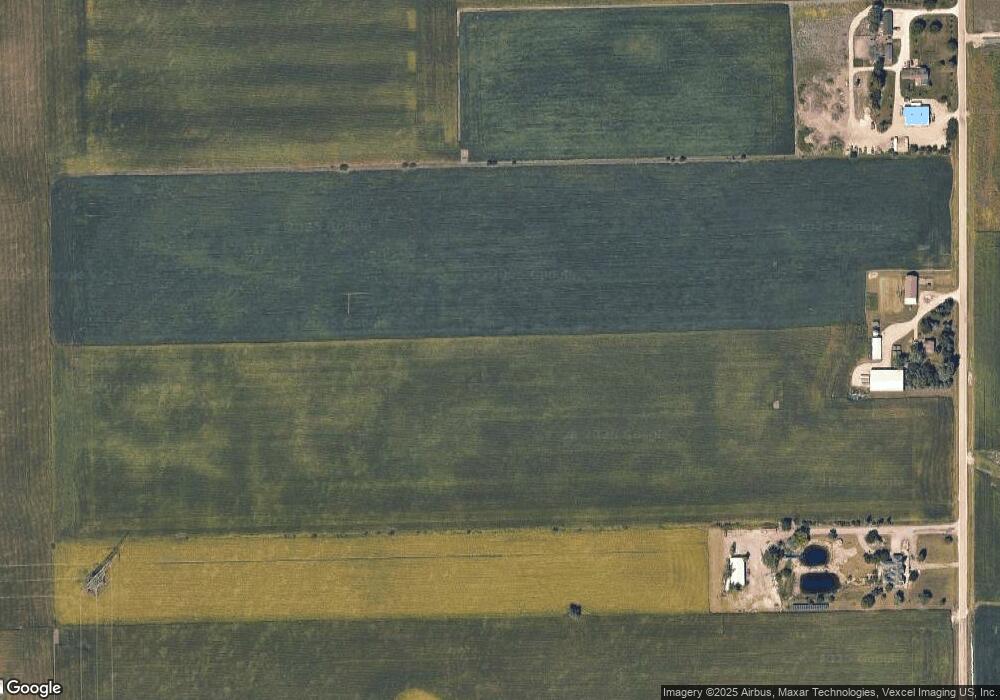
14859 Brisbin Rd Minooka, IL 60447
North Minooka NeighborhoodEstimated Value: $329,000 - $608,000
3
Beds
1
Bath
1,462
Sq Ft
$302/Sq Ft
Est. Value
About This Home
This home is located at 14859 Brisbin Rd, Minooka, IL 60447 and is currently estimated at $441,043, approximately $301 per square foot. 14859 Brisbin Rd is a home located in Kendall County with nearby schools including Jones Elementary School, Minooka Junior High School, and Minooka Intermediate School.
Ownership History
Date
Name
Owned For
Owner Type
Purchase Details
Closed on
Apr 30, 2020
Sold by
Karales Virgil N and Karales Ruth L
Bought by
Larkin Daniel
Current Estimated Value
Home Financials for this Owner
Home Financials are based on the most recent Mortgage that was taken out on this home.
Original Mortgage
$325,000
Interest Rate
3.3%
Mortgage Type
New Conventional
Purchase Details
Closed on
Jan 17, 2014
Sold by
Karales Virgil N
Bought by
Larkin Donald S and Larkin Jo Beth
Home Financials for this Owner
Home Financials are based on the most recent Mortgage that was taken out on this home.
Original Mortgage
$364,150
Interest Rate
4.5%
Mortgage Type
Purchase Money Mortgage
Purchase Details
Closed on
Feb 22, 2000
Sold by
Karales Virgil N and Karales Ruth L
Bought by
Virgil N Karales Declaration Of Living T and Ruth L Karales Declaration Of Living Tru
Create a Home Valuation Report for This Property
The Home Valuation Report is an in-depth analysis detailing your home's value as well as a comparison with similar homes in the area
Home Values in the Area
Average Home Value in this Area
Purchase History
| Date | Buyer | Sale Price | Title Company |
|---|---|---|---|
| Larkin Daniel | $325,000 | Chicago Title | |
| Larkin Donald S | $559,000 | Chicago Title Insurance Co | |
| Virgil N Karales Declaration Of Living T | -- | -- |
Source: Public Records
Mortgage History
| Date | Status | Borrower | Loan Amount |
|---|---|---|---|
| Closed | Larkin Daniel | $325,000 | |
| Previous Owner | Larkin Donald S | $364,150 |
Source: Public Records
Tax History Compared to Growth
Tax History
| Year | Tax Paid | Tax Assessment Tax Assessment Total Assessment is a certain percentage of the fair market value that is determined by local assessors to be the total taxable value of land and additions on the property. | Land | Improvement |
|---|---|---|---|---|
| 2024 | $5,523 | $84,100 | $15,380 | $68,720 |
| 2023 | $4,594 | $77,170 | $14,590 | $62,580 |
| 2022 | $4,594 | $68,757 | $12,667 | $56,090 |
| 2021 | $4,394 | $65,138 | $12,567 | $52,571 |
| 2020 | $3,427 | $51,061 | $9,406 | $41,655 |
| 2019 | $3,362 | $49,093 | $8,917 | $40,176 |
| 2018 | $3,225 | $47,346 | $8,837 | $38,509 |
| 2017 | $3,181 | $45,386 | $8,767 | $36,619 |
| 2016 | $4,358 | $59,364 | $25,833 | $33,531 |
| 2015 | $4,350 | $59,364 | $25,833 | $33,531 |
| 2014 | -- | $55,998 | $25,833 | $30,165 |
Source: Public Records
Map
Nearby Homes
- 15771 Brisbin Rd
- 15781 Brisbin Rd
- 1133 Coneflower Ct
- 12026 Grove Rd
- 2050 Isabella Ln
- 194 acres W Holt Rd
- 2041 Isabella Ln
- Lot 1 Minooka Ridge & Jones Rd
- 2823 Ninovan Ln
- 2811 Ninovan Ln
- 2817 Ninovan Ln
- 2812 Ninovan Ln
- 2813 Ninovan Ln
- 2804 Ninovan Ln
- 8527 Sawyer Ct
- 901 Sable Ridge Dr
- 24 Aspen St
- 8010 Wood River St
- 35 Cedar St
- 1510 Balboa Dr
- 14755 Brisbin Rd
- 14975 Brisbin Rd
- 14707 Brisbin Rd
- 14625 Brisbin Rd
- 14550 Brisbin Rd
- 14525 Brisbin Rd
- 5700 Us Highway 52
- 5765 Us Highway 52
- 15431 Brisbin Rd
- 5651 Bell Rd
- 15751 Brisbin Rd
- 5230 Us Highway 52
- 15045 Grove Rd
- 5470 Bell Rd
- 14625 Grove Rd
- 14900 Grove Rd
- 14800 Grove Rd
- N/A Grove Rd
- 14810 Church Rd
- 14933 Brisbin Rd
