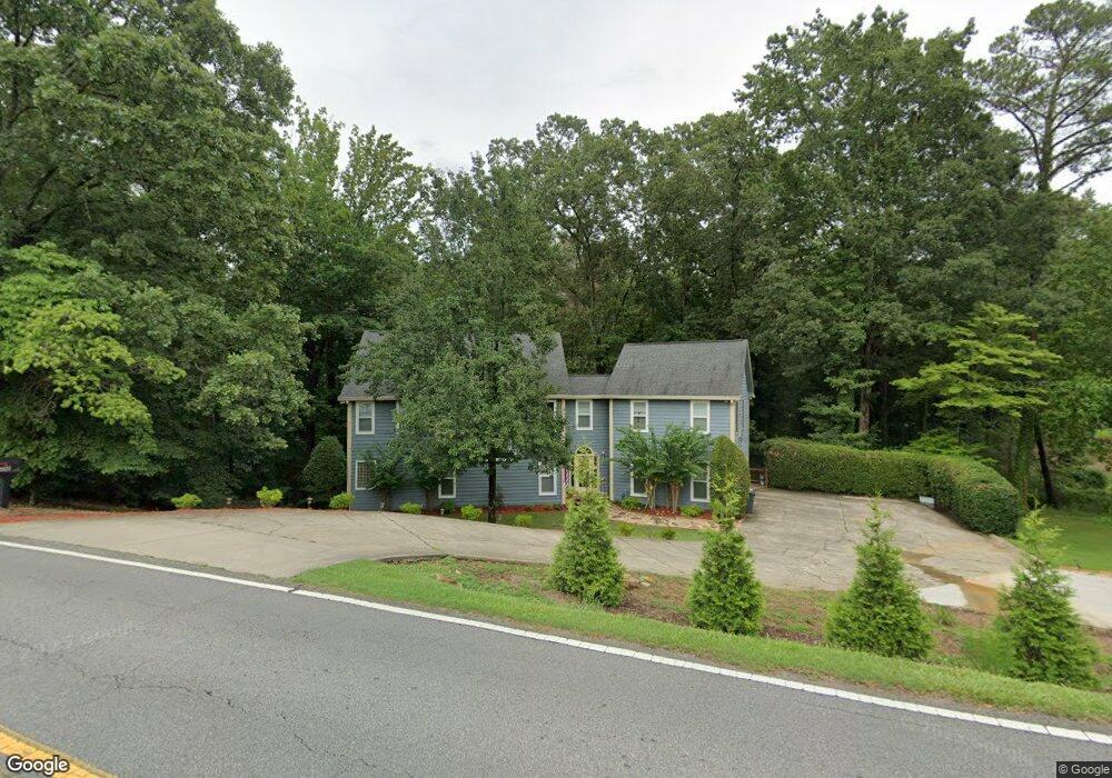
1486 Murdock Rd Marietta, GA 30062
East Cobb NeighborhoodEstimated Value: $645,000 - $780,000
3
Beds
2
Baths
3,199
Sq Ft
$217/Sq Ft
Est. Value
About This Home
This home is located at 1486 Murdock Rd, Marietta, GA 30062 and is currently estimated at $695,707, approximately $217 per square foot. 1486 Murdock Rd is a home located in Cobb County with nearby schools including Murdock Elementary School, Dodgen Middle School, and Pope High School.
Ownership History
Date
Name
Owned For
Owner Type
Purchase Details
Closed on
Jun 25, 2021
Sold by
Drummond Amy L
Bought by
Ross Drummond Amy L
Current Estimated Value
Home Financials for this Owner
Home Financials are based on the most recent Mortgage that was taken out on this home.
Original Mortgage
$310,000
Outstanding Balance
$227,476
Interest Rate
2.2%
Mortgage Type
New Conventional
Estimated Equity
$468,231
Purchase Details
Closed on
May 7, 2014
Sold by
Drummond Amy Ross
Bought by
Drummond Amy L
Home Financials for this Owner
Home Financials are based on the most recent Mortgage that was taken out on this home.
Original Mortgage
$258,400
Interest Rate
4.37%
Mortgage Type
New Conventional
Purchase Details
Closed on
Dec 3, 1993
Sold by
Boatright Terry K
Bought by
Drummond John R Amy R
Home Financials for this Owner
Home Financials are based on the most recent Mortgage that was taken out on this home.
Original Mortgage
$146,400
Interest Rate
7.09%
Create a Home Valuation Report for This Property
The Home Valuation Report is an in-depth analysis detailing your home's value as well as a comparison with similar homes in the area
Home Values in the Area
Average Home Value in this Area
Purchase History
| Date | Buyer | Sale Price | Title Company |
|---|---|---|---|
| Ross Drummond Amy L | -- | None Available | |
| Drummond Amy L | -- | -- | |
| Drummond Amy Ross | -- | -- | |
| Drummond John R Amy R | $38,000 | -- |
Source: Public Records
Mortgage History
| Date | Status | Borrower | Loan Amount |
|---|---|---|---|
| Open | Ross Drummond Amy L | $310,000 | |
| Closed | Drummond Amy L | $258,400 | |
| Previous Owner | Drummond John R Amy R | $146,400 |
Source: Public Records
Tax History
| Year | Tax Paid | Tax Assessment Tax Assessment Total Assessment is a certain percentage of the fair market value that is determined by local assessors to be the total taxable value of land and additions on the property. | Land | Improvement |
|---|---|---|---|---|
| 2025 | $4,863 | $212,088 | $96,356 | $115,732 |
| 2024 | $4,867 | $212,088 | $96,356 | $115,732 |
| 2023 | $3,848 | $190,112 | $89,476 | $100,636 |
| 2022 | $3,602 | $152,436 | $67,108 | $85,328 |
| 2021 | $3,602 | $152,436 | $67,108 | $85,328 |
| 2020 | $3,171 | $132,764 | $53,340 | $79,424 |
| 2019 | $3,171 | $132,764 | $53,340 | $79,424 |
| 2018 | $3,171 | $132,764 | $53,340 | $79,424 |
| 2017 | $2,904 | $124,160 | $44,736 | $79,424 |
| 2016 | $2,911 | $124,160 | $44,736 | $79,424 |
| 2015 | $2,812 | $117,216 | $37,856 | $79,360 |
| 2014 | $2,565 | $105,444 | $0 | $0 |
Source: Public Records
Map
Nearby Homes
- 3171 Sewell Mill Rd
- 1358 Murdock Rd
- 3246 Lost Mill Trace
- 1349 Murdock Rd
- 3011 Castleton Way Unit 1
- 3531 Princeton Corners Ln
- 3530 Princeton Corners Ln
- 1386 Churchill Way
- 2890 Brookcliff Ln
- 1728 Barrington Cir
- 1172 Dogwood Forest Dr NE
- 2994 Octavia Cir
- 1414 Logan Cir
- 1194 Manor Crest Ct NE
- 1704 Barrington Cir
- 1718 Barrington Cir
- 2943 Canton Chase Dr
- 3650 Brighton Place
- 1827 Meadowood Dr
- 3055 Brown Point Place NE
- 1530 Murdock Rd
- 1452 Murdock Rd
- 3161 Garden Lane Dr
- 3221 Sewell Mill Rd
- 1469 Murdock Rd
- 1458 Murdock Rd NE
- 3227 Sewell Mill Rd
- 1511 Murdock Rd
- 3233 Sewell Mill Rd
- 1485 Pleasant View Cir
- 1501 Pleasant View Cir
- 3239 Sewell Mill Rd
- 3143 Garden Lane Dr
- 1517 Pleasant View Cir
- 3154 Garden Lane Dr
- 3211 Sewell Mill Rd
- 3140 Garden Lane Dr
- 1424 Murdock Rd Unit 3
- 1540 Murdock Rd
- 1423 Murdock Rd
Your Personal Tour Guide
Ask me questions while you tour the home.