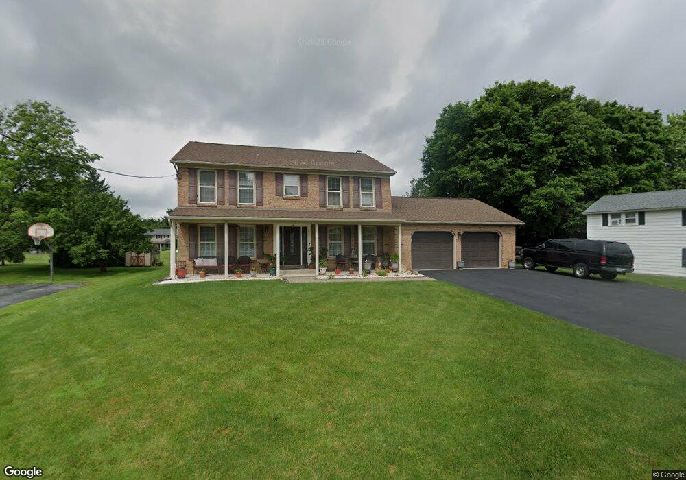
1486 S Krocks Rd Allentown, PA 18106
Lower Macungie Township East NeighborhoodEstimated Value: $467,000 - $508,000
4
Beds
3
Baths
2,310
Sq Ft
$209/Sq Ft
Est. Value
About This Home
This home is located at 1486 S Krocks Rd, Allentown, PA 18106 and is currently estimated at $482,084, approximately $208 per square foot. 1486 S Krocks Rd is a home located in Lehigh County with nearby schools including Willow Lane Elementary School, Lower Macungie Middle School, and Emmaus High School.
Ownership History
Date
Name
Owned For
Owner Type
Purchase Details
Closed on
Jul 7, 2004
Sold by
Toonder F Geoffrey and Toonder Carole
Bought by
Draklellis George and Draklellis Aristothea
Current Estimated Value
Home Financials for this Owner
Home Financials are based on the most recent Mortgage that was taken out on this home.
Original Mortgage
$195,000
Outstanding Balance
$98,056
Interest Rate
6.32%
Mortgage Type
Purchase Money Mortgage
Estimated Equity
$384,028
Purchase Details
Closed on
Nov 30, 1989
Sold by
Staffaroni Mark A and Staffaroni Cynthia A
Bought by
Mohney Christopher P and Mohney Juliana
Purchase Details
Closed on
Jun 12, 1985
Sold by
Buroker Walter L and Buroker Linda M
Bought by
Staffaroni Mark A and Staffaroni Cynthia A
Purchase Details
Closed on
Aug 21, 1981
Bought by
Buroker Walter L and Buroker Linda M
Create a Home Valuation Report for This Property
The Home Valuation Report is an in-depth analysis detailing your home's value as well as a comparison with similar homes in the area
Home Values in the Area
Average Home Value in this Area
Purchase History
| Date | Buyer | Sale Price | Title Company |
|---|---|---|---|
| Draklellis George | $244,000 | -- | |
| Mohney Christopher P | $173,900 | -- | |
| Staffaroni Mark A | $108,000 | -- | |
| Buroker Walter L | $96,800 | -- |
Source: Public Records
Mortgage History
| Date | Status | Borrower | Loan Amount |
|---|---|---|---|
| Open | Draklellis George | $195,000 |
Source: Public Records
Tax History Compared to Growth
Tax History
| Year | Tax Paid | Tax Assessment Tax Assessment Total Assessment is a certain percentage of the fair market value that is determined by local assessors to be the total taxable value of land and additions on the property. | Land | Improvement |
|---|---|---|---|---|
| 2025 | $6,273 | $245,700 | $34,900 | $210,800 |
| 2024 | $6,069 | $245,700 | $34,900 | $210,800 |
| 2023 | $5,948 | $245,700 | $34,900 | $210,800 |
| 2022 | $5,807 | $245,700 | $210,800 | $34,900 |
| 2021 | $5,683 | $245,700 | $34,900 | $210,800 |
| 2020 | $5,629 | $245,700 | $34,900 | $210,800 |
| 2019 | $5,533 | $245,700 | $34,900 | $210,800 |
| 2018 | $5,461 | $245,700 | $34,900 | $210,800 |
| 2017 | $5,365 | $245,700 | $34,900 | $210,800 |
| 2016 | -- | $245,700 | $34,900 | $210,800 |
| 2015 | -- | $245,700 | $34,900 | $210,800 |
| 2014 | -- | $245,700 | $34,900 | $210,800 |
Source: Public Records
Map
Nearby Homes
- 6007 Timberknoll Dr
- 5736 Greens Dr
- 6179 Fairway Ln
- 5673 Wedge Ln
- 2056 Autumn Ridge Rd
- 1991 Autumn Ridge Rd
- 5619 Stonecroft Ln
- 5524 Stonecroft Ln
- 5280 Townsquare Dr
- 1675 Hamlet Dr
- 5300 Hanover Dr
- 1037 Village Round Unit L
- 997 Village Round Unit K
- 997K Village Round Unit 104K
- 5475 Hamilton Blvd Unit 7
- 6645 Stein Way Unit 6639-6661
- 1385 Brookside Rd
- 5133 Meadow Ln
- 6522 Trafalgar Dr
- 6022 Eli Cir
- 1502 S Krocks Rd
- 1464 S Krocks Rd
- 1520 S Krocks Rd
- 1491 S Krocks Rd
- 1456 S Krocks Rd
- 1475 S Krocks Rd
- 1515 S Krocks Rd
- 1461 Mashie Dr
- 1459 S Krocks Rd
- 1447 Mashie Dr
- 1536 S Krocks Rd
- 1440 S Krocks Rd
- 1479 Mashie Dr
- 1535 Birdie St
- 1506 Par Causeway
- 1431 Mashie Dr
- 1490 Par Causeway
- 1499 Mashie Dr
- 1522 Par Causeway
- 1424 S Krocks Rd