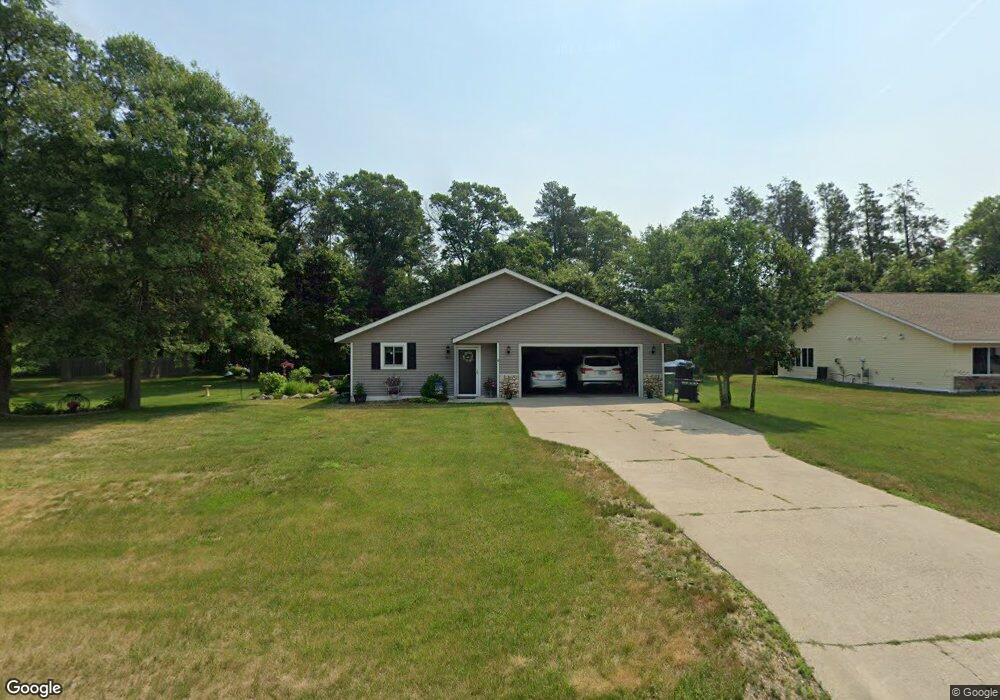
14874 Holly Dr Baxter, MN 56425
Estimated Value: $318,055 - $388,000
3
Beds
2
Baths
1,596
Sq Ft
$222/Sq Ft
Est. Value
About This Home
This home is located at 14874 Holly Dr, Baxter, MN 56425 and is currently estimated at $355,014, approximately $222 per square foot. 14874 Holly Dr is a home located in Crow Wing County with nearby schools including Baxter Elementary School, Forestview Middle School, and Brainerd Senior High School.
Ownership History
Date
Name
Owned For
Owner Type
Purchase Details
Closed on
Jun 1, 2015
Bought by
Benson Nicholai and Benson Cathie
Current Estimated Value
Home Financials for this Owner
Home Financials are based on the most recent Mortgage that was taken out on this home.
Original Mortgage
$114,000
Outstanding Balance
$87,948
Interest Rate
3.64%
Estimated Equity
$267,066
Purchase Details
Closed on
Feb 1, 2011
Bought by
Lokken Dan D
Create a Home Valuation Report for This Property
The Home Valuation Report is an in-depth analysis detailing your home's value as well as a comparison with similar homes in the area
Home Values in the Area
Average Home Value in this Area
Purchase History
| Date | Buyer | Sale Price | Title Company |
|---|---|---|---|
| Benson Nicholai | $142,900 | -- | |
| Lokken Dan D | $145,000 | -- |
Source: Public Records
Mortgage History
| Date | Status | Borrower | Loan Amount |
|---|---|---|---|
| Open | Benson Nicholai | $114,000 |
Source: Public Records
Tax History
| Year | Tax Paid | Tax Assessment Tax Assessment Total Assessment is a certain percentage of the fair market value that is determined by local assessors to be the total taxable value of land and additions on the property. | Land | Improvement |
|---|---|---|---|---|
| 2025 | $2,678 | $277,000 | $56,000 | $221,000 |
| 2024 | $2,678 | $282,100 | $54,500 | $227,600 |
| 2023 | $2,426 | $274,700 | $51,500 | $223,200 |
| 2022 | $2,202 | $241,200 | $36,500 | $204,700 |
| 2021 | $2,104 | $188,400 | $35,100 | $153,300 |
| 2020 | $1,978 | $177,300 | $37,400 | $139,900 |
| 2019 | $1,816 | $167,900 | $35,200 | $132,700 |
| 2018 | $1,682 | $159,300 | $35,200 | $124,100 |
| 2017 | $1,562 | $133,781 | $29,331 | $104,450 |
| 2016 | $1,604 | $123,000 | $24,400 | $98,600 |
| 2015 | $1,502 | $112,900 | $19,900 | $93,000 |
| 2014 | $668 | $102,700 | $13,800 | $88,900 |
Source: Public Records
Map
Nearby Homes
- 14943 Hemlock Dr
- 14545 Grand Oaks Dr
- 14557 Jewelwood Dr
- 7010 Woida Rd
- TBD Clearwater Rd N
- 7205 Clearwater Rd N
- L1&2 B3 Clearwater Rd N
- L1&2 B1 Clearwater Rd N
- 14729 Wildflower Dr
- 6552 Austin Rd
- L4B2 Wildflower Dr
- Outlot A and D Rockrose Dr
- 14205 Cherrywood Dr
- 14750 Lynwood Dr
- 6195 Cosmos Rd
- TBD Inglewood Dr
- 14691 Lynndale Dr
- 14104 Inglewood Dr
- 14502 Lynndale Dr N
- TBD Dahlin Rd N
- L13 B2 Hemlock Dr
- 14904 Holly Dr
- 14856 Holly Dr
- Lot 14 Hemlock Dr
- L14 B2 Hemlock Dr
- L12 B2 Hemlock Dr
- 14893 Holly Dr
- 14871 Holly Dr
- 14922 14922 Holly Dr
- 14926 Holly Dr
- L5 B3 Hemlock Dr
- 0 Lot 11 Hemlock Dr Unit 3537297
- 0 Hemlock-Drive- Unit 3521766
- 0 Lot 11 Hemlock Dr Unit 3543266
- 0 Lot 11 Hemlock Dr Unit 3537829
- 0 Lot 14 Hemlock Dr Unit 4520145
- TBD Hemlock Dr
- 14905 Holly Dr
- 14842 Holly Dr
- 14922 Holly Dr
Your Personal Tour Guide
Ask me questions while you tour the home.