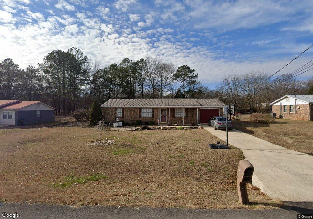
149 Chesapeake Dr Scottsboro, AL 35769
Estimated Value: $170,000 - $228,000
3
Beds
1
Bath
1,146
Sq Ft
$167/Sq Ft
Est. Value
About This Home
This home is located at 149 Chesapeake Dr, Scottsboro, AL 35769 and is currently estimated at $191,583, approximately $167 per square foot. 149 Chesapeake Dr is a home located in Jackson County with nearby schools including Scottsboro High School and Scottsboro Christian Academy.
Ownership History
Date
Name
Owned For
Owner Type
Purchase Details
Closed on
Sep 26, 2023
Sold by
Talkington Richard D
Bought by
Hastings Kimberly Dawn and Bagley David Charles
Current Estimated Value
Purchase Details
Closed on
Aug 8, 2008
Sold by
Remich John Richard and Remich Mary K
Bought by
Talkington Richard D and Talkington Jessica
Home Financials for this Owner
Home Financials are based on the most recent Mortgage that was taken out on this home.
Original Mortgage
$82,000
Interest Rate
6.32%
Create a Home Valuation Report for This Property
The Home Valuation Report is an in-depth analysis detailing your home's value as well as a comparison with similar homes in the area
Home Values in the Area
Average Home Value in this Area
Purchase History
| Date | Buyer | Sale Price | Title Company |
|---|---|---|---|
| Hastings Kimberly Dawn | $146,000 | -- | |
| Talkington Richard D | -- | -- |
Source: Public Records
Mortgage History
| Date | Status | Borrower | Loan Amount |
|---|---|---|---|
| Previous Owner | Talkington Richard D | $82,000 |
Source: Public Records
Tax History Compared to Growth
Tax History
| Year | Tax Paid | Tax Assessment Tax Assessment Total Assessment is a certain percentage of the fair market value that is determined by local assessors to be the total taxable value of land and additions on the property. | Land | Improvement |
|---|---|---|---|---|
| 2024 | $422 | $9,100 | $0 | $0 |
| 2023 | $392 | $9,300 | $0 | $0 |
| 2022 | $402 | $9,300 | $0 | $0 |
| 2021 | $402 | $9,300 | $0 | $0 |
| 2020 | $373 | $8,700 | $0 | $0 |
| 2019 | $330 | $7,820 | $0 | $0 |
| 2018 | $330 | $7,820 | $0 | $0 |
| 2017 | $330 | $78,100 | $0 | $0 |
| 2016 | $311 | $74,100 | $0 | $0 |
| 2015 | $316 | $75,100 | $0 | $0 |
| 2014 | $316 | $75,100 | $0 | $0 |
| 2013 | -- | $75,100 | $0 | $0 |
Source: Public Records
Map
Nearby Homes
- 216 Canadian Dr
- Lot 11 Pruett Cir
- 50 Pruett Cir
- 2981 Bob Jones Rd
- 17 Goose Pond Island Dr
- 222 Lakewood Dr
- 565 Goosepond Island Dr
- 150 Lake Pointe Dr
- 131 Anderson St E
- 118 Greenwood Dr
- 383 Anderson St W
- 1481 Peninsula Dr
- 2310 Bob Jones Rd
- 4 acres Bob Jones Rd
- 1.0 Acre Lake Pointe Cir
- 3 Acres S Broad St
- 4140 S Broad St
- 104 Wimberly Dr
- 2567 Lookout Mountain Dr
- 105 Chasewood Cove
- 129 Chesapeake Dr
- 169 Chesapeake Dr
- 140 Chesapeake Dr
- 162 Chesapeake Dr
- 189 Chesapeake Dr
- 899 Hancock Dr E
- 99 Chesapeake Dr
- 860 Hancock Dr E
- 124 Chesapeake Dr
- 877 Hancock Dr E
- 184 Chesapeake Dr
- 915 Hancock Dr E
- 915 Hancock Dr E
- 209 Chesapeake Dr
- 292 Snow Dr
- 25 Canadian Dr
- 845 Hancock Dr E
- 206 Chesapeake Dr
- 270 Snow Dr
- 298 Snow Dr