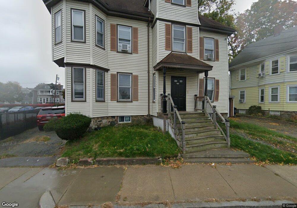
149 High St Waltham, MA 02453
South Side NeighborhoodEstimated Value: $1,151,886 - $1,276,000
8
Beds
6
Baths
3,694
Sq Ft
$325/Sq Ft
Est. Value
About This Home
This home is located at 149 High St, Waltham, MA 02453 and is currently estimated at $1,200,222, approximately $324 per square foot. 149 High St is a home located in Middlesex County with nearby schools including Henry Whittemore Elementary School, John W. Mcdevitt Middle School, and Waltham Sr High School.
Ownership History
Date
Name
Owned For
Owner Type
Purchase Details
Closed on
Apr 30, 2004
Sold by
Guerrier Jean Carlo and Ulysse-Guerrier Jeanine
Bought by
Faustini Clayton
Current Estimated Value
Purchase Details
Closed on
Sep 22, 1994
Sold by
Main St Bldg Corp
Bought by
Guerrier Jean C
Home Financials for this Owner
Home Financials are based on the most recent Mortgage that was taken out on this home.
Original Mortgage
$145,300
Interest Rate
8.56%
Mortgage Type
Purchase Money Mortgage
Purchase Details
Closed on
Jun 15, 1992
Sold by
Main St Bldg Corp
Bought by
Main St Bldg Corp
Create a Home Valuation Report for This Property
The Home Valuation Report is an in-depth analysis detailing your home's value as well as a comparison with similar homes in the area
Home Values in the Area
Average Home Value in this Area
Purchase History
| Date | Buyer | Sale Price | Title Company |
|---|---|---|---|
| Faustini Clayton | $550,000 | -- | |
| Guerrier Jean C | $154,000 | -- | |
| Main St Bldg Corp | $183,000 | -- |
Source: Public Records
Mortgage History
| Date | Status | Borrower | Loan Amount |
|---|---|---|---|
| Previous Owner | Main St Bldg Corp | $141,500 | |
| Previous Owner | Main St Bldg Corp | $20,000 | |
| Previous Owner | Main St Bldg Corp | $145,300 |
Source: Public Records
Tax History Compared to Growth
Tax History
| Year | Tax Paid | Tax Assessment Tax Assessment Total Assessment is a certain percentage of the fair market value that is determined by local assessors to be the total taxable value of land and additions on the property. | Land | Improvement |
|---|---|---|---|---|
| 2025 | $9,346 | $951,700 | $318,100 | $633,600 |
| 2024 | $8,549 | $886,800 | $318,100 | $568,700 |
| 2023 | $8,640 | $837,200 | $289,700 | $547,500 |
| 2022 | $8,782 | $788,300 | $264,500 | $523,800 |
| 2021 | $8,334 | $736,200 | $239,300 | $496,900 |
| 2020 | $8,223 | $688,100 | $226,700 | $461,400 |
| 2019 | $7,572 | $598,100 | $224,500 | $373,600 |
| 2018 | $6,796 | $538,900 | $207,900 | $331,000 |
| 2017 | $6,531 | $520,000 | $189,000 | $331,000 |
| 2016 | $6,094 | $497,900 | $166,900 | $331,000 |
| 2015 | $5,718 | $435,500 | $163,800 | $271,700 |
Source: Public Records
Map
Nearby Homes
- 138 Myrtle St Unit 2
- 162 Myrtle St Unit 1
- 312 Newton St Unit 1A
- 308 Newton St Unit 1
- 81 Alder St
- 39 Clinton St Unit 2
- 39 Clinton St Unit 1
- 42 Alder St
- 47 Alder St Unit 6
- 40 Myrtle St Unit 9
- 25 Tolman St Unit 2
- 24 Tolman St Unit A
- 9 John St
- 15 Alder St Unit 1
- 61 Hall St Unit 9
- 61 Hall St Unit 7
- 75 Cherry St
- 31-37 Washington Ave
- 28-32 Calvary St
- 659 Moody St Unit 2
- 148 Alder St Unit 150
- 150 Alder St Unit 1
- 150 Alder St
- 150 Alder St Unit 2
- 146 Alder St
- 145 High St Unit 147
- 145 High St
- 145 High St Unit 2
- 144 Alder St
- 141 High St Unit 4
- 141 High St
- 141 High St Unit 1A
- 152 High St
- 140 Alder St
- 134 Alder St Unit 136
- 139-141 Alder St Unit 2
- 139-141 Alder St Unit 3
- 139-141 Alder St Unit 1
- 139-141 Alder St
- 151 Alder St