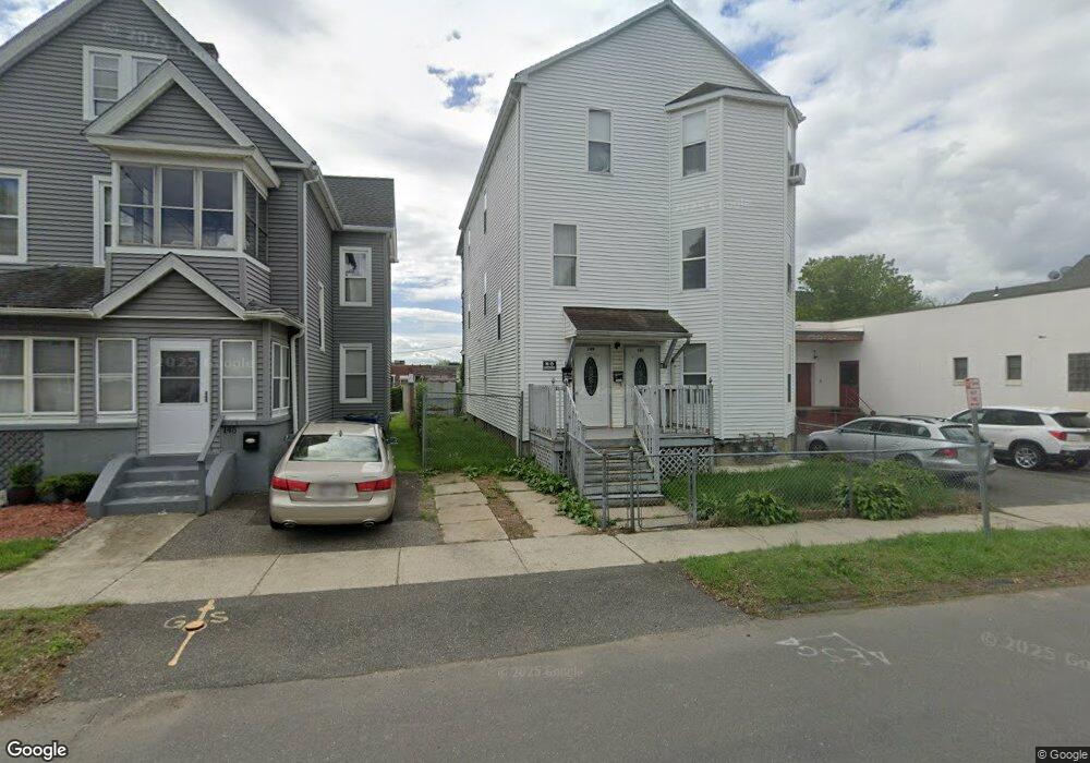
149 New Bridge St West Springfield, MA 01089
Estimated Value: $239,932 - $592,000
6
Beds
3
Baths
3,186
Sq Ft
$131/Sq Ft
Est. Value
About This Home
This home is located at 149 New Bridge St, West Springfield, MA 01089 and is currently estimated at $417,233, approximately $130 per square foot. 149 New Bridge St is a home located in Hampden County with nearby schools including West Springfield High School, Hampden Charter School of Science West, and Libertas Academy Charter School.
Ownership History
Date
Name
Owned For
Owner Type
Purchase Details
Closed on
Aug 13, 1996
Sold by
First Bk Beverly Hills
Bought by
Burlachenko Aleksandr and Burlachenko Dina
Current Estimated Value
Home Financials for this Owner
Home Financials are based on the most recent Mortgage that was taken out on this home.
Original Mortgage
$61,196
Interest Rate
8.24%
Mortgage Type
Purchase Money Mortgage
Create a Home Valuation Report for This Property
The Home Valuation Report is an in-depth analysis detailing your home's value as well as a comparison with similar homes in the area
Home Values in the Area
Average Home Value in this Area
Purchase History
| Date | Buyer | Sale Price | Title Company |
|---|---|---|---|
| Burlachenko Aleksandr | $62,500 | -- |
Source: Public Records
Mortgage History
| Date | Status | Borrower | Loan Amount |
|---|---|---|---|
| Open | Burlachenko Aleksandr | $64,417 | |
| Closed | Burlachenko Aleksandr | $61,196 |
Source: Public Records
Tax History
| Year | Tax Paid | Tax Assessment Tax Assessment Total Assessment is a certain percentage of the fair market value that is determined by local assessors to be the total taxable value of land and additions on the property. | Land | Improvement |
|---|---|---|---|---|
| 2025 | $4,509 | $303,200 | $84,900 | $218,300 |
| 2024 | $4,490 | $303,200 | $84,900 | $218,300 |
| 2023 | $3,925 | $252,600 | $84,900 | $167,700 |
| 2022 | $3,853 | $244,500 | $77,000 | $167,500 |
| 2021 | $3,165 | $187,300 | $61,300 | $126,000 |
| 2020 | $3,182 | $187,300 | $61,300 | $126,000 |
| 2019 | $3,177 | $187,300 | $61,300 | $126,000 |
| 2018 | $3,193 | $187,300 | $61,300 | $126,000 |
| 2017 | $3,193 | $187,300 | $61,300 | $126,000 |
| 2016 | $3,141 | $184,900 | $58,900 | $126,000 |
| 2015 | $2,851 | $167,800 | $57,800 | $110,000 |
| 2014 | $691 | $167,800 | $57,800 | $110,000 |
Source: Public Records
Map
Nearby Homes
- 31 Russell St
- 20 E School St
- 20 Sprague St
- 37 Day St
- 20 Cottage St
- 29 Lowell Ave
- 63 Worcester St
- 146 Union St
- 188 Windsor St
- 140 Chestnut St Unit 706
- 140 Chestnut St Unit 702
- 140 Chestnut St Unit 204
- 140 Chestnut St Unit 819
- 140 Chestnut St Unit 619
- 140 Chestnut St Unit 816
- 140 Chestnut St Unit 604
- 140 Chestnut St Unit 407
- 92 Norman St
- 122 Norman St
- 0 Maple St
- 149 New Bridge St
- 145 New Bridge St
- 161 New Bridge St
- 44 Mulberry St
- 11 Barnard St
- 152 New Bridge St
- 23 New Bridge St
- 158 New Bridge St
- 140 New Bridge St
- 134 New Bridge St
- 348 Memorial Ave
- 340 Memorial Ave
- 1000 Main St
- 1022 Main St
- 20 Cook St
- 366 Memorial Ave
- 358 Memorial Ave
- 30 Cook St
- 178 New Bridge St
- 1023 Main St
Your Personal Tour Guide
Ask me questions while you tour the home.