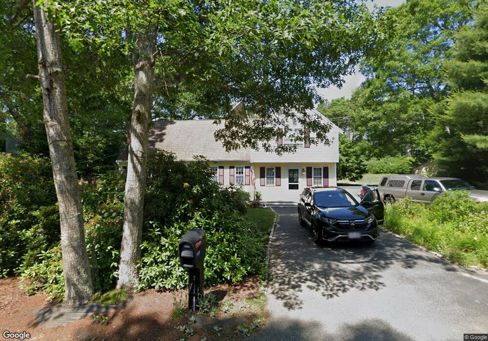
149 Patriot Way Centerville, MA 02632
Centerville NeighborhoodEstimated Value: $720,000 - $783,000
4
Beds
2
Baths
2,131
Sq Ft
$348/Sq Ft
Est. Value
About This Home
This home is located at 149 Patriot Way, Centerville, MA 02632 and is currently estimated at $741,315, approximately $347 per square foot. 149 Patriot Way is a home located in Barnstable County with nearby schools including Centerville Elementary School, Barnstable United Elementary School, and Barnstable Intermediate School.
Ownership History
Date
Name
Owned For
Owner Type
Purchase Details
Closed on
Oct 17, 2022
Sold by
Eames Mark E and Eames Judith C
Bought by
Eames Mark E and Eames Judith C
Current Estimated Value
Create a Home Valuation Report for This Property
The Home Valuation Report is an in-depth analysis detailing your home's value as well as a comparison with similar homes in the area
Home Values in the Area
Average Home Value in this Area
Purchase History
| Date | Buyer | Sale Price | Title Company |
|---|---|---|---|
| Eames Mark E | -- | None Available |
Source: Public Records
Tax History Compared to Growth
Tax History
| Year | Tax Paid | Tax Assessment Tax Assessment Total Assessment is a certain percentage of the fair market value that is determined by local assessors to be the total taxable value of land and additions on the property. | Land | Improvement |
|---|---|---|---|---|
| 2025 | $5,260 | $650,200 | $178,200 | $472,000 |
| 2024 | $4,874 | $624,100 | $178,200 | $445,900 |
| 2023 | $4,640 | $556,300 | $162,200 | $394,100 |
| 2022 | $4,374 | $453,700 | $120,700 | $333,000 |
| 2021 | $4,261 | $406,200 | $120,700 | $285,500 |
| 2020 | $4,410 | $402,400 | $129,600 | $272,800 |
| 2019 | $4,178 | $370,400 | $129,600 | $240,800 |
| 2018 | $3,866 | $344,600 | $136,400 | $208,200 |
| 2017 | $3,597 | $334,300 | $136,400 | $197,900 |
| 2016 | $3,655 | $335,300 | $137,400 | $197,900 |
| 2015 | $3,551 | $327,300 | $131,600 | $195,700 |
Source: Public Records
Map
Nearby Homes
- 62 Three Ponds Dr
- 900 Old Stage Rd
- 73 Tern Ln
- 66 Tern Ln
- 296 Buckskin Path
- 315 Prince Hinckley Rd
- 87 Foxglove Rd
- 40 Appaloosa Way
- 81 Monomoy Cir
- 1044 Old Falmouth Rd
- 1028 Old Falmouth Rd
- 88 Joe Thompson Rd
- 74 Saddler Ln
- 80 Saddler Ln
- 21 Shannon Way
- 205 James Otis Rd
- 50 Currycomb Cir
- 29 Summerwind Ln
- 16 Bridgets Path
- 350 Plum St
- 127 Patriot Way
- 140 Patriot Way
- 119 Patriot Way
- 171 Cap'N Lijah's Rd
- 171 Captain Lijahs Rd
- 171 Capn Lijahs Rd
- 161 Capn Lijahs Rd
- 161 Cap'N Lijah's Rd
- 156 Patriot Way
- 111 Patriot Way
- 195 Captain Lijah
- 151 Cap'N Lijah's Rd
- 151 Capn Lijahs Rd
- 151 Captain Lijahs Rd
- 94 Hitching Post Ln
- 101 Patriot Way
- 181 Capn Lijahs Rd
- 181 Captain Lijahs Rd
- 0 Patriot Way
- 141 Capn Lijahs Rd