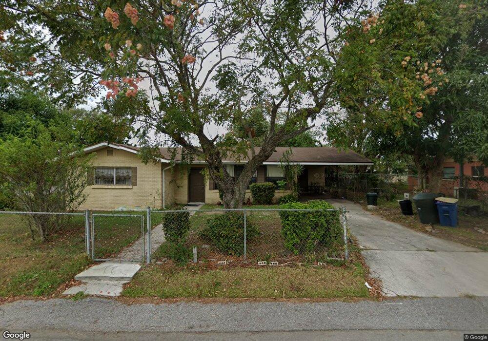
1490 Bryant St Bartow, FL 33830
Estimated Value: $210,000 - $219,000
3
Beds
1
Bath
1,166
Sq Ft
$183/Sq Ft
Est. Value
About This Home
This home is located at 1490 Bryant St, Bartow, FL 33830 and is currently estimated at $212,939, approximately $182 per square foot. 1490 Bryant St is a home located in Polk County with nearby schools including Spessard L Holland Elementary School, Bartow Elementary Academy, and Bartow Middle School.
Ownership History
Date
Name
Owned For
Owner Type
Purchase Details
Closed on
Sep 21, 2025
Sold by
Outlaw Andrea
Bought by
Outlaw Agnes Marie Jones
Current Estimated Value
Purchase Details
Closed on
Jun 27, 2025
Sold by
Wilson Faye
Bought by
Outlaw Agnes Marie Jones
Purchase Details
Closed on
Jun 26, 2025
Sold by
Duplanty Jerita
Bought by
Outlaw Agnes Marie Jones
Purchase Details
Closed on
Jun 25, 2025
Sold by
Watkins Virginia Michelle Jones
Bought by
Outlaw Agnes Marie Jones
Create a Home Valuation Report for This Property
The Home Valuation Report is an in-depth analysis detailing your home's value as well as a comparison with similar homes in the area
Home Values in the Area
Average Home Value in this Area
Purchase History
| Date | Buyer | Sale Price | Title Company |
|---|---|---|---|
| Outlaw Agnes Marie Jones | -- | None Listed On Document | |
| Outlaw Agnes Marie Jones | -- | None Listed On Document | |
| Outlaw Agnes Marie Jones | -- | None Listed On Document | |
| Outlaw Agnes Marie Jones | -- | None Listed On Document | |
| Outlaw Agnes Marie Jones | -- | None Listed On Document |
Source: Public Records
Tax History
| Year | Tax Paid | Tax Assessment Tax Assessment Total Assessment is a certain percentage of the fair market value that is determined by local assessors to be the total taxable value of land and additions on the property. | Land | Improvement |
|---|---|---|---|---|
| 2025 | $3,165 | $159,442 | -- | -- |
| 2024 | $2,923 | $144,947 | -- | -- |
| 2023 | $2,923 | $131,770 | -- | -- |
| 2022 | $2,480 | $119,791 | $0 | $0 |
| 2021 | $2,012 | $108,901 | $0 | $0 |
| 2020 | $1,710 | $99,001 | $4,624 | $94,377 |
| 2018 | $374 | $41,639 | $0 | $0 |
| 2017 | $359 | $40,783 | $0 | $0 |
| 2016 | $349 | $39,944 | $0 | $0 |
| 2015 | $257 | $39,666 | $0 | $0 |
| 2014 | $342 | $39,351 | $0 | $0 |
Source: Public Records
Map
Nearby Homes
- 810 N Maple Ave
- 845 N Gordon Ave
- 1060 Austin St
- 1040 Austin St
- 929 Polk St
- 0 Polk St W
- 920 Forrest Dr
- 0 N Maple Ave
- 930 Pinecrest Dr
- 533 Waldon Ave
- 775 Forrest Dr
- 1015 Childs Ave
- 755 Forrest Dr
- 830 Shady Ln
- 650 Shady Ln
- 824 Allison Place
- 745 Marion Place
- 1706 Laurel Oaks Dr
- 689 Shanklin Ave
- 1900 Saddlewood Ct
- 1470 Bryant St
- 1495 Austin St
- 1475 Austin St
- 1430 Bryant St
- 1480 Austin St
- 1490 Austin St
- 1445 Bryant St
- 1435 Austin St
- 1470 Austin St
- 805 Parham Cir
- 1407 Bryant St
- 1394 King St
- 820 Crown Ave
- 1425 Austin St
- 1415 Austin St
- 1392 King St Unit 1392
- 1392 King St
- 1392 King St Unit 1394
- 610 Crown Ave
- 1405 Bryant St
Your Personal Tour Guide
Ask me questions while you tour the home.