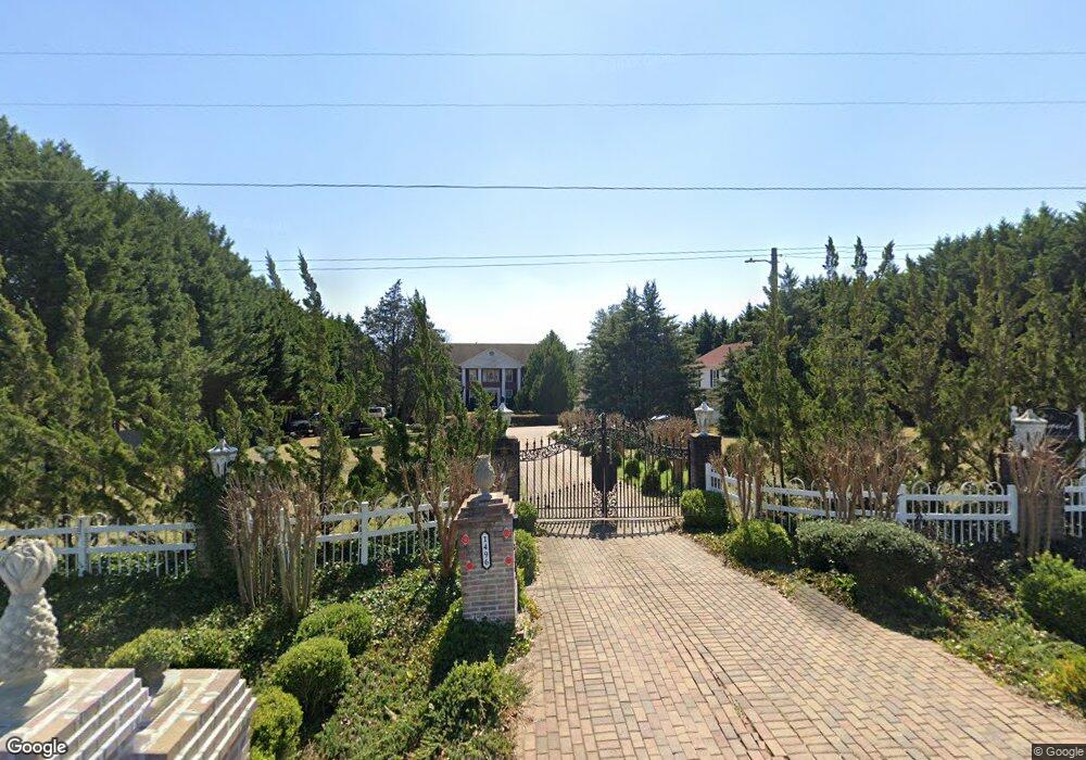
1490 Campground Rd McDonough, GA 30252
Estimated Value: $577,000 - $599,000
5
Beds
4
Baths
2,820
Sq Ft
$210/Sq Ft
Est. Value
About This Home
This home is located at 1490 Campground Rd, McDonough, GA 30252 and is currently estimated at $591,044, approximately $209 per square foot. 1490 Campground Rd is a home located in Henry County with nearby schools including East Lake Elementary School, Union Grove Middle School, and Union Grove High School.
Ownership History
Date
Name
Owned For
Owner Type
Purchase Details
Closed on
Jun 4, 2025
Sold by
Mcdonald Devon
Bought by
Black Beard Properties Llc
Current Estimated Value
Home Financials for this Owner
Home Financials are based on the most recent Mortgage that was taken out on this home.
Original Mortgage
$405,750
Outstanding Balance
$273,527
Interest Rate
6.76%
Mortgage Type
New Conventional
Estimated Equity
$317,517
Purchase Details
Closed on
Sep 7, 2017
Sold by
Tulloch Dionne
Bought by
Mcdonald Devon
Purchase Details
Closed on
Aug 28, 2017
Sold by
Simmons Gary D
Bought by
Mcdonald Devon and Tulloch Dionne
Purchase Details
Closed on
Jul 22, 2015
Sold by
Gibbs Angela
Bought by
Mcdonald Devon and Tulloch Dionne
Home Financials for this Owner
Home Financials are based on the most recent Mortgage that was taken out on this home.
Original Mortgage
$198,500
Interest Rate
4.04%
Mortgage Type
New Conventional
Create a Home Valuation Report for This Property
The Home Valuation Report is an in-depth analysis detailing your home's value as well as a comparison with similar homes in the area
Home Values in the Area
Average Home Value in this Area
Purchase History
| Date | Buyer | Sale Price | Title Company |
|---|---|---|---|
| Black Beard Properties Llc | $350,000 | -- | |
| Mcdonald Devon | -- | -- | |
| Mcdonald Devon | -- | -- | |
| Mcdonald Devon | $210,000 | -- |
Source: Public Records
Mortgage History
| Date | Status | Borrower | Loan Amount |
|---|---|---|---|
| Open | Black Beard Properties Llc | $405,750 | |
| Previous Owner | Mcdonald Devon | $198,500 |
Source: Public Records
Tax History Compared to Growth
Tax History
| Year | Tax Paid | Tax Assessment Tax Assessment Total Assessment is a certain percentage of the fair market value that is determined by local assessors to be the total taxable value of land and additions on the property. | Land | Improvement |
|---|---|---|---|---|
| 2025 | $7,214 | $181,480 | $34,360 | $147,120 |
| 2024 | $7,214 | $174,880 | $30,960 | $143,920 |
| 2023 | $6,532 | $169,240 | $29,800 | $139,440 |
| 2022 | $5,509 | $142,560 | $27,520 | $115,040 |
| 2021 | $4,616 | $119,280 | $23,600 | $95,680 |
| 2020 | $4,256 | $109,920 | $22,240 | $87,680 |
| 2019 | $4,180 | $107,920 | $21,080 | $86,840 |
| 2018 | $3,640 | $93,840 | $19,480 | $74,360 |
| 2016 | $3,262 | $84,000 | $16,464 | $67,536 |
| 2015 | $3,250 | $81,160 | $17,280 | $63,880 |
| 2014 | $2,987 | $73,640 | $17,280 | $56,360 |
Source: Public Records
Map
Nearby Homes
- 1650 Campground Rd
- 280 W Knight Rd
- 565 Elliott Rd
- Addison Plan at Brush Arbor
- Violet Plan at Brush Arbor
- Penelope Plan at Brush Arbor
- 104 Accolade Pkwy
- 100 Homesite Valleyview Ct
- 569 Saltbox Ln
- 112 Accolade Pkwy
- 4114 Valleyview Ct
- 557 Saltbox Ln
- 210 Enfield Ln
- 598 Elliott Rd
- 1422 New Holland Cir
- 1247 Bent Creek Dr
- 1245 Bent Creek Dr
- 215 Elliott Rd
- 2001 Brush Arbor Dr
- 205 Elliott Rd
- 1502 Campground Rd
- 1496 Campground Rd
- 1474 Campground Rd
- 1442 Campground Rd
- 1600 Campground Rd
- 1517 Campground Rd
- 1501 Campground Rd
- 1541 Campground Rd
- 1445 Campground Rd
- 1435 Campground Rd
- 1425 Campground Rd
- 1330 Campground Rd
- 1591 Campground Rd
- 1631 Campground Rd
- 1601 Campground Rd
- 56 Bryans Dr
- 1645 Campground Rd
- 72 Bryans Dr
- 1690 Campground Rd
- 1659 Campground Rd