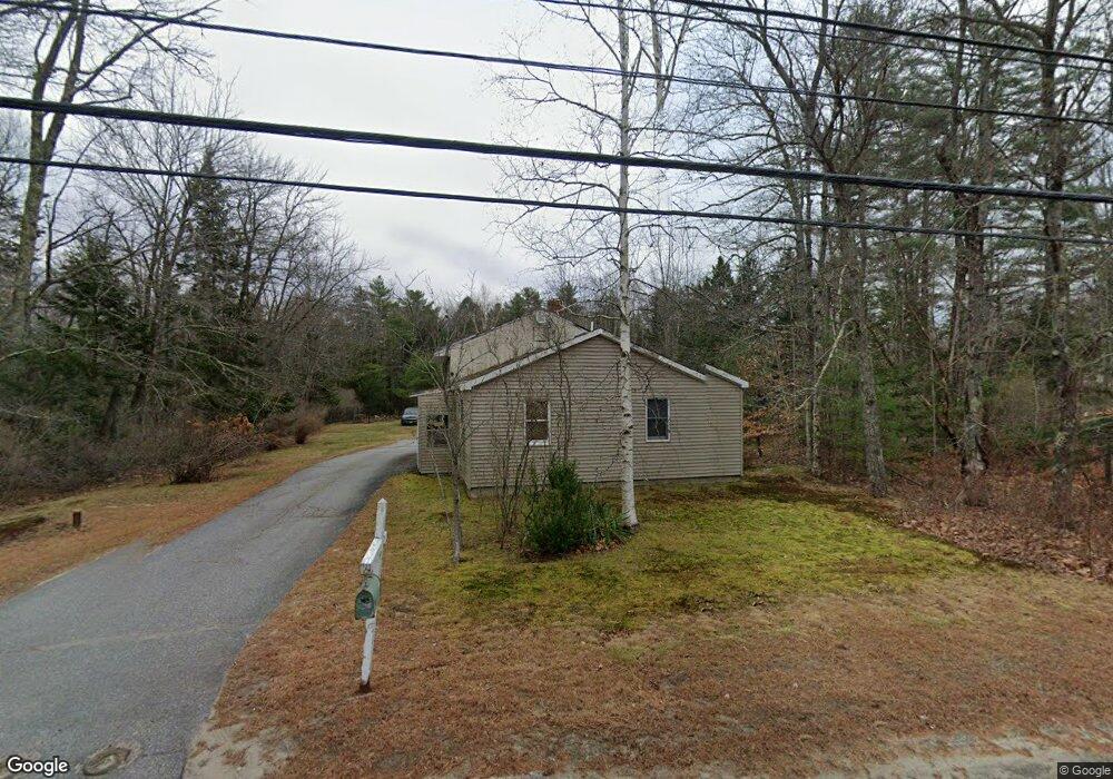
1490 Us Route 1 Freeport, ME 04032
Estimated Value: $318,899 - $403,000
1
Bed
1
Bath
960
Sq Ft
$375/Sq Ft
Est. Value
About This Home
This home is located at 1490 Us Route 1, Freeport, ME 04032 and is currently estimated at $359,975, approximately $374 per square foot. 1490 Us Route 1 is a home located in Cumberland County with nearby schools including Morse Street School, Mast Landing School, and Freeport Middle School.
Ownership History
Date
Name
Owned For
Owner Type
Purchase Details
Closed on
Jun 27, 2007
Sold by
Campbell Zane G and Carmichael Jennifer A
Bought by
Brogli Jonathan D
Current Estimated Value
Home Financials for this Owner
Home Financials are based on the most recent Mortgage that was taken out on this home.
Original Mortgage
$154,020
Outstanding Balance
$94,952
Interest Rate
6.24%
Mortgage Type
Unknown
Estimated Equity
$265,023
Create a Home Valuation Report for This Property
The Home Valuation Report is an in-depth analysis detailing your home's value as well as a comparison with similar homes in the area
Home Values in the Area
Average Home Value in this Area
Purchase History
| Date | Buyer | Sale Price | Title Company |
|---|---|---|---|
| Brogli Jonathan D | -- | -- |
Source: Public Records
Mortgage History
| Date | Status | Borrower | Loan Amount |
|---|---|---|---|
| Open | Brogli Jonathan D | $154,020 |
Source: Public Records
Tax History Compared to Growth
Tax History
| Year | Tax Paid | Tax Assessment Tax Assessment Total Assessment is a certain percentage of the fair market value that is determined by local assessors to be the total taxable value of land and additions on the property. | Land | Improvement |
|---|---|---|---|---|
| 2024 | $2,687 | $201,300 | $105,600 | $95,700 |
| 2023 | $2,498 | $181,700 | $96,000 | $85,700 |
| 2022 | $2,340 | $171,400 | $85,700 | $85,700 |
| 2021 | $2,288 | $171,400 | $85,700 | $85,700 |
| 2020 | $2,177 | $155,500 | $79,400 | $76,100 |
| 2019 | $2,085 | $145,800 | $74,900 | $70,900 |
| 2018 | $2,030 | $134,900 | $64,600 | $70,300 |
| 2017 | $1,945 | $130,100 | $63,300 | $66,800 |
| 2016 | $1,909 | $120,800 | $58,600 | $62,200 |
| 2015 | $1,987 | $118,300 | $58,600 | $59,700 |
| 2014 | $1,924 | $121,800 | $58,600 | $63,200 |
| 2013 | $1,854 | $117,000 | $54,400 | $62,600 |
Source: Public Records
Map
Nearby Homes
- 1487 Us Route 1
- 1 Allen Range Rd
- 1495 U S 1
- 1495 U S Route 1
- 1495 Us Route 1
- 1480 U S 1
- 2 Allen Range Rd
- 5 Allen Range Rd
- 1473 Us Route 1
- 1469 Us Route 1
- 1487 U S 1
- 1468 Us Route 1
- 1456 Us Route 1
- 0 Us Route 1 Unit 1594336
- 0 Us Route 1 Unit 1594334
- 0 Us Route 1 Unit 1052817
- 0 Us Route 1 Unit 1209741
- 0 Us Route 1 Unit 1292892
- 0 Us Route 1 Unit 1368879
- 0 Us Route 1 Unit 1439331