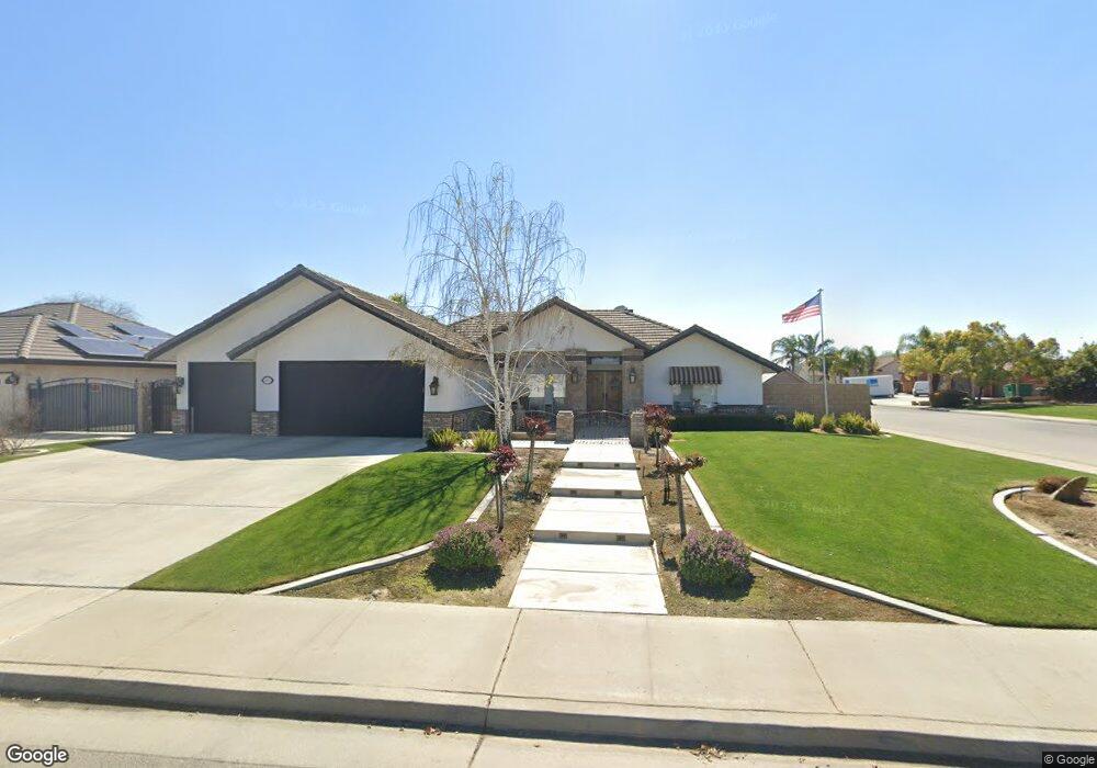
14917 Dobbs Ave Bakersfield, CA 93314
Estimated Value: $652,656 - $786,000
4
Beds
2
Baths
2,261
Sq Ft
$316/Sq Ft
Est. Value
About This Home
This home is located at 14917 Dobbs Ave, Bakersfield, CA 93314 and is currently estimated at $713,664, approximately $315 per square foot. 14917 Dobbs Ave is a home located in Kern County with nearby schools including Independence Elementary School, Freedom Middle School, and Frontier High School.
Ownership History
Date
Name
Owned For
Owner Type
Purchase Details
Closed on
May 13, 1996
Sold by
Renfrow Eloy
Bought by
Mcsweeney Roy F and Mcsweeney Wendy J
Current Estimated Value
Home Financials for this Owner
Home Financials are based on the most recent Mortgage that was taken out on this home.
Original Mortgage
$181,050
Interest Rate
8.32%
Create a Home Valuation Report for This Property
The Home Valuation Report is an in-depth analysis detailing your home's value as well as a comparison with similar homes in the area
Home Values in the Area
Average Home Value in this Area
Purchase History
| Date | Buyer | Sale Price | Title Company |
|---|---|---|---|
| Mcsweeney Roy F | $191,000 | American Title |
Source: Public Records
Mortgage History
| Date | Status | Borrower | Loan Amount |
|---|---|---|---|
| Previous Owner | Mcsweeney Roy F | $181,050 |
Source: Public Records
Tax History Compared to Growth
Tax History
| Year | Tax Paid | Tax Assessment Tax Assessment Total Assessment is a certain percentage of the fair market value that is determined by local assessors to be the total taxable value of land and additions on the property. | Land | Improvement |
|---|---|---|---|---|
| 2025 | $7,140 | $525,258 | $65,132 | $460,126 |
| 2024 | $6,977 | $514,962 | $63,855 | $451,107 |
| 2023 | $6,977 | $504,867 | $62,603 | $442,264 |
| 2022 | $6,842 | $494,969 | $61,376 | $433,593 |
| 2021 | $6,683 | $485,267 | $60,173 | $425,094 |
| 2020 | $6,579 | $480,293 | $59,556 | $420,737 |
| 2019 | $6,465 | $480,293 | $59,556 | $420,737 |
| 2018 | $6,302 | $461,650 | $57,245 | $404,405 |
| 2017 | $6,197 | $452,601 | $56,123 | $396,478 |
| 2016 | $5,788 | $443,730 | $55,023 | $388,707 |
| 2015 | $5,501 | $418,154 | $54,197 | $363,957 |
| 2014 | $5,177 | $390,849 | $53,136 | $337,713 |
Source: Public Records
Map
Nearby Homes
- 14854 Tribute Way
- 14912 Henderson Ave
- 14804 Henderson Ave
- 15027 Henderson Ave
- 2539 Marva Marie Ct
- 14942 Championship Way
- 15042 Championship Way
- 3408 Shauna Marie St
- 15510 Carparzo Dr
- 14035 Rosedale Hwy Unit 83
- 14035 Rosedale Hwy Unit 137
- 14035 Rosedale Hwy Unit 162
- 14035 Rosedale Hwy Unit 87
- 14035 Rosedale Hwy Unit 108
- 14035 Rosedale Hwy Unit 112
- 14035 Rosedale Hwy Unit 69
- 14035 Rosedale Hwy Unit 72
- 14035 Rosedale Hwy Unit 82
- 15626 Sammie Ave
- Plan 1698 at Northpoint
- 14909 Dobbs Ave
- 14901 Dobbs Ave
- 2718 Sugar St
- 2809 Sugar St
- 14827 Dobbs Ave
- 14924 Dobbs Ave
- 2719 Sugar St
- 15002 Dobbs Ave
- 14916 Dobbs Ave
- 14916 David Ct
- 14908 Dobbs Ave
- 14908 David Ct
- 14819 Dobbs Ave
- 2808 Adee Ln
- 14900 Dobbs Ave
- 2800 Adee Ln
- 15010 Dobbs Ave
- 2711 Sugar St
- 14826 Dobbs Ave Unit B
- 15018 Dobbs Ave