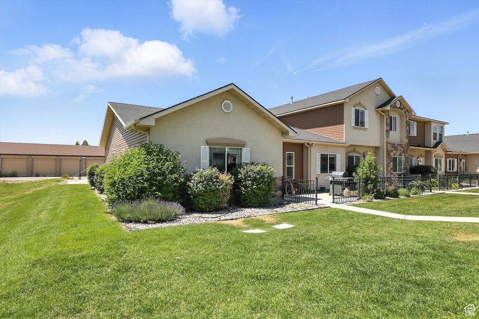
1492 N 565 W Unit 101 Logan, UT 84341
Bridger NeighborhoodEstimated payment $1,849/month
Highlights
- Mountain View
- Corner Lot
- Community Playground
- Clubhouse
- 2 Car Attached Garage
- Tile Flooring
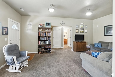
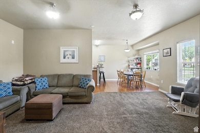
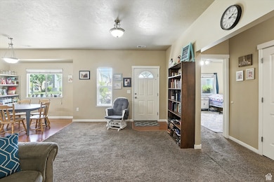
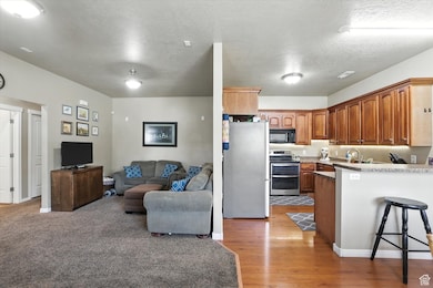
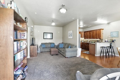
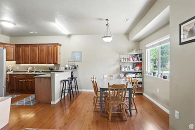
About This Home
Ground-level 3 bed, 2 bath home in the heart of Logan, located in the Bridgerland Meadows community. Enjoy single-level living with a bright, open layout, spacious bedrooms, and a huge private primary suite. Close to parks, schools, USU, and shopping. Low-maintenance living with HOA covering exterior and landscaping. Great for first-time buyers, downsizers, or investors!
Listing Agent
Lacey Hansen
Rodeo Realty License #6655770 Listed on: 07/08/2025
Townhouse Details
Home Type
- Townhome
Est. Annual Taxes
- $1,333
Year Built
- Built in 2008
Lot Details
- 871 Sq Ft Lot
- Landscaped
- Sprinkler System
HOA Fees
- $160 Monthly HOA Fees
Parking
- 2 Car Attached Garage
Home Design
- Stone Siding
- Stucco
Interior Spaces
- 1,398 Sq Ft Home
- 1-Story Property
- Central Vacuum
- Mountain Views
- Electric Dryer Hookup
Kitchen
- Free-Standing Range
- Microwave
- Disposal
Flooring
- Carpet
- Tile
Bedrooms and Bathrooms
- 3 Main Level Bedrooms
- 2 Full Bathrooms
Schools
- Bridger Elementary School
- Mt Logan Middle School
- Logan High School
Utilities
- Forced Air Heating and Cooling System
- Natural Gas Connected
Listing and Financial Details
- Exclusions: Refrigerator
- Assessor Parcel Number 04-183-1801
Community Details
Overview
- Bridgerland Meadows Association, Phone Number (435) 755-7829
- Bridgerland Meadows Subdivision
Amenities
- Clubhouse
Recreation
- Community Playground
- Snow Removal
Pet Policy
- Pets Allowed
Map
Home Values in the Area
Average Home Value in this Area
Tax History
| Year | Tax Paid | Tax Assessment Tax Assessment Total Assessment is a certain percentage of the fair market value that is determined by local assessors to be the total taxable value of land and additions on the property. | Land | Improvement |
|---|---|---|---|---|
| 2025 | $1,262 | $163,215 | $0 | $0 |
| 2024 | $1,333 | $167,015 | $0 | $0 |
| 2023 | $1,612 | $192,500 | $0 | $0 |
| 2022 | $1,776 | $198,000 | $0 | $0 |
| 2021 | $1,327 | $228,600 | $70,000 | $158,600 |
| 2020 | $1,260 | $195,350 | $40,000 | $155,350 |
| 2019 | $1,317 | $195,349 | $40,000 | $155,349 |
| 2018 | $1,209 | $163,705 | $25,000 | $138,705 |
| 2017 | $1,207 | $86,405 | $0 | $0 |
| 2016 | $1,251 | $79,640 | $0 | $0 |
| 2015 | $1,023 | $70,585 | $0 | $0 |
| 2014 | $853 | $65,085 | $0 | $0 |
| 2013 | -- | $65,085 | $0 | $0 |
Property History
| Date | Event | Price | List to Sale | Price per Sq Ft |
|---|---|---|---|---|
| 10/13/2025 10/13/25 | Price Changed | $299,900 | -1.3% | $215 / Sq Ft |
| 10/04/2025 10/04/25 | Price Changed | $304,000 | -1.0% | $217 / Sq Ft |
| 09/25/2025 09/25/25 | Price Changed | $307,000 | -1.6% | $220 / Sq Ft |
| 09/20/2025 09/20/25 | Price Changed | $312,000 | -1.0% | $223 / Sq Ft |
| 08/25/2025 08/25/25 | Price Changed | $315,000 | -3.1% | $225 / Sq Ft |
| 08/06/2025 08/06/25 | Price Changed | $325,000 | -2.7% | $232 / Sq Ft |
| 07/25/2025 07/25/25 | Price Changed | $334,000 | -0.3% | $239 / Sq Ft |
| 07/08/2025 07/08/25 | For Sale | $335,000 | -- | $240 / Sq Ft |
Purchase History
| Date | Type | Sale Price | Title Company |
|---|---|---|---|
| Warranty Deed | -- | Cache Title Company Inc | |
| Interfamily Deed Transfer | -- | Hickman Land Title Company | |
| Corporate Deed | -- | Hickman Land Title Company |
Mortgage History
| Date | Status | Loan Amount | Loan Type |
|---|---|---|---|
| Open | $270,750 | New Conventional | |
| Previous Owner | $138,000 | New Conventional | |
| Previous Owner | $158,512 | FHA |
Source: UtahRealEstate.com
MLS Number: 2096977
APN: 04-183-1801
Disclaimer: Certain information contained herein is derived from information provided by parties other than Homes.com. All information provided is deemed reliable, but is not guaranteed to be accurate and should be independently verified.
![]() IDX information is provided exclusively for consumers’ personal, non-commercial use, that it may not be used for any purpose other than to identify prospective properties consumers may be interested in purchasing, and that the data is deemed reliable but is not guaranteed accurate by the MLS. Licensor is only providing the MLS Content and not other sources of data provided in the Product.
IDX information is provided exclusively for consumers’ personal, non-commercial use, that it may not be used for any purpose other than to identify prospective properties consumers may be interested in purchasing, and that the data is deemed reliable but is not guaranteed accurate by the MLS. Licensor is only providing the MLS Content and not other sources of data provided in the Product.
Based on information from the Wasatch Front Regional Multiple Listing Service, Inc.. All data, including all measurements and calculations of area, is obtained from various sources and has not been, and will not be, verified by broker or the MLS. All information should be independently reviewed and verified for accuracy. Properties may or may not be listed by the office/agent presenting the information.
- 539 W 1465 N Unit 17-102
- 514 W 1490 N Unit 102
- 1565 N 565 W Unit 101
- 1584 N 565 W Unit 104
- 1583 N 400 W Unit 103
- 200 N 600 W
- 1762 N 460 W Unit 103-10
- 2 Somerset Place
- 2200 N 220 W
- 1355 N 220 W
- 48 Kensington Place
- Park Avenue 1600 Plan at Park Avenue 1600
- 1926 Lavender Loop Unit 6
- 259 W 1800 N
- 1085 N 375 W Unit 20
- 85 Hampton Place
- 1068 N 250 W
- 894 N 400 W
- 873 N 480 W
- 875 N 440 W