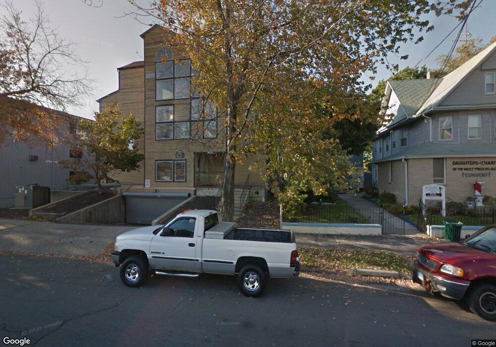
1492 North Ave Unit 212 Bridgeport, CT 06604
Brooklawn-Saint Vincent NeighborhoodEstimated Value: $220,404 - $245,000
2
Beds
2
Baths
829
Sq Ft
$281/Sq Ft
Est. Value
About This Home
This home is located at 1492 North Ave Unit 212, Bridgeport, CT 06604 and is currently estimated at $233,101, approximately $281 per square foot. 1492 North Ave Unit 212 is a home located in Fairfield County with nearby schools including Geraldine Johnson School, Central High School, and Catholic Academy of Bridgeport-St. Raphael Academy.
Ownership History
Date
Name
Owned For
Owner Type
Purchase Details
Closed on
Sep 21, 2009
Sold by
Department Of Housing & Urban Dev
Bought by
Clarke Colin
Current Estimated Value
Purchase Details
Closed on
Feb 17, 2009
Sold by
Chfa
Bought by
Department Of Housing & Urban Dev
Purchase Details
Closed on
Aug 3, 2004
Sold by
Cogan Robert and Cogan Carol
Bought by
Cadet Karen
Home Financials for this Owner
Home Financials are based on the most recent Mortgage that was taken out on this home.
Original Mortgage
$125,900
Interest Rate
6.33%
Purchase Details
Closed on
Mar 18, 2004
Sold by
Chenard Yvan
Bought by
Cogan 2Nd Robert and Cogan Carol
Home Financials for this Owner
Home Financials are based on the most recent Mortgage that was taken out on this home.
Original Mortgage
$66,400
Interest Rate
5.71%
Create a Home Valuation Report for This Property
The Home Valuation Report is an in-depth analysis detailing your home's value as well as a comparison with similar homes in the area
Home Values in the Area
Average Home Value in this Area
Purchase History
| Date | Buyer | Sale Price | Title Company |
|---|---|---|---|
| Clarke Colin | -- | -- | |
| Clarke Colin | -- | -- | |
| Department Of Housing & Urban Dev | $1,000 | -- | |
| Department Of Housing & Urban Dev | $1,000 | -- | |
| Cadet Karen | $134,000 | -- | |
| Cadet Karen | $134,000 | -- | |
| Cogan 2Nd Robert | $85,000 | -- | |
| Cogan 2Nd Robert | $85,000 | -- |
Source: Public Records
Mortgage History
| Date | Status | Borrower | Loan Amount |
|---|---|---|---|
| Previous Owner | Cogan 2Nd Robert | $125,900 | |
| Previous Owner | Cogan 2Nd Robert | $66,400 |
Source: Public Records
Tax History Compared to Growth
Tax History
| Year | Tax Paid | Tax Assessment Tax Assessment Total Assessment is a certain percentage of the fair market value that is determined by local assessors to be the total taxable value of land and additions on the property. | Land | Improvement |
|---|---|---|---|---|
| 2025 | $3,606 | $82,990 | $0 | $82,990 |
| 2024 | $3,606 | $82,990 | $0 | $82,990 |
| 2023 | $3,606 | $82,990 | $0 | $82,990 |
| 2022 | $3,606 | $82,990 | $0 | $82,990 |
| 2021 | $3,606 | $82,990 | $0 | $82,990 |
| 2020 | $1,874 | $34,710 | $0 | $34,710 |
| 2019 | $1,874 | $34,710 | $0 | $34,710 |
| 2018 | $1,887 | $34,710 | $0 | $34,710 |
| 2017 | $1,887 | $34,710 | $0 | $34,710 |
| 2016 | $1,887 | $34,710 | $0 | $34,710 |
| 2015 | $3,381 | $80,120 | $0 | $80,120 |
| 2014 | $3,381 | $80,120 | $0 | $80,120 |
Source: Public Records
Map
Nearby Homes
- 191 Oak St
- 100 Lorraine St
- 125 E Eaton St
- 318 Center St
- 309 Pequonnock St
- 31 Taft Ave
- 78 Fairmount Ave
- 826 Norman St
- 75 Sanford Ave
- 200 Harral Ave
- 113 Milne St Unit 115
- 90 Tom Thumb St
- 1373 Iranistan Ave
- 566 Wood Ave
- 687 Wood Ave
- 414 Wood Ave
- 665 W Taft Ave
- 60 Olive St
- 184 Pacific St
- 1275 Capitol Ave
- 1492 North Ave Unit 211
- 1492 North Ave Unit 210
- 1492 North Ave Unit 209
- 1492 North Ave Unit 208
- 1492 North Ave Unit 207
- 1492 North Ave Unit 206
- 1492 North Ave Unit 205
- 1492 North Ave Unit 204
- 1492 North Ave Unit 203
- 1492 North Ave Unit 202
- 1492 North Ave Unit 201
- 1492 North Ave Unit 112
- 1492 North Ave Unit 111
- 1492 North Ave Unit 110
- 1492 North Ave Unit 109
- 1492 North Ave Unit 108
- 1492 North Ave Unit 107
- 1492 North Ave Unit 105
- 1492 North Ave Unit 104