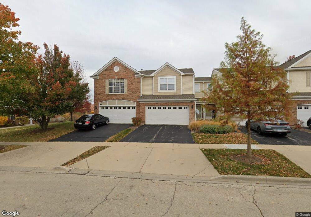
1493 Millbrook Dr Algonquin, IL 60102
Far West Algonquin NeighborhoodEstimated Value: $265,258 - $315,000
2
Beds
2
Baths
1,567
Sq Ft
$189/Sq Ft
Est. Value
About This Home
This home is located at 1493 Millbrook Dr, Algonquin, IL 60102 and is currently estimated at $295,565, approximately $188 per square foot. 1493 Millbrook Dr is a home located in McHenry County with nearby schools including Westfield Community School, Lincoln Prairie Elementary School, and Harry D Jacobs High School.
Ownership History
Date
Name
Owned For
Owner Type
Purchase Details
Closed on
Jul 1, 2005
Sold by
Centex Homes
Bought by
Matson Michael D
Current Estimated Value
Home Financials for this Owner
Home Financials are based on the most recent Mortgage that was taken out on this home.
Original Mortgage
$185,812
Outstanding Balance
$96,745
Interest Rate
5.62%
Mortgage Type
Unknown
Estimated Equity
$198,820
Create a Home Valuation Report for This Property
The Home Valuation Report is an in-depth analysis detailing your home's value as well as a comparison with similar homes in the area
Home Values in the Area
Average Home Value in this Area
Purchase History
| Date | Buyer | Sale Price | Title Company |
|---|---|---|---|
| Matson Michael D | $232,265 | -- |
Source: Public Records
Mortgage History
| Date | Status | Borrower | Loan Amount |
|---|---|---|---|
| Open | Matson Michael D | $185,812 |
Source: Public Records
Tax History
| Year | Tax Paid | Tax Assessment Tax Assessment Total Assessment is a certain percentage of the fair market value that is determined by local assessors to be the total taxable value of land and additions on the property. | Land | Improvement |
|---|---|---|---|---|
| 2024 | $5,822 | $82,420 | $15,898 | $66,522 |
| 2023 | $5,501 | $73,715 | $14,219 | $59,496 |
| 2022 | $4,725 | $61,094 | $11,245 | $49,849 |
| 2021 | $4,518 | $56,916 | $10,476 | $46,440 |
| 2020 | $4,391 | $54,901 | $10,105 | $44,796 |
| 2019 | $4,274 | $52,547 | $9,672 | $42,875 |
| 2018 | $3,911 | $47,033 | $8,935 | $38,098 |
| 2017 | $3,815 | $44,308 | $8,417 | $35,891 |
| 2016 | $3,739 | $41,557 | $7,894 | $33,663 |
| 2013 | -- | $52,601 | $7,364 | $45,237 |
Source: Public Records
Map
Nearby Homes
- 1453 Millbrook Dr
- 1552 Matthew Dr Unit 1552
- 2956 Harnish Dr
- 2602 Amber Ln Unit 49
- 895 Eineke Blvd
- 0 Boyer Rd Unit MRD11328255
- 2161 Burnham Ct
- 2069 Peach Tree Ln Unit 4116
- 2054 Peach Tree Ln Unit 4171
- 2051 Carlisle St
- 18 Peach Tree Ct Unit 4154
- 1157 Sawmill Ln
- 1900 Waverly Ln
- 1181 Glenmont St
- 1221 Glenmont St
- 1850 White Oak Dr
- 1231 Glenmont St
- 1233 Glenmont St
- 1237 Glenmont St
- 1239 Glenmont St
- 1495 Millbrook Dr
- 1491 Millbrook Dr
- 1497 Millbrook Dr
- 1487 Millbrook Dr
- 1485 Millbrook Dr
- 1490 Millbrook Dr
- 1483 Millbrook Dr
- 1492 Millbrook Dr
- 1480 Millbrook Dr
- 1481 Millbrook Dr
- 1494 Millbrook Dr
- 1482 Millbrook Dr
- 1496 Millbrook Dr
- 1484 Millbrook Dr
- 1474 Millbrook Dr
- 1477 Millbrook Dr
- 1507 Millbrook Dr Unit 4
- 1472 Millbrook Dr
- 1505 Millbrook Dr Unit 3
- 1503 Millbrook Dr Unit 2
Your Personal Tour Guide
Ask me questions while you tour the home.