Estimated Value: $308,000 - $468,000
--
Bed
2
Baths
1,878
Sq Ft
$210/Sq Ft
Est. Value
About This Home
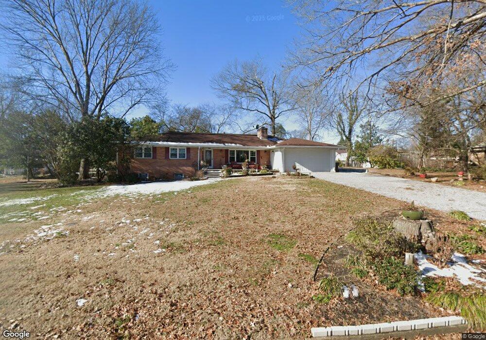
This home is located at 1493 Springbrook Rd, Alcoa, TN 37701 and is currently estimated at $394,486, approximately $210 per square foot. 1493 Springbrook Rd is a home located in Blount County with nearby schools including Alcoa Elementary School, Alcoa Middle School, and Alcoa High School.
Ownership History
Date
Name
Owned For
Owner Type
Purchase Details
Closed on
Feb 28, 2017
Sold by
Malone Goldia R
Bought by
Daniel Mamer
Current Estimated Value
Purchase Details
Closed on
Dec 15, 2016
Sold by
Malone Goldia R
Bought by
Malone Goldia R and Morgan Huey P
Purchase Details
Closed on
Nov 17, 2016
Sold by
Malone Goldia R
Bought by
Dagley Michael and Dagley Misty
Purchase Details
Closed on
Aug 13, 2004
Sold by
Akard Mike
Bought by
Malone Goldia R
Home Financials for this Owner
Home Financials are based on the most recent Mortgage that was taken out on this home.
Original Mortgage
$187,500
Interest Rate
5.97%
Purchase Details
Closed on
Aug 12, 2004
Bought by
Malone Gary L and Malone Goldia R
Home Financials for this Owner
Home Financials are based on the most recent Mortgage that was taken out on this home.
Original Mortgage
$187,500
Interest Rate
5.97%
Purchase Details
Closed on
Dec 19, 1958
Bought by
Carter Earnest and Carter Cassie
Create a Home Valuation Report for This Property
The Home Valuation Report is an in-depth analysis detailing your home's value as well as a comparison with similar homes in the area
Home Values in the Area
Average Home Value in this Area
Purchase History
| Date | Buyer | Sale Price | Title Company |
|---|---|---|---|
| Daniel Mamer | -- | -- | |
| Malone Goldia R | -- | -- | |
| Dagley Michael | $125,000 | -- | |
| Malone Goldia R | $187,500 | -- | |
| Malone Gary L | $187,500 | -- | |
| Carter Earnest | -- | -- |
Source: Public Records
Mortgage History
| Date | Status | Borrower | Loan Amount |
|---|---|---|---|
| Previous Owner | Carter Earnest | $187,500 | |
| Previous Owner | Carter Earnest | $187,500 |
Source: Public Records
Tax History Compared to Growth
Tax History
| Year | Tax Paid | Tax Assessment Tax Assessment Total Assessment is a certain percentage of the fair market value that is determined by local assessors to be the total taxable value of land and additions on the property. | Land | Improvement |
|---|---|---|---|---|
| 2025 | -- | $95,950 | $0 | $0 |
| 2024 | $3,148 | $95,950 | $14,075 | $81,875 |
| 2023 | $3,148 | $95,950 | $14,075 | $81,875 |
| 2022 | $2,755 | $58,125 | $9,375 | $48,750 |
| 2021 | $2,755 | $58,125 | $9,375 | $48,750 |
| 2020 | $2,755 | $58,125 | $9,375 | $48,750 |
| 2019 | $2,755 | $58,125 | $9,375 | $48,750 |
| 2018 | $2,225 | $50,225 | $11,000 | $39,225 |
| 2017 | $2,173 | $50,225 | $11,000 | $39,225 |
| 2016 | $2,173 | $49,050 | $11,000 | $38,050 |
| 2015 | $2,016 | $49,050 | $11,000 | $38,050 |
| 2014 | $2,143 | $49,050 | $11,000 | $38,050 |
| 2013 | $2,143 | $52,125 | $0 | $0 |
Source: Public Records
Map
Nearby Homes
- 1321 Nobel St Unit E
- 1367 Dalton St
- 1345 Dalton St
- 1340 Dalton St
- 1791 Ramsay St
- 1761 Dalton St
- 0 N Wright Rd
- 1765 N Wright Rd
- 653 E Hunt Rd
- 1852 Kettering Rd
- 947 Poplar St
- 946 Poplar St
- 960 Poplar St
- 966 Poplar St
- 1656 Peppertree Dr
- 1536 Tsuga Dr
- 1569 Ashwood Place
- 1301 Edenbridge Dr
- 1647 Banebury Ln
- 552 N Wright Rd
- 1507 Springbrook Rd
- 1516 Huxley St
- 1439 Ramsay St
- 1431 Ramsay St
- 547 Lake St
- 1425 Ramsay St
- 1509 Ramsay St
- 1513 Springbrook Rd
- 1522 Huxley St
- 1515 Ramsay St
- 1417 Ramsay St
- 1440 Maury St
- 1521 Ramsay St
- 1434 Maury St
- 1502 Maury St
- 1428 Maury St
- 1519 Springbrook Rd
- 0 Springbrook Park
- 1528 Huxley St
- 1422 Maury St