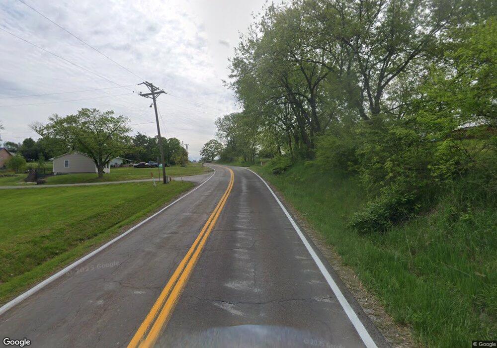
14965 Highway E Camden Point, MO 64018
Estimated Value: $246,000 - $289,000
3
Beds
1
Bath
1,260
Sq Ft
$209/Sq Ft
Est. Value
About This Home
This home is located at 14965 Highway E, Camden Point, MO 64018 and is currently estimated at $263,558, approximately $209 per square foot. 14965 Highway E is a home located in Platte County with nearby schools including North Platte Elementary School, North Platte Intermediate School, and North Platte Junior High School.
Ownership History
Date
Name
Owned For
Owner Type
Purchase Details
Closed on
Sep 18, 2020
Sold by
Plegge Walter and Plegge Kristen
Bought by
Nance Nicholas
Current Estimated Value
Home Financials for this Owner
Home Financials are based on the most recent Mortgage that was taken out on this home.
Original Mortgage
$169,696
Outstanding Balance
$149,968
Interest Rate
2.8%
Mortgage Type
New Conventional
Estimated Equity
$113,590
Purchase Details
Closed on
May 18, 2007
Sold by
Fannie Mae
Bought by
Plegge Walter
Home Financials for this Owner
Home Financials are based on the most recent Mortgage that was taken out on this home.
Original Mortgage
$104,975
Interest Rate
6.22%
Mortgage Type
New Conventional
Create a Home Valuation Report for This Property
The Home Valuation Report is an in-depth analysis detailing your home's value as well as a comparison with similar homes in the area
Purchase History
| Date | Buyer | Sale Price | Title Company |
|---|---|---|---|
| Nance Nicholas | -- | Stewart Title Company | |
| Plegge Walter | -- | None Available |
Source: Public Records
Mortgage History
| Date | Status | Borrower | Loan Amount |
|---|---|---|---|
| Open | Nance Nicholas | $169,696 | |
| Previous Owner | Plegge Walter | $104,975 |
Source: Public Records
Tax History
| Year | Tax Paid | Tax Assessment Tax Assessment Total Assessment is a certain percentage of the fair market value that is determined by local assessors to be the total taxable value of land and additions on the property. | Land | Improvement |
|---|---|---|---|---|
| 2025 | $2,343 | $31,253 | $11,293 | $19,960 |
| 2024 | $2,245 | $31,253 | $11,293 | $19,960 |
| 2023 | $2,245 | $31,253 | $11,293 | $19,960 |
| 2022 | $2,111 | $29,100 | $11,293 | $17,807 |
| 2021 | $2,117 | $29,100 | $11,293 | $17,807 |
| 2020 | $1,900 | $25,526 | $2,850 | $22,676 |
| 2019 | $1,900 | $25,526 | $2,850 | $22,676 |
| 2018 | $1,911 | $25,526 | $2,850 | $22,676 |
| 2017 | $1,911 | $25,526 | $2,850 | $22,676 |
| 2016 | $1,892 | $25,526 | $2,850 | $22,676 |
| 2015 | $1,891 | $25,526 | $2,850 | $22,676 |
| 2013 | $1,846 | $25,526 | $0 | $0 |
Source: Public Records
Map
Nearby Homes
- 19710 Kansas City Blvd
- 207 2nd St E
- U Highway
- 0 U Hwy Unit HMS2588353
- 21970 Lamar Rd
- 0 Cockriel Rd
- 103 Johnson Cir
- 521 E 2nd St
- 107 E 2nd St
- 601 Main St
- 103 Sally Cir
- 314 Fairview Cir
- 24110 Highway Y N A
- 0 Missouri 273
- 212 High St
- 12890 Bethel Terrace
- 19845 S Ridgely Rd
- 0 Little Platte Rd Unit HMS2597502
- 1216 Hampton Dr
- 22 Florentina St
- 14965 County Rd E
- 14905 County Rd E
- 14905 Mo-E
- 19800 Kansas City Blvd
- 19800 Kansas City Blvd
- 14845 Highway E
- 14845 County Rd E
- 19850 Kansas City Blvd
- 19715 Kansas City Blvd
- 14790 County Rd E
- 14790 County Rd E
- 14790 Highway E
- 19705 Kansas City Blvd
- 1103 3rd St
- 1203 3rd St
- 1009 3rd St
- 19685 Interurban Rd
- 205 Scout St
- 14760 County Rd E
- 19701 Kansas City Blvd
Your Personal Tour Guide
Ask me questions while you tour the home.
