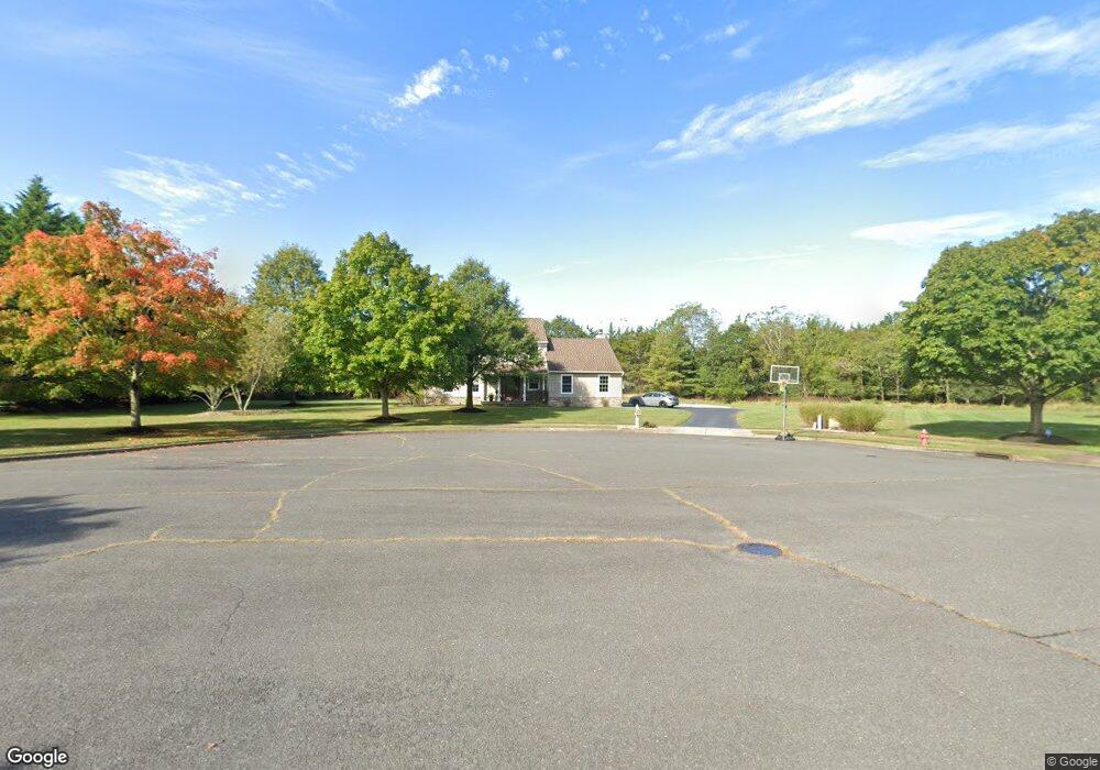
1497 Deborah Ct Wall Township, NJ 07719
Estimated Value: $1,050,430 - $1,205,000
4
Beds
3
Baths
2,254
Sq Ft
$512/Sq Ft
Est. Value
About This Home
This home is located at 1497 Deborah Ct, Wall Township, NJ 07719 and is currently estimated at $1,155,108, approximately $512 per square foot. 1497 Deborah Ct is a home located in Monmouth County with nearby schools including Wall High School and The Brookside School.
Ownership History
Date
Name
Owned For
Owner Type
Purchase Details
Closed on
Mar 30, 2010
Sold by
Roberts Charles and Roberts Susan E
Bought by
Legere John P and Legere Tina M
Current Estimated Value
Home Financials for this Owner
Home Financials are based on the most recent Mortgage that was taken out on this home.
Original Mortgage
$434,100
Outstanding Balance
$290,839
Interest Rate
5.12%
Mortgage Type
Stand Alone First
Estimated Equity
$864,269
Purchase Details
Closed on
Sep 13, 1999
Sold by
Mccollum Lewis
Bought by
Roberts Charles and Knopp Susan
Home Financials for this Owner
Home Financials are based on the most recent Mortgage that was taken out on this home.
Original Mortgage
$273,600
Interest Rate
7.8%
Mortgage Type
Purchase Money Mortgage
Purchase Details
Closed on
Jul 15, 1994
Sold by
Middlesex Devt
Bought by
Mccollum Lewis and Mccollum Barbara
Home Financials for this Owner
Home Financials are based on the most recent Mortgage that was taken out on this home.
Original Mortgage
$202,000
Interest Rate
8.4%
Mortgage Type
Purchase Money Mortgage
Create a Home Valuation Report for This Property
The Home Valuation Report is an in-depth analysis detailing your home's value as well as a comparison with similar homes in the area
Home Values in the Area
Average Home Value in this Area
Purchase History
| Date | Buyer | Sale Price | Title Company |
|---|---|---|---|
| Legere John P | $542,700 | River Edge Title Agency Llc | |
| Roberts Charles | $342,000 | -- | |
| Mccollum Lewis | $251,800 | -- |
Source: Public Records
Mortgage History
| Date | Status | Borrower | Loan Amount |
|---|---|---|---|
| Open | Legere John P | $434,100 | |
| Previous Owner | Roberts Charles | $273,600 | |
| Previous Owner | Mccollum Lewis | $202,000 |
Source: Public Records
Tax History Compared to Growth
Tax History
| Year | Tax Paid | Tax Assessment Tax Assessment Total Assessment is a certain percentage of the fair market value that is determined by local assessors to be the total taxable value of land and additions on the property. | Land | Improvement |
|---|---|---|---|---|
| 2025 | $12,470 | $591,000 | $263,800 | $327,200 |
| 2024 | $12,098 | $591,000 | $263,800 | $327,200 |
| 2023 | $12,098 | $591,000 | $263,800 | $327,200 |
| 2022 | $11,802 | $591,000 | $263,800 | $327,200 |
| 2021 | $11,802 | $591,000 | $263,800 | $327,200 |
| 2020 | $11,660 | $591,000 | $263,800 | $327,200 |
| 2019 | $11,519 | $591,000 | $263,800 | $327,200 |
| 2018 | $11,065 | $572,700 | $263,800 | $308,900 |
| 2017 | $10,847 | $572,700 | $263,800 | $308,900 |
| 2016 | $10,618 | $572,700 | $263,800 | $308,900 |
| 2015 | $10,057 | $340,900 | $123,900 | $217,000 |
| 2014 | $10,232 | $354,800 | $137,800 | $217,000 |
Source: Public Records
Map
Nearby Homes
- 1442 Garrett Dr
- 11 Tarpon Dr Unit 1001
- 1908 Sherwood Dr
- 1314 Winding Brook Ln
- 151 S Manor Ct Unit 1
- 183 S Manor Ct
- 2101 Friar Ct
- 1334 Willow Dr
- 2134 Old Mill Rd
- 1314 Willow Dr
- 2174 Begonia Ave
- 2164 Old Mill Rd
- 2005 Nassau Dr
- 1301 Warren Ave Unit 5
- 1919 Atlantic Ave Unit 26
- 1919 Atlantic Ave Unit 15
- 2808 Concord Dr
- 2253 Wagner Ln
- 2217 Old Mill Rd
- 1980 Campbell Rd
- 1496 Deborah Ct
- 1495 Deborah Ct
- 1494 Deborah Ct
- 1499 Ocean Rd
- 1495 Ocean Rd
- 2104 Baileys Corner Rd
- 1493 Deborah Ct
- 1498 Garrett Dr
- 1496 Garrett Dr
- 1493 Ocean Rd
- 2099 Ohadi Dr
- 2098 Ohadi Dr
- 1504 Ocean Rd
- 1492 Deborah Ct
- 1494 Garrett Dr
- 1498 Ocean Rd
- 1491 Deborah Ct
- 1496 Ocean Rd
- 1493 Samuel Dr
- 1488 Garrett Dr