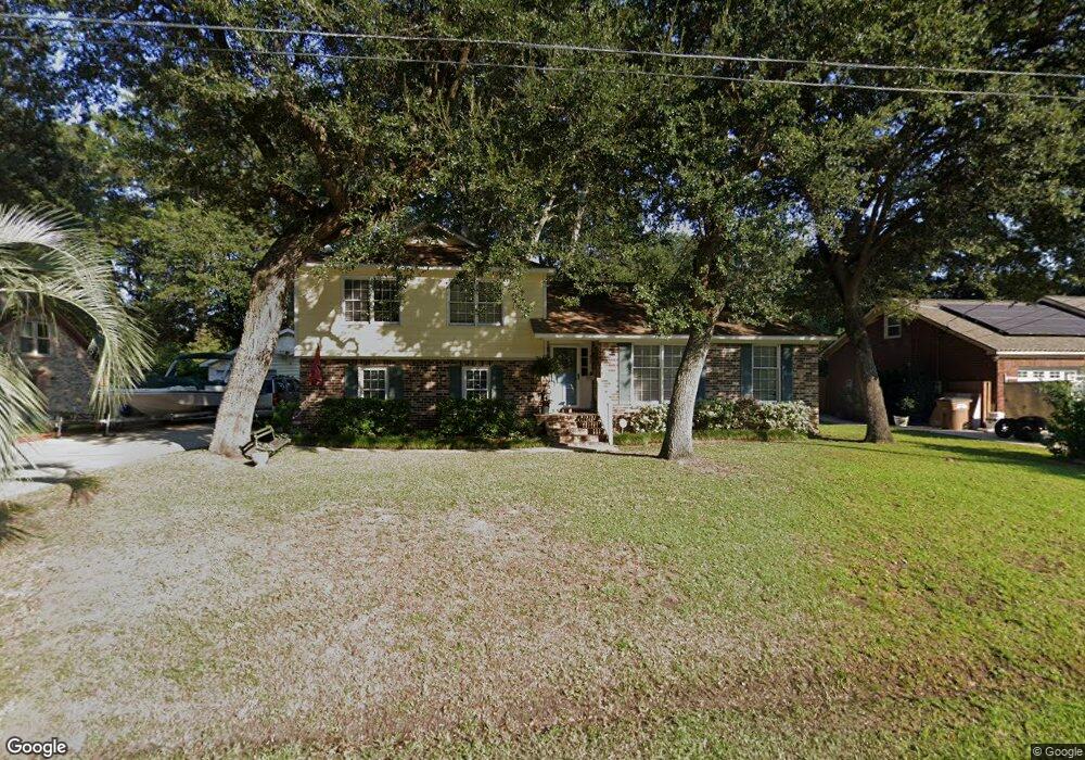
1497 Kentwood Cir Charleston, SC 29412
James Island NeighborhoodEstimated Value: $579,000 - $697,000
3
Beds
2
Baths
2,206
Sq Ft
$289/Sq Ft
Est. Value
About This Home
This home is located at 1497 Kentwood Cir, Charleston, SC 29412 and is currently estimated at $636,515, approximately $288 per square foot. 1497 Kentwood Cir is a home located in Charleston County with nearby schools including James Island Elementary School, Camp Road Middle, and Septima P Clark Corporate Academy.
Ownership History
Date
Name
Owned For
Owner Type
Purchase Details
Closed on
Sep 27, 2010
Sold by
Bostick Cheryl
Bought by
Bostick Paul and Bostick Paul
Current Estimated Value
Home Financials for this Owner
Home Financials are based on the most recent Mortgage that was taken out on this home.
Original Mortgage
$175,000
Interest Rate
4.42%
Mortgage Type
New Conventional
Create a Home Valuation Report for This Property
The Home Valuation Report is an in-depth analysis detailing your home's value as well as a comparison with similar homes in the area
Home Values in the Area
Average Home Value in this Area
Purchase History
| Date | Buyer | Sale Price | Title Company |
|---|---|---|---|
| Bostick Paul | -- | -- |
Source: Public Records
Mortgage History
| Date | Status | Borrower | Loan Amount |
|---|---|---|---|
| Closed | Bostick Paul | $175,000 |
Source: Public Records
Tax History Compared to Growth
Tax History
| Year | Tax Paid | Tax Assessment Tax Assessment Total Assessment is a certain percentage of the fair market value that is determined by local assessors to be the total taxable value of land and additions on the property. | Land | Improvement |
|---|---|---|---|---|
| 2024 | $1,369 | $11,040 | $0 | $0 |
| 2023 | $1,369 | $11,040 | $0 | $0 |
| 2022 | $1,238 | $11,040 | $0 | $0 |
| 2021 | $1,324 | $11,040 | $0 | $0 |
| 2020 | $1,338 | $11,040 | $0 | $0 |
| 2019 | $1,224 | $9,600 | $0 | $0 |
| 2017 | $1,299 | $9,600 | $0 | $0 |
| 2016 | $1,246 | $9,600 | $0 | $0 |
| 2015 | $1,291 | $9,600 | $0 | $0 |
| 2014 | $1,224 | $0 | $0 | $0 |
| 2011 | -- | $0 | $0 | $0 |
Source: Public Records
Map
Nearby Homes
- 1030 Pauline Ave
- 1014 Arborwood Dr
- 1135 Bellwood Rd
- 1418 Kentwood Cir
- 1453 Camp Rd
- 1047 Bradford Ave
- 1153 Pauline Ave
- 1 S Anderson Ave
- 1107 Secessionville Rd
- 1152 Bradford Ave
- 17 S Anderson Ave Unit A,B,C, D
- 1402 Camp Rd Unit 5E
- 1402 Camp Rd Unit 6E
- 1402 Camp Rd Unit 1H
- 1402 Camp Rd Unit 8B
- 1402 Camp Rd Unit 9C
- 1402 Camp Rd Unit 12F
- 1182 Folly Rd Unit A,B,C,D
- 1815 Walsingham Way
- 1056 Yorktown Dr
- 1493 Kentwood Cir
- 1501 Kentwood Cir
- 1039 Arborwood Dr
- 1035 Arborwood Dr
- 1496 Kentwood Cir
- 1043 Arborwood Dr
- 1489 Kentwood Cir
- 1498 Kentwood Cir
- 1505 Kentwood Cir
- 1031 Arborwood Dr
- 1494 Kentwood Cir
- 1502 Kentwood Cir
- 1492 Kentwood Cir
- 1047 Arborwood Dr
- 1027 Arborwood Dr
- 1485 Kentwood Cir
- 1504 Kentwood Cir
- 1040 Arborwood Dr
- 1038 Arborwood Dr
- 1042 Arborwood Dr