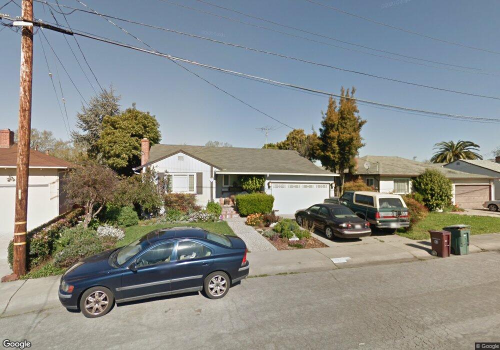
14989 Swenson St San Leandro, CA 94579
Washington Manor-Bonaire NeighborhoodEstimated Value: $756,868 - $820,000
3
Beds
1
Bath
1,076
Sq Ft
$726/Sq Ft
Est. Value
About This Home
This home is located at 14989 Swenson St, San Leandro, CA 94579 and is currently estimated at $780,967, approximately $725 per square foot. 14989 Swenson St is a home located in Alameda County with nearby schools including Dayton Elementary School, Washington Manor Middle School, and Arroyo High School.
Ownership History
Date
Name
Owned For
Owner Type
Purchase Details
Closed on
May 22, 2013
Sold by
Cole Richard D and Cole Carol F
Bought by
Cole Carol F and Cole Richard D
Current Estimated Value
Home Financials for this Owner
Home Financials are based on the most recent Mortgage that was taken out on this home.
Original Mortgage
$287,000
Interest Rate
3.38%
Mortgage Type
New Conventional
Purchase Details
Closed on
Oct 25, 2011
Sold by
Follrath Cole Richard D and Follrath Cole Carol
Bought by
Cole Richard D and Cole Carol F
Home Financials for this Owner
Home Financials are based on the most recent Mortgage that was taken out on this home.
Original Mortgage
$233,000
Interest Rate
4.02%
Mortgage Type
New Conventional
Create a Home Valuation Report for This Property
The Home Valuation Report is an in-depth analysis detailing your home's value as well as a comparison with similar homes in the area
Home Values in the Area
Average Home Value in this Area
Purchase History
| Date | Buyer | Sale Price | Title Company |
|---|---|---|---|
| Cole Carol F | -- | Wfg Title Company Of Califor | |
| Cole Richard D | -- | Calcounties Title Nation |
Source: Public Records
Mortgage History
| Date | Status | Borrower | Loan Amount |
|---|---|---|---|
| Closed | Cole Carol F | $287,000 | |
| Closed | Cole Richard D | $233,000 |
Source: Public Records
Tax History Compared to Growth
Tax History
| Year | Tax Paid | Tax Assessment Tax Assessment Total Assessment is a certain percentage of the fair market value that is determined by local assessors to be the total taxable value of land and additions on the property. | Land | Improvement |
|---|---|---|---|---|
| 2025 | $4,752 | $350,825 | $137,979 | $219,846 |
| 2024 | $4,752 | $343,809 | $135,273 | $215,536 |
| 2023 | $4,738 | $343,931 | $132,621 | $211,310 |
| 2022 | $4,659 | $330,188 | $130,021 | $207,167 |
| 2021 | $4,525 | $323,577 | $127,472 | $203,105 |
| 2020 | $4,419 | $327,189 | $126,165 | $201,024 |
| 2019 | $4,418 | $320,774 | $123,692 | $197,082 |
| 2018 | $4,142 | $314,486 | $121,267 | $193,219 |
| 2017 | $3,951 | $308,321 | $118,890 | $189,431 |
| 2016 | $3,852 | $302,276 | $116,559 | $185,717 |
| 2015 | $3,766 | $297,736 | $114,808 | $182,928 |
| 2014 | $3,709 | $291,905 | $112,560 | $179,345 |
Source: Public Records
Map
Nearby Homes
- 688 Garside Ct
- 15009 Kesterson St
- 15001 Norton St Unit 1
- 15049 Kesterson St
- 619 Beatrice St
- 391 Anza Way
- 700 Fargo Ave Unit 2
- 700 Fargo Ave Unit 5
- 700 Fargo Ave Unit 12
- 700 Fargo Ave Unit 1
- 650 Fargo Ave Unit 4
- 720 Fargo Ave Unit 14
- 670 Fargo Ave Unit 5
- 747 Lewelling Blvd
- 747 Lewelling Blvd Unit SPC 22
- 829 Crespi Dr
- 585 Majestic Way Unit 40
- 874 Lewelling Blvd
- 3847 Yorkshire St Unit 8
- 15356 Sullivan Ave
- 14983 Swenson St
- 14993 Swenson St
- 684 Garside Ct
- 14981 Swenson St
- 14997 Swenson St
- 680 Garside Ct
- 692 Garside Ct
- 14988 Swenson St
- 14994 Crosby St
- 14996 Swenson St
- 676 Garside Ct
- 14976 Swenson St
- 14998 Crosby St
- 14977 Swenson St
- 651 Manor Blvd
- 672 Garside Ct
- 14973 Swenson St
- 15009 Swenson St
- 14970 Swenson St
- 668 668 Garside Ct