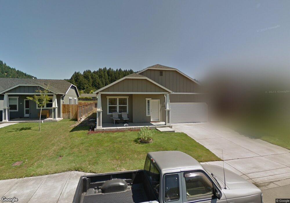
1499 S 58th St Springfield, OR 97478
Thurston NeighborhoodEstimated Value: $413,000 - $448,000
3
Beds
2
Baths
1,690
Sq Ft
$258/Sq Ft
Est. Value
About This Home
This home is located at 1499 S 58th St, Springfield, OR 97478 and is currently estimated at $436,692, approximately $258 per square foot. 1499 S 58th St is a home located in Lane County with nearby schools including Riverbend Elementary School, Agnes Stewart Middle School, and Thurston High School.
Ownership History
Date
Name
Owned For
Owner Type
Purchase Details
Closed on
Jan 21, 2009
Sold by
The Bank Of New York
Bought by
Baughn Sean J
Current Estimated Value
Home Financials for this Owner
Home Financials are based on the most recent Mortgage that was taken out on this home.
Original Mortgage
$140,000
Outstanding Balance
$87,442
Interest Rate
5.04%
Mortgage Type
Purchase Money Mortgage
Estimated Equity
$349,250
Purchase Details
Closed on
Sep 22, 2008
Sold by
Havelock Kevin B and Havelock Patricia A
Bought by
The Bank Of New York
Purchase Details
Closed on
Nov 28, 2006
Sold by
Hayden Enterprises Inc
Bought by
Havelock Kevin B and Havelock Patricia A
Home Financials for this Owner
Home Financials are based on the most recent Mortgage that was taken out on this home.
Original Mortgage
$43,450
Interest Rate
6.05%
Mortgage Type
Stand Alone Second
Create a Home Valuation Report for This Property
The Home Valuation Report is an in-depth analysis detailing your home's value as well as a comparison with similar homes in the area
Home Values in the Area
Average Home Value in this Area
Purchase History
| Date | Buyer | Sale Price | Title Company |
|---|---|---|---|
| Baughn Sean J | $175,000 | First American Title Ins Co | |
| The Bank Of New York | $174,250 | Accommodation | |
| Havelock Kevin B | $217,480 | Cascade Title Co |
Source: Public Records
Mortgage History
| Date | Status | Borrower | Loan Amount |
|---|---|---|---|
| Open | Baughn Sean J | $140,000 | |
| Previous Owner | Havelock Kevin B | $43,450 | |
| Previous Owner | Havelock Kevin B | $173,950 |
Source: Public Records
Tax History Compared to Growth
Tax History
| Year | Tax Paid | Tax Assessment Tax Assessment Total Assessment is a certain percentage of the fair market value that is determined by local assessors to be the total taxable value of land and additions on the property. | Land | Improvement |
|---|---|---|---|---|
| 2025 | $4,249 | $231,700 | -- | -- |
| 2024 | $4,180 | $224,952 | -- | -- |
| 2023 | $4,180 | $218,400 | $0 | $0 |
| 2022 | $3,871 | $212,039 | $0 | $0 |
| 2021 | $3,802 | $205,864 | $0 | $0 |
| 2020 | $3,691 | $199,868 | $0 | $0 |
| 2019 | $3,580 | $194,047 | $0 | $0 |
| 2018 | $3,375 | $182,909 | $0 | $0 |
| 2017 | $3,245 | $182,909 | $0 | $0 |
| 2016 | $3,177 | $177,582 | $0 | $0 |
| 2015 | $3,086 | $172,410 | $0 | $0 |
| 2014 | $3,040 | $167,388 | $0 | $0 |
Source: Public Records
Map
Nearby Homes
- 1839 S 57th St
- 6195 Graystone Loop
- 0 Forsythia St
- 6225 Forest Ridge Dr
- 6035 Fernhill Loop
- 5289 Cedar View Dr
- 0 Forest Ridge Dr Unit 637211360
- 0 Forest Ridge Dr Unit 298125461
- 0 Forest Ridge Dr Unit 415181610
- 967 S 66th Place
- 5335 Daisy St Unit TL 0130
- 0 Forest Ridge Unit 520732026
- 5335 Main St Unit 236
- 5204 Cedar View Dr
- 5292 Squirrel St
- 5198 Cedar View Dr
- 205 S 54th St
- 205 S 54th St Unit 23
- 6715 Ivy St
- 5193 Holly St
- 1477 S 58th St
- 1525 S 58th St
- 1547 S 58th St
- 5796 Peridot Way
- 5799 Peridot Way
- 1581 S 58th St
- 1433 S 58th St
- 5792 Peridot Way
- 5791 Peridot Way
- 5794 Cinder St
- 5784 Peridot Way
- 5783 Peridot Way
- 5786 Cinder St
- 1601 S 58th St
- 5793 Montclaire Way
- 5785 Montclaire Way
- 5776 Peridot Way
- 5775 Peridot Way
- 1504 S 59th St
- 5780 Cinder St