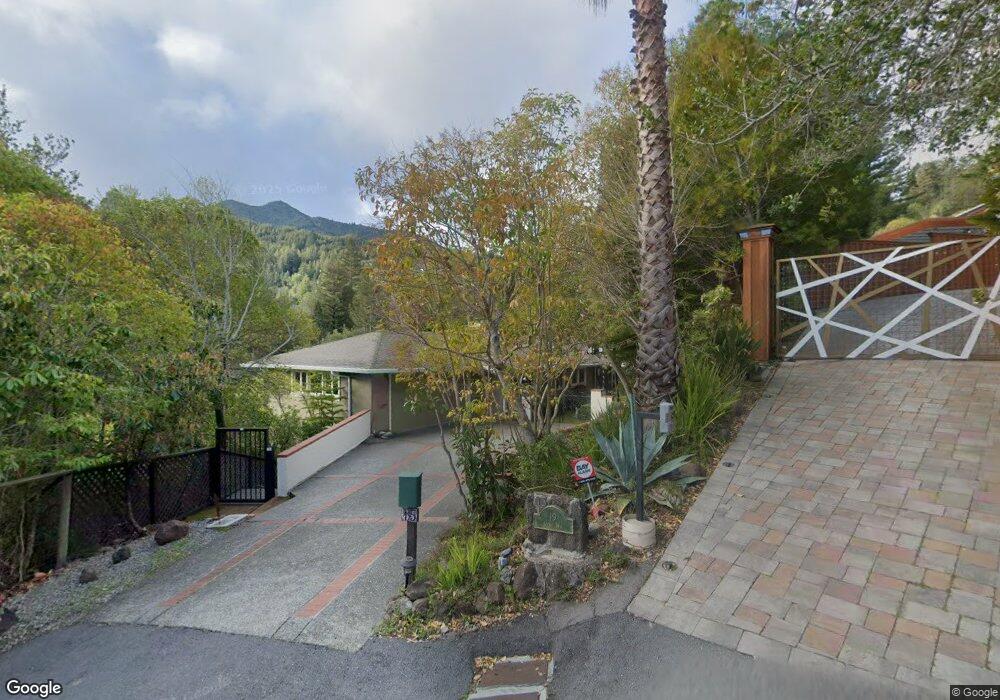
15 Acorn Way Kentfield, CA 94904
Estimated Value: $3,038,000 - $5,529,000
4
Beds
3
Baths
2,834
Sq Ft
$1,296/Sq Ft
Est. Value
About This Home
This home is located at 15 Acorn Way, Kentfield, CA 94904 and is currently estimated at $3,671,489, approximately $1,295 per square foot. 15 Acorn Way is a home located in Marin County with nearby schools including Anthony G. Bacich Elementary School, Adaline E. Kent Middle School, and Redwood High School.
Ownership History
Date
Name
Owned For
Owner Type
Purchase Details
Closed on
Jun 17, 2021
Sold by
Hoon Cynthia Kami
Bought by
Kami Cynthia A and The Cynthia A Kami Revocable T
Current Estimated Value
Home Financials for this Owner
Home Financials are based on the most recent Mortgage that was taken out on this home.
Original Mortgage
$579,000
Outstanding Balance
$524,212
Interest Rate
2.9%
Mortgage Type
New Conventional
Estimated Equity
$3,147,277
Purchase Details
Closed on
Aug 19, 2011
Sold by
Hoon Cynthia Kami and Kami Cynthia A
Bought by
Kami Cynthia A and The Cynthia A Kami Revocable T
Home Financials for this Owner
Home Financials are based on the most recent Mortgage that was taken out on this home.
Original Mortgage
$694,000
Interest Rate
4.5%
Mortgage Type
New Conventional
Purchase Details
Closed on
Jul 15, 2011
Sold by
Hoon Cynthia Kami
Bought by
Kami Cynthia A and Cynthia A Kami Revocable Trust
Home Financials for this Owner
Home Financials are based on the most recent Mortgage that was taken out on this home.
Original Mortgage
$694,000
Interest Rate
4.5%
Mortgage Type
New Conventional
Purchase Details
Closed on
Jul 8, 2011
Sold by
Hoon Philip A and Hoon Cynthia Ann Kami
Bought by
Hoon Cynthia Kami
Home Financials for this Owner
Home Financials are based on the most recent Mortgage that was taken out on this home.
Original Mortgage
$694,000
Interest Rate
4.5%
Mortgage Type
New Conventional
Purchase Details
Closed on
Mar 19, 2002
Sold by
Hoon Philip A and Hoon Cynthia Ann Kami
Bought by
Hoon Philip A and Hoon Cynthia Ann Kami
Purchase Details
Closed on
Jul 16, 1998
Sold by
50 Mackenzie Glenn S H and 50 Mackenzie S
Bought by
Hoon Philip A and Hoon Cynthia Ann Kami
Home Financials for this Owner
Home Financials are based on the most recent Mortgage that was taken out on this home.
Original Mortgage
$840,000
Interest Rate
6.75%
Purchase Details
Closed on
Sep 15, 1994
Sold by
Mackenzie Glenn S and Mackenzie Susan H
Bought by
Mackenzie Glenn S and Mackenzie Susan H
Create a Home Valuation Report for This Property
The Home Valuation Report is an in-depth analysis detailing your home's value as well as a comparison with similar homes in the area
Home Values in the Area
Average Home Value in this Area
Purchase History
| Date | Buyer | Sale Price | Title Company |
|---|---|---|---|
| Kami Cynthia A | -- | Fidelity National Title Co | |
| Hoon Cynthia Kami | -- | Fidelity National Title Co | |
| Kami Cynthia A | -- | None Available | |
| Kami Cynthia A | -- | Fidelity National Title | |
| Hoon Cynthia Kami | -- | Fidelity National Title Co | |
| Hoon Philip A | -- | North American Title Co | |
| Hoon Philip A | $1,050,000 | Cal Land Title | |
| Mackenzie Glenn S | -- | -- |
Source: Public Records
Mortgage History
| Date | Status | Borrower | Loan Amount |
|---|---|---|---|
| Open | Hoon Cynthia Kami | $579,000 | |
| Closed | Hoon Cynthia Kami | $694,000 | |
| Closed | Hoon Philip A | $840,000 |
Source: Public Records
Tax History Compared to Growth
Tax History
| Year | Tax Paid | Tax Assessment Tax Assessment Total Assessment is a certain percentage of the fair market value that is determined by local assessors to be the total taxable value of land and additions on the property. | Land | Improvement |
|---|---|---|---|---|
| 2025 | $22,583 | $1,645,990 | $1,018,946 | $627,044 |
| 2024 | $22,583 | $1,613,724 | $998,972 | $614,752 |
| 2023 | $22,107 | $1,582,087 | $979,387 | $602,700 |
| 2022 | $21,976 | $1,551,070 | $960,186 | $590,884 |
| 2021 | $21,588 | $1,520,662 | $941,362 | $579,300 |
| 2020 | $21,302 | $1,505,070 | $931,710 | $573,360 |
| 2019 | $20,607 | $1,475,565 | $913,445 | $562,120 |
| 2018 | $20,128 | $1,446,637 | $895,537 | $551,100 |
| 2017 | $19,162 | $1,418,277 | $877,981 | $540,296 |
| 2016 | $18,442 | $1,390,473 | $860,769 | $529,704 |
| 2015 | $18,415 | $1,369,588 | $847,840 | $521,748 |
| 2014 | $17,437 | $1,342,761 | $831,233 | $511,528 |
Source: Public Records
Map
Nearby Homes
- 216 Evergreen Dr
- 22 Cedar Ave
- 100 Black Log Rd
- 128 Ridgecrest Rd
- 87 Laurel Grove Ave
- 9 Fay Dr
- 16 Edna Ct
- 52 Austin Ave
- 19 Belle Ave
- 745 Redwood Rd
- 723 Redwood Rd
- 265 Crescent Rd
- 505 Larkspur Plaza Dr Unit 9
- 500 Via Hidalgo
- 310 Larkspur Plaza Dr
- 6 Madrona St
- 5 W Hillside Ave
- 24 Boardwalk One
- 207 D St
- 50 Via Belardo Unit 12
- 404 Woodland Rd
- 19 Acorn Way
- 408 Woodland Rd
- 432 Woodland Rd
- 400 Woodland Rd
- 436 Woodland Rd
- 21 Acorn Way
- 424 Woodland Rd
- 25 Acorn Way
- 414 Woodland Rd
- 403 Woodland Rd
- 329 Goodhill Rd
- 401 Woodland Rd
- 325 Goodhill Rd
- 320 Woodland Rd
- 33 Acorn Way
- 397 Woodland Rd
- 10 Acorn Way
- 5 Upland Rd
- 427 Woodland Rd