
Seller's Agent in 2025
Christine Reilly
ERA Key Realty Services - Worcester
(508) 615-1526
2 in this area
120 Total Sales
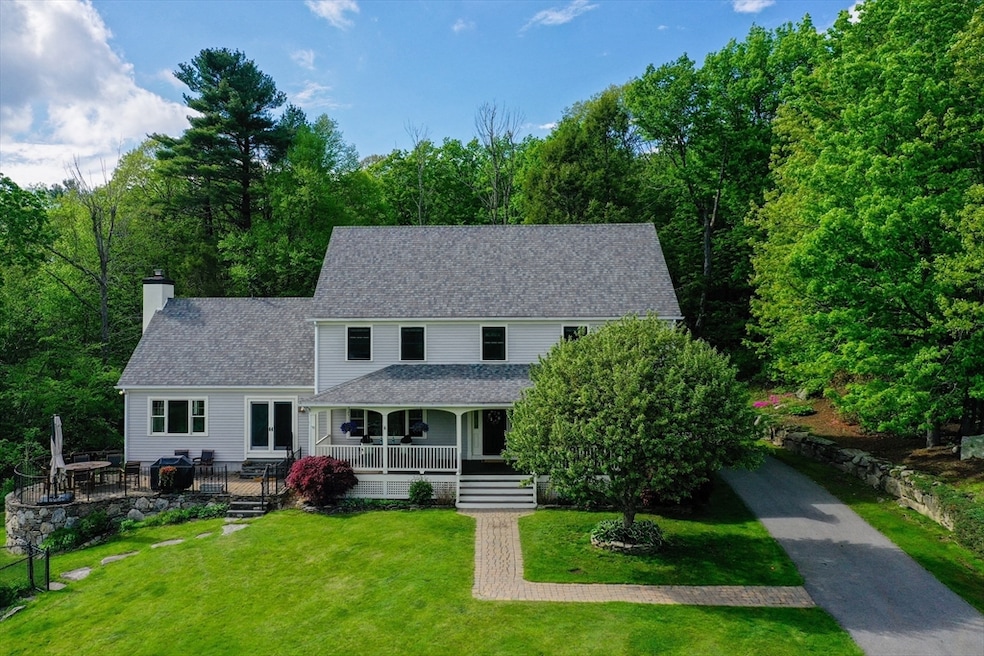
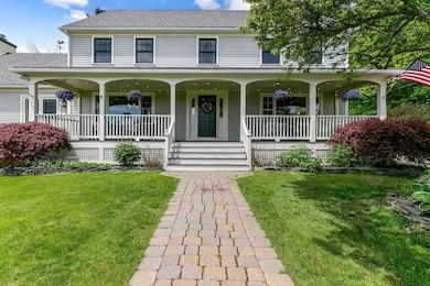
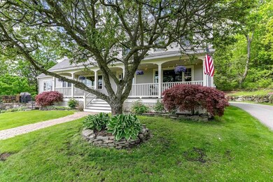
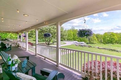
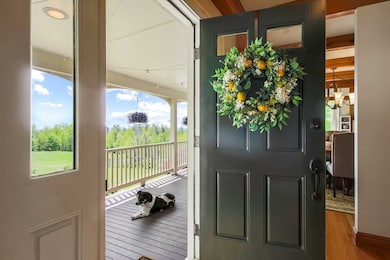
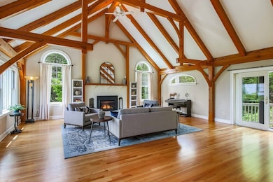

From Beautiful Sunrises to Stunning Sunsets this gorgeous, estate style, 4BR, 2.5BA custom post & beam home on 8 private acres in sought-after Princeton is a must see. This 3,700 sq ft property features hardwood floors, radiant heat on the main level, natural brick fireplace with propane insert in 2 story great room, office, den or dining room, plus a 3-season rm. Huge Kitchen with center island features seating for 6! Extra finished rooms on 3rd floor is perfect for extended or large families. See Update list attached. Enjoy outdoor living with a heated 20x40 in-ground pool, patio, farmers porch, outdoor shower, and electronic pet fence. Home includes a 2-car under garage, paved parking for 10+, hardwired generator, and Title V in hand. Adjacent to Audubon Wildlife Refuge & close to Mount Wachusett for hiking, skiing, and year-round activities. Top-rated school district. Additional 4-acre buildable lot available (MLS# 73355667). A rare opportunity for privacy, recreation & expansion!
Last Agent to Sell the Property
ERA Key Realty Services - Worcester Listed on: 05/19/2025
| Date | Type | Sale Price | Title Company |
|---|---|---|---|
| Deed | $1,000,000 | -- | |
| Deed | $1,000,000 | -- | |
| Deed | $73,000 | -- | |
| Deed | $73,000 | -- | |
| Deed | $73,000 | -- | |
| Deed | $73,000 | -- |
| Date | Status | Loan Amount | Loan Type |
|---|---|---|---|
| Open | $600,000 | New Conventional | |
| Closed | $600,000 | New Conventional | |
| Previous Owner | $348,000 | No Value Available |
| Date | Event | Price | List to Sale | Price per Sq Ft |
|---|---|---|---|---|
| 07/30/2025 07/30/25 | Sold | $1,000,000 | -9.1% | $269 / Sq Ft |
| 06/06/2025 06/06/25 | Pending | -- | -- | -- |
| 05/19/2025 05/19/25 | For Sale | $1,100,000 | -- | $296 / Sq Ft |
| Year | Tax Paid | Tax Assessment Tax Assessment Total Assessment is a certain percentage of the fair market value that is determined by local assessors to be the total taxable value of land and additions on the property. | Land | Improvement |
|---|---|---|---|---|
| 2025 | $9,917 | $682,500 | $178,000 | $504,500 |
| 2024 | $9,452 | $673,700 | $175,400 | $498,300 |
| 2023 | $8,884 | $586,800 | $139,900 | $446,900 |
| 2022 | $8,508 | $542,600 | $139,900 | $402,700 |
| 2021 | $8,279 | $513,600 | $139,900 | $373,700 |
| 2020 | $8,009 | $505,300 | $139,900 | $365,400 |
| 2019 | $7,983 | $498,300 | $137,000 | $361,300 |
| 2018 | $7,601 | $439,900 | $118,300 | $321,600 |
| 2017 | $7,571 | $425,800 | $161,800 | $264,000 |
| 2016 | $7,579 | $425,800 | $161,800 | $264,000 |
Seller's Agent in 2025
Christine Reilly
ERA Key Realty Services - Worcester
(508) 615-1526
2 in this area
120 Total Sales
Source: MLS Property Information Network (MLS PIN)
MLS Number: 73377102
APN: PRIN M:012A B:0002 L:00000
Disclaimer: Certain information contained herein is derived from information provided by parties other than Homes.com. All information provided is deemed reliable, but is not guaranteed to be accurate and should be independently verified.
![]() The property listing data and information, or the Images, set forth herein were provided to MLS Property Information Network, Inc. from third party sources, including sellers, lessors and public records, and were compiled by MLS Property Information Network, Inc. The property listing data and information, and the Images, are for the personal, non-commercial use of consumers having a good faith interest in purchasing or leasing listed properties of the type displayed to them and may not be used for any purpose other than to identify prospective properties which such consumers may have a good faith interest in purchasing or leasing. MLS Property Information Network, Inc. and its subscribers disclaim any and all representations and warranties as to the accuracy of the property listing data and information, or as to the accuracy of any of the Images, set forth herein.
The property listing data and information, or the Images, set forth herein were provided to MLS Property Information Network, Inc. from third party sources, including sellers, lessors and public records, and were compiled by MLS Property Information Network, Inc. The property listing data and information, and the Images, are for the personal, non-commercial use of consumers having a good faith interest in purchasing or leasing listed properties of the type displayed to them and may not be used for any purpose other than to identify prospective properties which such consumers may have a good faith interest in purchasing or leasing. MLS Property Information Network, Inc. and its subscribers disclaim any and all representations and warranties as to the accuracy of the property listing data and information, or as to the accuracy of any of the Images, set forth herein.