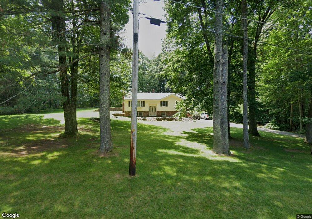
15 Amberwood Dr Atkinson, NH 03811
Estimated Value: $603,815 - $649,000
3
Beds
2
Baths
1,684
Sq Ft
$373/Sq Ft
Est. Value
About This Home
This home is located at 15 Amberwood Dr, Atkinson, NH 03811 and is currently estimated at $628,704, approximately $373 per square foot. 15 Amberwood Dr is a home located in Rockingham County with nearby schools including Atkinson Academy, Timberlane Regional Middle School, and Timberlane Regional High School.
Ownership History
Date
Name
Owned For
Owner Type
Purchase Details
Closed on
Feb 16, 2016
Sold by
Mulcahy Charles D and Mulcahy Maureen
Bought by
Mulcahy Charles D
Current Estimated Value
Purchase Details
Closed on
Oct 1, 1999
Sold by
Page William D and Page Joan E
Bought by
Mulcahy Charles D and Mulcahy Maureen
Home Financials for this Owner
Home Financials are based on the most recent Mortgage that was taken out on this home.
Original Mortgage
$145,000
Interest Rate
7.85%
Create a Home Valuation Report for This Property
The Home Valuation Report is an in-depth analysis detailing your home's value as well as a comparison with similar homes in the area
Home Values in the Area
Average Home Value in this Area
Purchase History
| Date | Buyer | Sale Price | Title Company |
|---|---|---|---|
| Mulcahy Charles D | -- | -- | |
| Mulcahy Charles D | $191,000 | -- |
Source: Public Records
Mortgage History
| Date | Status | Borrower | Loan Amount |
|---|---|---|---|
| Previous Owner | Mulcahy Charles D | $201,029 | |
| Previous Owner | Mulcahy Charles D | $145,000 |
Source: Public Records
Tax History Compared to Growth
Tax History
| Year | Tax Paid | Tax Assessment Tax Assessment Total Assessment is a certain percentage of the fair market value that is determined by local assessors to be the total taxable value of land and additions on the property. | Land | Improvement |
|---|---|---|---|---|
| 2024 | $5,857 | $453,300 | $231,000 | $222,300 |
| 2023 | $6,573 | $453,300 | $231,000 | $222,300 |
| 2022 | $5,562 | $453,300 | $231,000 | $222,300 |
| 2021 | $5,603 | $453,300 | $231,000 | $222,300 |
| 2020 | $4,847 | $264,300 | $154,000 | $110,300 |
| 2019 | $4,670 | $264,300 | $154,000 | $110,300 |
| 2018 | $4,739 | $264,300 | $154,000 | $110,300 |
| 2017 | $4,837 | $264,300 | $154,000 | $110,300 |
| 2016 | $4,770 | $266,800 | $154,000 | $112,800 |
| 2015 | $4,832 | $253,000 | $149,000 | $104,000 |
| 2014 | $4,832 | $253,000 | $149,000 | $104,000 |
| 2013 | $4,807 | $253,000 | $149,000 | $104,000 |
Source: Public Records
Map
Nearby Homes
- 132 Maple Ave
- Lot 11 Crown Hill Rd
- 52 Academy Ave
- 19 Crown Hill Rd
- 22 Knightland Rd
- 9 Hickory Pond Ln Unit 9
- 25 Cottonwood Rd
- 2 Devonshire Rd
- 13 Cottonwood Rd
- 4 Huckleberry Ln
- 3 Knightland Rd
- 15 Marilyn Dr
- 15 Culver St Unit 23
- 15 Culver St Unit 18
- 7 Stevens Ct Unit 7
- 7 Stevens Ct
- 127 Cowbell Crossing
- 7 Middle Rd Unit B
- 267 Main St
- 27 Village Dr
- 16 Amberwood Dr
- 7 Dearborn Ridge Rd
- 9 Dearborn Ridge Rd
- 17 Amberwood Dr
- 13 Amberwood Dr
- 14 Amberwood Dr
- 11 Dearborn Ridge Rd
- 10 Dearborn Ridge Rd
- 8 Dearborn Ridge Rd
- 13 Dearborn Ridge Rd
- 6 Dearborn Ridge Rd
- 18 Amberwood Dr
- 11 Amberwood Dr
- 12 Amberwood Dr
- 2 Dearborn Ridge Rd
- 3 Fernwood Dr
- 20 Amberwood Dr
- 4 Dearborn Ridge Rd
- 19 Amberwood Dr
- 10 Amberwood Dr