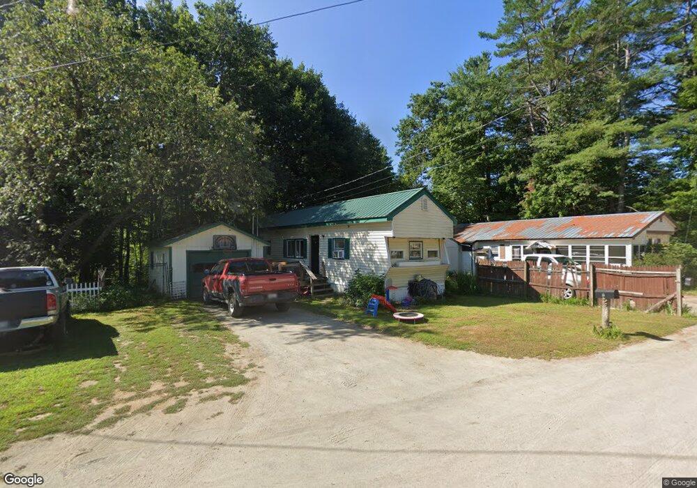
15 B and B Rd Hartland, ME 04943
Estimated Value: $56,623 - $165,000
--
Bed
--
Bath
--
Sq Ft
8,712
Sq Ft Lot
About This Home
This home is located at 15 B and B Rd, Hartland, ME 04943 and is currently estimated at $105,906. 15 B and B Rd is a home with nearby schools including Hartland Consolidated School, Somerset Elementary School, and Nokomis Regional Middle School/High School.
Ownership History
Date
Name
Owned For
Owner Type
Purchase Details
Closed on
Jul 21, 2023
Sold by
Tollefson Bradley D and Tollefson Pamela S
Bought by
Moons Edward and Moons Marcia
Current Estimated Value
Home Financials for this Owner
Home Financials are based on the most recent Mortgage that was taken out on this home.
Original Mortgage
$9,000
Outstanding Balance
$8,781
Interest Rate
6.69%
Mortgage Type
Purchase Money Mortgage
Estimated Equity
$97,125
Purchase Details
Closed on
Mar 21, 2022
Sold by
Muncipality
Bought by
Tollefson Bradley D and Tollefson Pamela S
Purchase Details
Closed on
Jun 20, 2011
Sold by
Harvey Ernest J
Bought by
Harvey Ernest J
Create a Home Valuation Report for This Property
The Home Valuation Report is an in-depth analysis detailing your home's value as well as a comparison with similar homes in the area
Home Values in the Area
Average Home Value in this Area
Purchase History
| Date | Buyer | Sale Price | Title Company |
|---|---|---|---|
| Moons Edward | -- | None Available | |
| Moons Edward | -- | None Available | |
| Moons Edward | -- | None Available | |
| Tollefson Bradley D | -- | None Available | |
| Tollefson Bradley D | -- | None Available | |
| Tollefson Bradley D | -- | None Available | |
| Harvey Ernest J | -- | -- | |
| Harvey Ernest J | -- | -- |
Source: Public Records
Mortgage History
| Date | Status | Borrower | Loan Amount |
|---|---|---|---|
| Open | Moons Edward | $9,000 | |
| Closed | Moons Edward | $9,000 |
Source: Public Records
Tax History Compared to Growth
Tax History
| Year | Tax Paid | Tax Assessment Tax Assessment Total Assessment is a certain percentage of the fair market value that is determined by local assessors to be the total taxable value of land and additions on the property. | Land | Improvement |
|---|---|---|---|---|
| 2024 | $491 | $31,660 | $12,380 | $19,280 |
| 2023 | $478 | $27,060 | $10,580 | $16,480 |
| 2022 | $503 | $24,160 | $9,450 | $14,710 |
| 2021 | $527 | $24,160 | $9,450 | $14,710 |
| 2020 | $536 | $24,160 | $9,450 | $14,710 |
| 2019 | $546 | $24,160 | $9,450 | $14,710 |
| 2018 | $546 | $24,160 | $9,450 | $14,710 |
| 2017 | $546 | $24,160 | $9,450 | $14,710 |
| 2016 | $447 | $24,160 | $9,450 | $14,710 |
| 2015 | $459 | $24,160 | $9,450 | $14,710 |
| 2014 | $447 | $24,160 | $9,450 | $14,710 |
Source: Public Records
Map
Nearby Homes
- 83 Commercial St
- 37 North St
- 50 Pleasant St
- 20 Burton St
- 247 Commercial St
- 20 Ford Hill Rd
- 118 Athens Rd
- 47 Higgins Rd
- 700 Warren Hill Rd
- PL5,6,9,10 Great Moose Dr
- 000 Huff Hill Rd E
- 630C Warren Hill Rd
- 630B Warren Hill Rd
- 381 Great Moose Dr
- M6 L22C Stage Rd
- 43 Stage Rd
- 431 Huff Hill Rd
- TBD Chipmunk Ln
- Po M7 L3-1 Wyman Rd
- 4 Main St