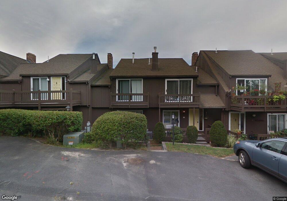
15 Bowsprit Ln Buzzards Bay, MA 02532
Estimated Value: $446,888 - $509,000
2
Beds
3
Baths
1,520
Sq Ft
$312/Sq Ft
Est. Value
About This Home
This home is located at 15 Bowsprit Ln, Buzzards Bay, MA 02532 and is currently estimated at $474,472, approximately $312 per square foot. 15 Bowsprit Ln is a home located in Barnstable County with nearby schools including Bourne High School, St Margaret Regional School, and Bridgeview Montessori School.
Ownership History
Date
Name
Owned For
Owner Type
Purchase Details
Closed on
Dec 6, 2017
Sold by
Cain Edward J and Cain Meryl L
Bought by
Cain Edward J and Cain Meryl L
Current Estimated Value
Purchase Details
Closed on
Mar 31, 2016
Sold by
Miller Kenneth P
Bought by
Plang Rithy and Plang Chantheng
Purchase Details
Closed on
Dec 1, 2015
Sold by
Zerbonne Marielle W
Bought by
Cain Edward J and Cain Meryl L
Purchase Details
Closed on
Nov 13, 2006
Sold by
Nash Millicent A and Nash William F
Bought by
Zerbonne Marielle W
Purchase Details
Closed on
Jun 27, 1997
Sold by
Besse Mary Ann and Besse Sumner B
Bought by
Saxton Diane B and Mobilia Lawrence J
Create a Home Valuation Report for This Property
The Home Valuation Report is an in-depth analysis detailing your home's value as well as a comparison with similar homes in the area
Home Values in the Area
Average Home Value in this Area
Purchase History
| Date | Buyer | Sale Price | Title Company |
|---|---|---|---|
| Cain Edward J | -- | -- | |
| Plang Rithy | $255,000 | -- | |
| Cain Edward J | $200,000 | -- | |
| Zerbonne Marielle W | $220,000 | -- | |
| Zerbonne Marielle W | $220,000 | -- | |
| Saxton Diane B | $87,500 | -- | |
| Saxton Diane B | $87,500 | -- |
Source: Public Records
Mortgage History
| Date | Status | Borrower | Loan Amount |
|---|---|---|---|
| Previous Owner | Zerbonne Marielle W | $100,000 | |
| Closed | Cain Edward J | $0 |
Source: Public Records
Tax History Compared to Growth
Tax History
| Year | Tax Paid | Tax Assessment Tax Assessment Total Assessment is a certain percentage of the fair market value that is determined by local assessors to be the total taxable value of land and additions on the property. | Land | Improvement |
|---|---|---|---|---|
| 2025 | $3,383 | $433,100 | $0 | $433,100 |
| 2024 | $2,894 | $360,800 | $0 | $360,800 |
| 2023 | $2,812 | $319,200 | $0 | $319,200 |
| 2022 | $2,754 | $272,900 | $0 | $272,900 |
| 2021 | $2,322 | $215,600 | $0 | $215,600 |
| 2020 | $2,038 | $189,800 | $0 | $189,800 |
| 2019 | $2,038 | $193,900 | $0 | $193,900 |
| 2018 | $2,068 | $196,200 | $0 | $196,200 |
| 2017 | $2,051 | $199,100 | $0 | $199,100 |
| 2016 | $2,373 | $233,600 | $0 | $233,600 |
| 2015 | $2,204 | $218,900 | $0 | $218,900 |
Source: Public Records
Map
Nearby Homes
- 24 Ships View Terrace
- 27 Ships View Terrace
- 4 Mainstay Ln
- 29 Weather Deck Rd
- 7 Mizzen Ln
- 90-92 Sandwich Rd Unit 9C
- 90-92 Sandwich Rd Unit 2
- 60 Sandwich Rd
- 38 Old Bridge Rd
- 304 Main St
- 44 Cotuit Rd
- 85 Waterhouse Rd
- 85 Waterhouse Rd
- 23 Settlers Way
- 405 Village Dr
- 405 Village Dr Unit 405
- 14 Great Rock Rd
- 18 Heather Hill Rd
- 4 Knob Ln
- 1 Hollyhock Knoll Ct Unit 1
- 59 Harbor Lights Rd
- 56 Harbor Lights Rd
- 19 Bowsprit Ln
- 18 Bowsprit Ln
- 17 Bowsprit Ln
- 16 Bowsprit Ln
- 14 Bowsprit Ln
- 13 Bowsprit Ln
- 56 Harbor Lights Ave Unit 56
- 59 Harbor Lights Ave Unit 59
- 59 Harbor Lights Ave Unit C
- 59 Harbor Lights Ave
- 56 Harbor Lights Rd Unit C56
- 13 Bowsprit Ln Unit 13
- 16 Bowsprit Ln Unit 16
- 56 Harbor Lights Rd
- 59 Harbor Lights Rd
- 15 Bowsprit Ln Unit 15
- 57 Harbor Lights Rd Unit 57
- 60 Harbor Lights Rd