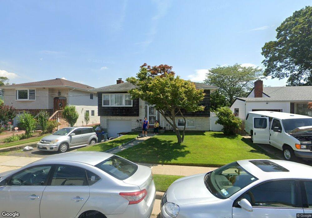
15 Branch Ave Freeport, NY 11520
Estimated Value: $593,000 - $701,024
5
Beds
3
Baths
3,200
Sq Ft
$202/Sq Ft
Est. Value
About This Home
This home is located at 15 Branch Ave, Freeport, NY 11520 and is currently estimated at $647,012, approximately $202 per square foot. 15 Branch Ave is a home located in Nassau County with nearby schools including Columbus Avenue School, Caroline G. Atkinson Intermediate School, and John W Dodd Middle School.
Ownership History
Date
Name
Owned For
Owner Type
Purchase Details
Closed on
Jul 16, 2013
Sold by
Anseimo John M and Anseimo Rose
Bought by
Martinez Emily
Current Estimated Value
Home Financials for this Owner
Home Financials are based on the most recent Mortgage that was taken out on this home.
Original Mortgage
$279,837
Outstanding Balance
$203,052
Interest Rate
3.87%
Mortgage Type
FHA
Estimated Equity
$443,960
Purchase Details
Closed on
Jul 19, 1995
Sold by
Bayer Irene
Bought by
Alvarez Svetlana
Home Financials for this Owner
Home Financials are based on the most recent Mortgage that was taken out on this home.
Original Mortgage
$60,000
Interest Rate
7.56%
Create a Home Valuation Report for This Property
The Home Valuation Report is an in-depth analysis detailing your home's value as well as a comparison with similar homes in the area
Home Values in the Area
Average Home Value in this Area
Purchase History
| Date | Buyer | Sale Price | Title Company |
|---|---|---|---|
| Martinez Emily | $285,000 | -- | |
| Alvarez Svetlana | $90,000 | -- |
Source: Public Records
Mortgage History
| Date | Status | Borrower | Loan Amount |
|---|---|---|---|
| Open | Martinez Emily | $279,837 | |
| Previous Owner | Alvarez Svetlana | $60,000 |
Source: Public Records
Tax History Compared to Growth
Tax History
| Year | Tax Paid | Tax Assessment Tax Assessment Total Assessment is a certain percentage of the fair market value that is determined by local assessors to be the total taxable value of land and additions on the property. | Land | Improvement |
|---|---|---|---|---|
| 2025 | $9,078 | $421 | $150 | $271 |
| 2024 | $973 | $421 | $150 | $271 |
| 2023 | $9,884 | $421 | $150 | $271 |
| 2022 | $9,884 | $421 | $150 | $271 |
| 2021 | $15,430 | $404 | $144 | $260 |
| 2020 | $11,454 | $793 | $407 | $386 |
| 2019 | $11,670 | $793 | $407 | $386 |
| 2018 | $11,483 | $793 | $0 | $0 |
| 2017 | $9,543 | $793 | $407 | $386 |
| 2016 | $10,734 | $793 | $407 | $386 |
| 2015 | $1,146 | $793 | $407 | $386 |
| 2014 | $1,146 | $793 | $407 | $386 |
| 2013 | $1,082 | $793 | $407 | $386 |
Source: Public Records
Map
Nearby Homes
- 78 Saint Marks Ave
- 437 Ray St
- 119 S Bay Ave
- 173 Cedar St
- 451 Atlantic Ave
- 88 Elliott Place
- 153 Westend Ave
- 31 Casino St Unit PH
- 531 Ray St Unit 10
- 171 Westside Ave
- 116 Westend Ave Unit 8
- 116 Westend Ave Unit 21
- 116 Westend Ave Unit 6
- 481 Archer St
- 159 Branch Ave
- 306 Park Ave
- 205 Saint Marks Ave
- 210 Westend Ave Unit 8B
- 208 Westend Ave Unit 11A
- 557 Southside Ave
- 9 Branch Ave
- 19 Branch Ave
- 48 Saint Marks Ave
- 7 Branch Ave
- 50 Saint Marks Ave
- 23 Branch Ave
- 40 Saint Marks Ave
- 405 S Bayview Ave
- 5 Branch Ave
- 58 Saint Marks Ave
- 27 Branch Ave
- 36 Saint Marks Ave
- 407 S Bayview Ave
- 62 Saint Marks Ave
- 28 Branch Ave
- 31 Branch Ave
- 409 S Bayview Ave
- 47 Saint Marks Ave
- 41 Saint Marks Ave
- 43 Saint Marks Ave