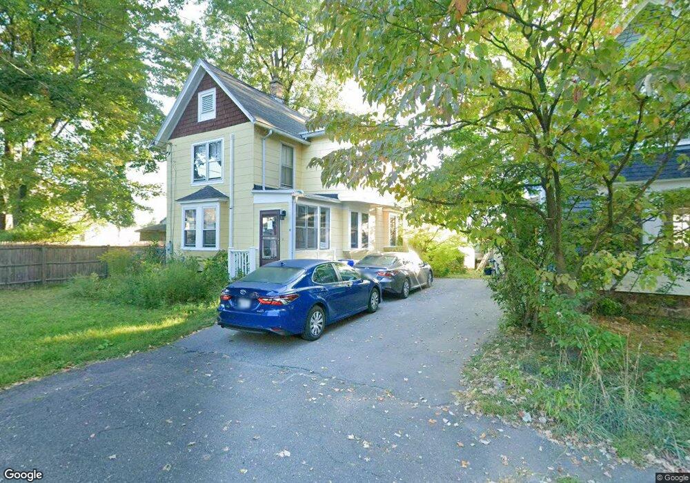
15 Bright Ave Northampton, MA 01060
Estimated Value: $514,142 - $573,000
3
Beds
2
Baths
1,412
Sq Ft
$382/Sq Ft
Est. Value
About This Home
This home is located at 15 Bright Ave, Northampton, MA 01060 and is currently estimated at $539,036, approximately $381 per square foot. 15 Bright Ave is a home located in Hampshire County with nearby schools including Northampton High School, Hilltown Cooperative Charter Public School, and The Montessori School of Northampton.
Ownership History
Date
Name
Owned For
Owner Type
Purchase Details
Closed on
May 18, 2001
Sold by
Prisock Louis G and Royster Deidre A
Bought by
Berkvist Andrew J and Gallers Anita J
Current Estimated Value
Home Financials for this Owner
Home Financials are based on the most recent Mortgage that was taken out on this home.
Original Mortgage
$150,300
Interest Rate
7.03%
Mortgage Type
Purchase Money Mortgage
Purchase Details
Closed on
Feb 25, 1997
Sold by
Hathaway Gaudree Foy Glen and Hathaway See Pamela
Bought by
Prisock Louis G and Royster Deidre A
Home Financials for this Owner
Home Financials are based on the most recent Mortgage that was taken out on this home.
Original Mortgage
$117,000
Interest Rate
7.8%
Mortgage Type
Purchase Money Mortgage
Create a Home Valuation Report for This Property
The Home Valuation Report is an in-depth analysis detailing your home's value as well as a comparison with similar homes in the area
Home Values in the Area
Average Home Value in this Area
Purchase History
| Date | Buyer | Sale Price | Title Company |
|---|---|---|---|
| Berkvist Andrew J | $167,000 | -- | |
| Prisock Louis G | $123,250 | -- |
Source: Public Records
Mortgage History
| Date | Status | Borrower | Loan Amount |
|---|---|---|---|
| Open | Prisock Louis G | $146,100 | |
| Closed | Prisock Louis G | $150,300 | |
| Previous Owner | Prisock Louis G | $117,000 |
Source: Public Records
Tax History
| Year | Tax Paid | Tax Assessment Tax Assessment Total Assessment is a certain percentage of the fair market value that is determined by local assessors to be the total taxable value of land and additions on the property. | Land | Improvement |
|---|---|---|---|---|
| 2025 | $6,193 | $444,600 | $227,900 | $216,700 |
| 2024 | $5,795 | $381,500 | $207,300 | $174,200 |
| 2023 | $5,039 | $318,100 | $188,400 | $129,700 |
| 2022 | $5,211 | $291,300 | $176,100 | $115,200 |
| 2021 | $4,990 | $287,300 | $163,000 | $124,300 |
| 2020 | $4,817 | $286,700 | $162,400 | $124,300 |
| 2019 | $4,827 | $277,900 | $162,400 | $115,500 |
| 2018 | $4,623 | $271,300 | $162,400 | $108,900 |
| 2017 | $4,528 | $271,300 | $162,400 | $108,900 |
| 2016 | $4,384 | $271,300 | $162,400 | $108,900 |
| 2015 | $4,201 | $265,900 | $146,000 | $119,900 |
| 2014 | $4,092 | $265,900 | $146,000 | $119,900 |
Source: Public Records
Map
Nearby Homes
- 13A Finn St
- 37 Finn St
- 61 Crescent St Unit 8
- 61 Crescent St Unit 7
- 25 Union St
- 25 Union St Unit 2
- 50 Union St Unit 18
- 30 Graves Ave Unit B
- 43 Center St Unit K
- 30 View Ave
- 20 View Ave Unit A
- 2434 Pleasant St Unit 4
- 29 Pleasant St Unit 1
- 231 Main St Unit 3R
- 10 Hawley St Unit 4C
- 10 Hawley St Unit 4D
- 10 Hawley St Unit 1C
- 10 Hawley St Unit 4B
- 10 Hawley St Unit 4A
- 22 Woodbine Ave
Your Personal Tour Guide
Ask me questions while you tour the home.