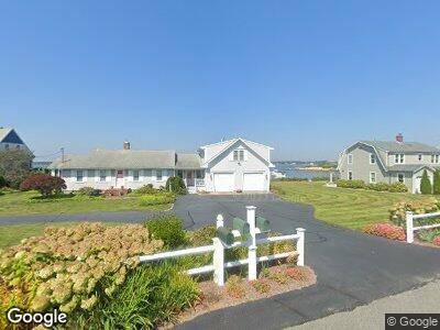
15 Bryant Rd Bourne, MA 2532
Estimated Value: $1,422,000 - $1,906,000
4
Beds
3
Baths
2,649
Sq Ft
$663/Sq Ft
Est. Value
About This Home
This home is located at 15 Bryant Rd, Bourne, MA 2532 and is currently estimated at $1,756,903, approximately $663 per square foot. 15 Bryant Rd is a home located in Barnstable County with nearby schools including Bourne High School, St Margaret Regional School, and Cadence Academy Preschool - Bourne.
Ownership History
Date
Name
Owned For
Owner Type
Purchase Details
Closed on
Oct 20, 2022
Sold by
Wayne N Webber T
Bought by
Wayne N Webber T
Current Estimated Value
Purchase Details
Closed on
Jul 9, 2013
Sold by
Webber Wayne N
Bought by
Wayne N Webber Ret and Webber
Home Financials for this Owner
Home Financials are based on the most recent Mortgage that was taken out on this home.
Original Mortgage
$212,214
Interest Rate
3.59%
Mortgage Type
New Conventional
Create a Home Valuation Report for This Property
The Home Valuation Report is an in-depth analysis detailing your home's value as well as a comparison with similar homes in the area
Home Values in the Area
Average Home Value in this Area
Purchase History
| Date | Buyer | Sale Price | Title Company |
|---|---|---|---|
| Wayne N Webber T | -- | None Available | |
| Wayne N Webber T N | -- | None Available | |
| Wayne N Webber Ret | -- | -- | |
| Wayne N Webber Ret | -- | -- |
Source: Public Records
Mortgage History
| Date | Status | Borrower | Loan Amount |
|---|---|---|---|
| Previous Owner | Wayne N Webber Ret | $212,214 | |
| Previous Owner | 15 Bryant Road Rt | $348,000 | |
| Previous Owner | 15 Bryant Road Rt | $400,000 | |
| Previous Owner | Webber Wayne N | $40,000 | |
| Previous Owner | Webber Wayne N | $123,200 |
Source: Public Records
Tax History Compared to Growth
Tax History
| Year | Tax Paid | Tax Assessment Tax Assessment Total Assessment is a certain percentage of the fair market value that is determined by local assessors to be the total taxable value of land and additions on the property. | Land | Improvement |
|---|---|---|---|---|
| 2025 | $13,486 | $1,726,800 | $1,111,500 | $615,300 |
| 2024 | $13,231 | $1,649,800 | $1,058,500 | $591,300 |
| 2023 | $12,942 | $1,469,000 | $936,800 | $532,200 |
| 2022 | $12,772 | $1,265,800 | $829,000 | $436,800 |
| 2021 | $12,544 | $1,164,700 | $754,500 | $410,200 |
| 2020 | $12,306 | $1,145,800 | $747,300 | $398,500 |
| 2019 | $11,632 | $1,106,800 | $747,300 | $359,500 |
| 2018 | $11,149 | $1,057,800 | $711,800 | $346,000 |
| 2017 | $10,748 | $1,043,500 | $711,800 | $331,700 |
| 2016 | $10,560 | $1,039,400 | $711,800 | $327,600 |
| 2015 | $9,989 | $992,000 | $664,400 | $327,600 |
Source: Public Records
Map
Nearby Homes
- 43 Sea Breeze Dr
- 43 Seabreeze Dr
- 60 Bourne Neck Dr
- 5 Bell Rd
- 3 Sias Point Rd
- 69-73 Main St & 0 Cohasset Ave
- 129-137 Main St
- 8 Pine Tree Dr
- 6 Wallace Ave
- 6 Wallace Ave Unit 1
- 30 Webster St
- 203 County Rd
- 24 Wyman Ave
- 7 Puritan Rd
- 12 Arthur St
- 2 Fairway Dr
- 37 Onset Ave
- 39 Onset Ave
- 29 Onset Ave
- 7 Carol Rd