Estimated Value: $553,928 - $630,000
3
Beds
2
Baths
1,584
Sq Ft
$375/Sq Ft
Est. Value
About This Home
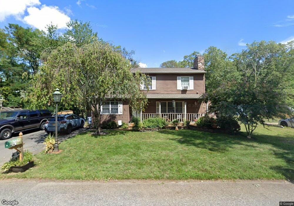
This home is located at 15 Burnt Bridge Ave, Brick, NJ 08724 and is currently estimated at $594,732, approximately $375 per square foot. 15 Burnt Bridge Ave is a home located in Ocean County with nearby schools including Midstreams Elementary School, Veterans Memorial Middle School, and Brick Township Memorial High School.
Ownership History
Date
Name
Owned For
Owner Type
Purchase Details
Closed on
Feb 7, 1994
Sold by
Garruto Audrey
Bought by
Clayton Scott and Clayton Colleen
Current Estimated Value
Home Financials for this Owner
Home Financials are based on the most recent Mortgage that was taken out on this home.
Original Mortgage
$118,000
Interest Rate
7.12%
Create a Home Valuation Report for This Property
The Home Valuation Report is an in-depth analysis detailing your home's value as well as a comparison with similar homes in the area
Home Values in the Area
Average Home Value in this Area
Purchase History
| Date | Buyer | Sale Price | Title Company |
|---|---|---|---|
| Clayton Scott | $125,000 | -- |
Source: Public Records
Mortgage History
| Date | Status | Borrower | Loan Amount |
|---|---|---|---|
| Closed | Clayton Scott | $118,000 |
Source: Public Records
Tax History
| Year | Tax Paid | Tax Assessment Tax Assessment Total Assessment is a certain percentage of the fair market value that is determined by local assessors to be the total taxable value of land and additions on the property. | Land | Improvement |
|---|---|---|---|---|
| 2025 | $7,994 | $306,300 | $177,000 | $129,300 |
| 2024 | $7,587 | $306,300 | $177,000 | $129,300 |
Source: Public Records
Map
Nearby Homes
- 2193 Route 88
- 2183 New Jersey 88
- 1 Drury Ct
- 101 Duchess Ln
- 516 Driscol Dr
- 531 Azalea Dr
- 3403 Bridge Ave Unit 13
- 124 Roosevelt Dr
- 106 Arrowhead Park Dr
- 14 Coolidge Dr
- 22 Coolidge Dr
- 106 Coolidge Dr
- 3208-3210 Cohocton Ave Unit 10
- 506 Azalea Dr
- 157 Natick Trail
- 209 Winchester Dr
- 416 Midstreams Rd
- 153 Natick Trail
- 550 Crestview Terrace
- 1404-1406 Treeneedle Rd
- 2 Bay Bridge Dr
- 11 Burnt Bridge Ave
- 4 Bay Bridge Dr
- 20 Oak Knoll Dr
- 6 Bay Bridge Dr
- 23 Burnt Bridge Ave
- 1 Bay Bridge Dr
- 3 Bay Bridge Dr
- 20 Burnt Bridge Ave
- 56 Crest Dr
- 5 Bay Bridge Dr
- 25 Burnt Bridge Ave
- 24 Burnt Bridge Ave
- 25 Oak Knoll Dr
- 7 Bay Bridge Dr
- 10 Bay Bridge Dr
- 26 Burnt Bridge Ave
- 27 Burnt Bridge Ave
- 18 Aldgate Dr
- 20 Aldgate Dr
Your Personal Tour Guide
Ask me questions while you tour the home.