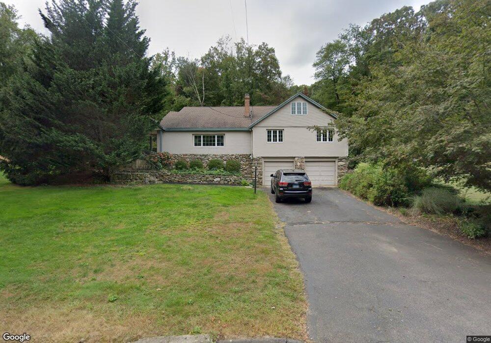
15 Clark Rd Haddam, CT 06438
Estimated Value: $472,285 - $574,000
3
Beds
2
Baths
2,347
Sq Ft
$226/Sq Ft
Est. Value
About This Home
This home is located at 15 Clark Rd, Haddam, CT 06438 and is currently estimated at $531,571, approximately $226 per square foot. 15 Clark Rd is a home located in Middlesex County with nearby schools including Haddam-Killingworth High School.
Ownership History
Date
Name
Owned For
Owner Type
Purchase Details
Closed on
Apr 1, 2005
Sold by
Sawyer Christopher S and Sawyer Eileen A
Bought by
Sosnowski Matthew S and Sosnowski Suzanne E
Current Estimated Value
Home Financials for this Owner
Home Financials are based on the most recent Mortgage that was taken out on this home.
Original Mortgage
$234,000
Interest Rate
5.61%
Purchase Details
Closed on
Apr 23, 1999
Sold by
Starr Leslie G
Bought by
Sawyer Christopher S and Sawyer Eileen A
Purchase Details
Closed on
Feb 22, 1993
Sold by
Federal Home Loan Mortgage Corporation
Bought by
Dubois Mark A and Starr Leslie G
Create a Home Valuation Report for This Property
The Home Valuation Report is an in-depth analysis detailing your home's value as well as a comparison with similar homes in the area
Home Values in the Area
Average Home Value in this Area
Purchase History
| Date | Buyer | Sale Price | Title Company |
|---|---|---|---|
| Sosnowski Matthew S | $292,500 | -- | |
| Sawyer Christopher S | $186,000 | -- | |
| Dubois Mark A | $95,000 | -- |
Source: Public Records
Mortgage History
| Date | Status | Borrower | Loan Amount |
|---|---|---|---|
| Open | Dubois Mark A | $215,615 | |
| Closed | Dubois Mark A | $45,000 | |
| Closed | Dubois Mark A | $234,000 |
Source: Public Records
Tax History Compared to Growth
Tax History
| Year | Tax Paid | Tax Assessment Tax Assessment Total Assessment is a certain percentage of the fair market value that is determined by local assessors to be the total taxable value of land and additions on the property. | Land | Improvement |
|---|---|---|---|---|
| 2025 | $7,378 | $214,800 | $86,440 | $128,360 |
| 2024 | $7,378 | $214,800 | $86,440 | $128,360 |
| 2023 | $7,275 | $214,800 | $86,440 | $128,360 |
| 2022 | $6,944 | $214,800 | $86,440 | $128,360 |
| 2021 | $6,771 | $214,800 | $86,440 | $128,360 |
| 2020 | $8,228 | $216,990 | $93,790 | $123,200 |
| 2019 | $6,876 | $216,990 | $93,790 | $123,200 |
| 2018 | $6,876 | $216,990 | $93,790 | $123,200 |
| 2017 | $6,876 | $216,990 | $93,790 | $123,200 |
| 2016 | $6,770 | $216,990 | $93,790 | $123,200 |
| 2015 | $6,618 | $212,100 | $93,790 | $118,310 |
| 2014 | $6,552 | $212,100 | $93,790 | $118,310 |
Source: Public Records
Map
Nearby Homes
- 16 Walkley Hill Rd
- 0 Walkley Hill Rd Unit 24088136
- 0 Parmelee Rd
- 25 Island Dock Rd
- 195 Injun Hollow Rd
- 0 Saybrook Rd
- 291 Injun Hollow Rd
- 195A Injun Hollow Rd
- 32 Maple Ave W
- 86 Christian Hill Rd
- 0 S Dish Mill Rd Unit 24082788
- 50 Haddam Neck Rd
- 291 Hog Hill Rd
- 289 Young St
- 10 Cherry Swamp Rd
- 40 & 42 Old Cart Rd
- 279 Pokorny Rd
- 428 Plains Rd
- 67 Moodus Leesville Rd
- 0 Mountain Laurel Dr
- 19 Clark Rd
- 19 Clark Rd
- 81 Walkley Hill Rd
- 11 Clark Rd
- 23 Clark Rd
- 91 Walkley Hill Rd
- 39 Clark Rd Unit BEN
- 65 Walkley Hill Rd
- 36 Clark Rd
- 36 Clark Rd Unit BEN
- 0 Swain Johnson Trail
- 37 Clark Rd
- 4 Swain Johnson Trail
- 100 Walkley Hill Rd
- 44 Clark Rd
- 9 Clark Rd
- 111 Walkley Hill Rd
- 54 Clark Rd
- 49 Walkley Hill Rd
- 24 Swain Johnson Trail