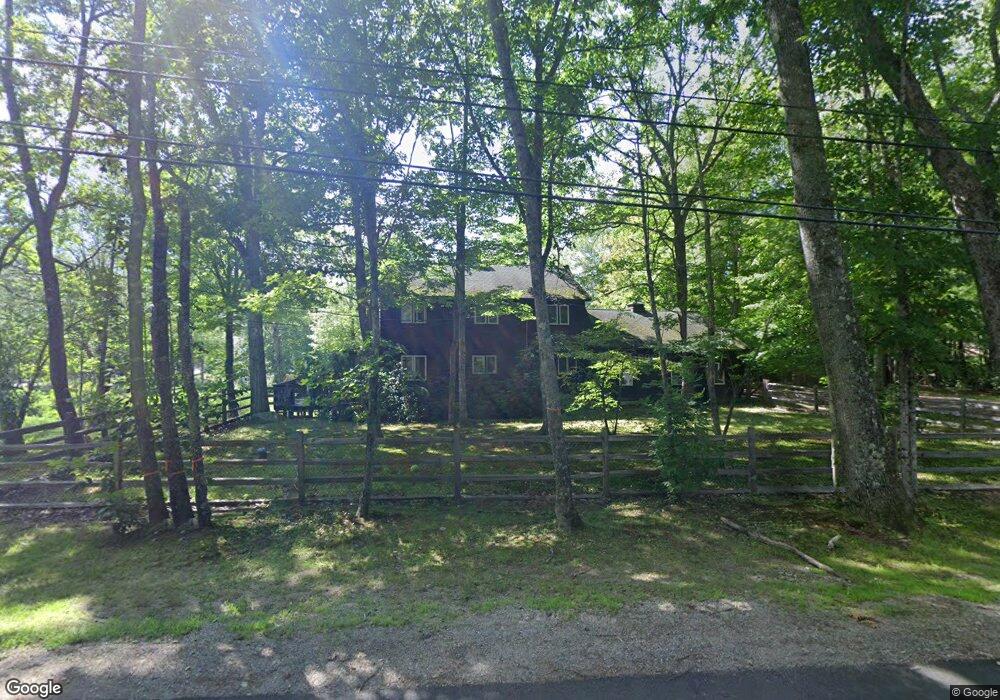
15 Cooper Rd Hebron, NH 03241
Estimated Value: $895,106 - $1,134,000
3
Beds
4
Baths
3,384
Sq Ft
$310/Sq Ft
Est. Value
About This Home
This home is located at 15 Cooper Rd, Hebron, NH 03241 and is currently estimated at $1,050,527, approximately $310 per square foot. 15 Cooper Rd is a home located in Grafton County with nearby schools including Bridgewater-Hebron Village School.
Ownership History
Date
Name
Owned For
Owner Type
Purchase Details
Closed on
Sep 30, 2010
Sold by
Means Susan M
Bought by
Orlander Jay D and Mitus Anna Jacqueline
Current Estimated Value
Purchase Details
Closed on
Apr 22, 2004
Sold by
Pilcher Invst T
Bought by
Means Susan M
Home Financials for this Owner
Home Financials are based on the most recent Mortgage that was taken out on this home.
Original Mortgage
$388,000
Interest Rate
5.4%
Mortgage Type
Purchase Money Mortgage
Create a Home Valuation Report for This Property
The Home Valuation Report is an in-depth analysis detailing your home's value as well as a comparison with similar homes in the area
Home Values in the Area
Average Home Value in this Area
Purchase History
| Date | Buyer | Sale Price | Title Company |
|---|---|---|---|
| Orlander Jay D | $385,000 | -- | |
| Means Susan M | $495,000 | -- |
Source: Public Records
Mortgage History
| Date | Status | Borrower | Loan Amount |
|---|---|---|---|
| Previous Owner | Means Susan M | $388,000 |
Source: Public Records
Tax History Compared to Growth
Tax History
| Year | Tax Paid | Tax Assessment Tax Assessment Total Assessment is a certain percentage of the fair market value that is determined by local assessors to be the total taxable value of land and additions on the property. | Land | Improvement |
|---|---|---|---|---|
| 2024 | $4,393 | $628,500 | $271,500 | $357,000 |
| 2023 | $4,010 | $628,500 | $271,500 | $357,000 |
| 2022 | $4,293 | $628,500 | $271,500 | $357,000 |
| 2021 | $4,098 | $628,500 | $271,500 | $357,000 |
| 2020 | $674 | $418,200 | $168,800 | $249,400 |
| 2019 | $52,196 | $418,200 | $168,800 | $249,400 |
| 2018 | $55,950 | $418,200 | $168,800 | $249,400 |
| 2017 | $3,739 | $418,200 | $168,800 | $249,400 |
| 2016 | $3,479 | $418,200 | $168,800 | $249,400 |
| 2015 | $3,434 | $431,400 | $166,400 | $265,000 |
| 2014 | $3,561 | $435,300 | $166,400 | $268,900 |
| 2013 | $3,504 | $435,300 | $166,400 | $268,900 |
Source: Public Records
Map
Nearby Homes
- 10 Merrill Rd
- 431 George Rd
- 33 Winterberry Ln
- Lot 26 Skyline Dr
- 0 Skyline Dr Unit 19
- 613 Mayhew Turnpike Unit 227-024 & 227-023
- 497 W Shore Rd
- 76 Davis Rd Unit 3
- 00 Ledgewood Cir Unit 7
- 171 Bell Rd
- 154 Bell Rd
- 4 Birchwood Dr Unit A
- 862 Mayhew Turnpike Unit 1
- 193 New Hebron Rd
- 208 New Hebron Rd
- 114 Ledgewood Terrace
- 341 Perkins Hill Rd
- 582 N Groton Rd
- 199 Cottage City Rd
- 023 Yeaton Rd