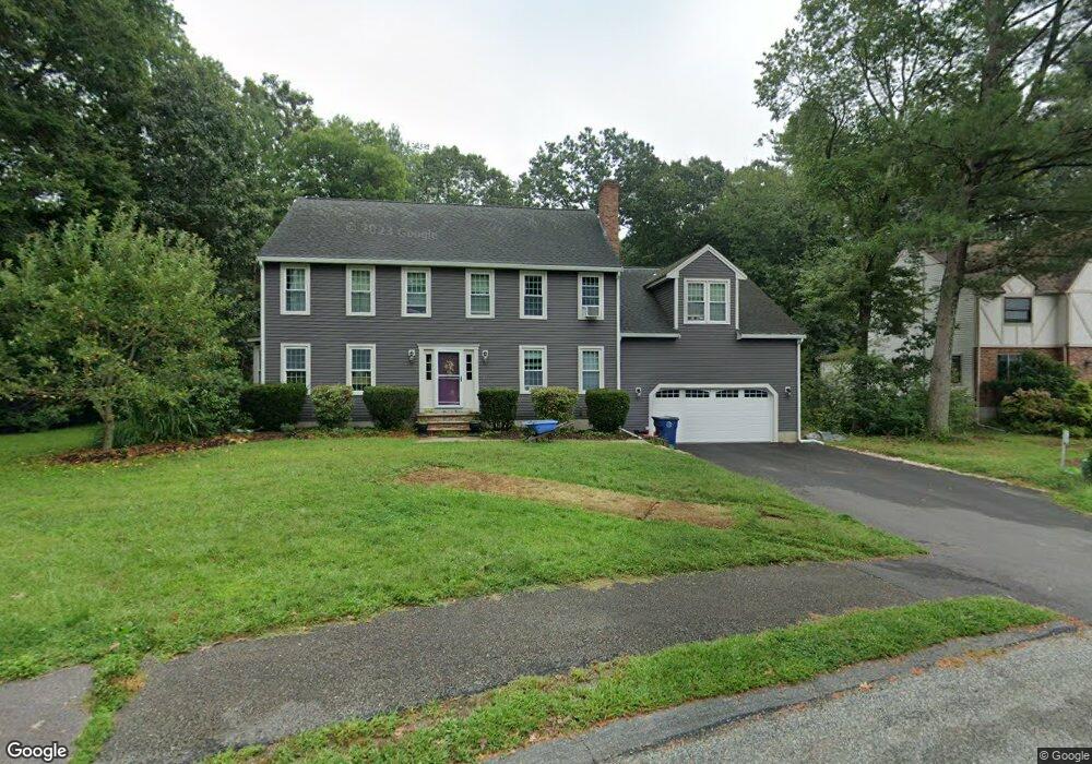
15 Crestview Ave Medway, MA 02053
Estimated Value: $882,785 - $1,054,000
4
Beds
3
Baths
2,803
Sq Ft
$333/Sq Ft
Est. Value
About This Home
This home is located at 15 Crestview Ave, Medway, MA 02053 and is currently estimated at $934,196, approximately $333 per square foot. 15 Crestview Ave is a home located in Norfolk County with nearby schools including John D. McGovern Elementary School, Burke-Memorial Elementary, and Medway Middle School.
Ownership History
Date
Name
Owned For
Owner Type
Purchase Details
Closed on
Jan 12, 2007
Sold by
Scott Caroline A and Savage Daniel D
Bought by
Fontecchio Gregg H and Fontecchio Patricia A
Current Estimated Value
Home Financials for this Owner
Home Financials are based on the most recent Mortgage that was taken out on this home.
Original Mortgage
$375,000
Interest Rate
6.18%
Mortgage Type
Purchase Money Mortgage
Purchase Details
Closed on
May 2, 1991
Sold by
Coras Tr Gregory J
Bought by
Savage Daniel T and Savage Linda M
Home Financials for this Owner
Home Financials are based on the most recent Mortgage that was taken out on this home.
Original Mortgage
$199,000
Interest Rate
9.55%
Mortgage Type
Purchase Money Mortgage
Create a Home Valuation Report for This Property
The Home Valuation Report is an in-depth analysis detailing your home's value as well as a comparison with similar homes in the area
Home Values in the Area
Average Home Value in this Area
Purchase History
| Date | Buyer | Sale Price | Title Company |
|---|---|---|---|
| Fontecchio Gregg H | $475,000 | -- | |
| Savage Daniel T | $249,900 | -- |
Source: Public Records
Mortgage History
| Date | Status | Borrower | Loan Amount |
|---|---|---|---|
| Open | Savage Daniel T | $355,800 | |
| Closed | Fontecchio Gregg H | $375,000 | |
| Previous Owner | Savage Daniel T | $221,250 | |
| Previous Owner | Savage Daniel T | $198,000 | |
| Previous Owner | Savage Daniel T | $199,000 |
Source: Public Records
Tax History Compared to Growth
Tax History
| Year | Tax Paid | Tax Assessment Tax Assessment Total Assessment is a certain percentage of the fair market value that is determined by local assessors to be the total taxable value of land and additions on the property. | Land | Improvement |
|---|---|---|---|---|
| 2025 | $10,678 | $749,300 | $323,400 | $425,900 |
| 2024 | $10,790 | $749,300 | $323,400 | $425,900 |
| 2023 | $10,461 | $656,300 | $294,300 | $362,000 |
| 2022 | $9,664 | $570,800 | $217,600 | $353,200 |
| 2021 | $9,600 | $549,800 | $203,100 | $346,700 |
| 2020 | $9,569 | $546,800 | $203,100 | $343,700 |
| 2019 | $8,923 | $525,800 | $194,800 | $331,000 |
| 2018 | $9,000 | $509,600 | $186,600 | $323,000 |
| 2017 | $8,912 | $497,300 | $182,400 | $314,900 |
| 2016 | $8,542 | $471,700 | $167,900 | $303,800 |
| 2015 | $8,472 | $464,500 | $165,800 | $298,700 |
| 2014 | $8,356 | $443,500 | $165,800 | $277,700 |
Source: Public Records
Map
Nearby Homes
- 280 Village St Unit D2
- 4 Shaw St
- 22 Sunset Dr
- 20 Broad St Unit 6
- 20 Broad St Unit A
- 20 Broad St Unit 4
- 14 Sanford St Unit 15
- 9 Sanford St
- 3 Meryl St
- 28 Wellington St
- 50 Main St
- 14 Heritage Dr
- 176 Main St Unit 3
- 12 Lovering St
- 106 Holliston St
- 841 Lincoln St
- 0 Elm St
- 7 Gloucester Dr
- 36 Lovering St
- 21 Riverside Rd