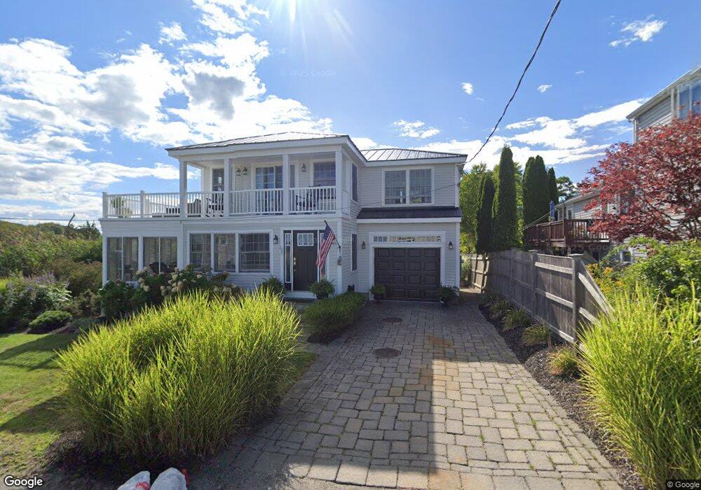
15 Dartmouth Rd Ipswich, MA 01938
Estimated Value: $1,098,000 - $1,214,296
2
Beds
2
Baths
1,260
Sq Ft
$916/Sq Ft
Est. Value
About This Home
This home is located at 15 Dartmouth Rd, Ipswich, MA 01938 and is currently estimated at $1,154,574, approximately $916 per square foot. 15 Dartmouth Rd is a home located in Essex County with nearby schools including Ipswich High School.
Ownership History
Date
Name
Owned For
Owner Type
Purchase Details
Closed on
Jun 10, 2024
Sold by
Martin Kevin G
Bought by
K G M Rt and Martin
Current Estimated Value
Purchase Details
Closed on
Jun 13, 2001
Sold by
Esk Rt
Bought by
Mcdonald Brendan
Purchase Details
Closed on
Jan 9, 2001
Sold by
Keefe Nola L and Keefe John F
Bought by
Blyth Joanthan and Blyth Stephen
Create a Home Valuation Report for This Property
The Home Valuation Report is an in-depth analysis detailing your home's value as well as a comparison with similar homes in the area
Home Values in the Area
Average Home Value in this Area
Purchase History
| Date | Buyer | Sale Price | Title Company |
|---|---|---|---|
| K G M Rt | -- | None Available | |
| K G M Rt | -- | None Available | |
| K G M Rt | -- | None Available | |
| Mcdonald Brendan | $240,000 | -- | |
| Blyth Joanthan | $130,000 | -- | |
| Mcdonald Brendan | $240,000 | -- | |
| Blyth Joanthan | $130,000 | -- |
Source: Public Records
Mortgage History
| Date | Status | Borrower | Loan Amount |
|---|---|---|---|
| Previous Owner | Blyth Joanthan | $390,000 | |
| Previous Owner | Blyth Joanthan | $180,000 |
Source: Public Records
Tax History Compared to Growth
Tax History
| Year | Tax Paid | Tax Assessment Tax Assessment Total Assessment is a certain percentage of the fair market value that is determined by local assessors to be the total taxable value of land and additions on the property. | Land | Improvement |
|---|---|---|---|---|
| 2025 | $11,786 | $1,057,000 | $697,300 | $359,700 |
| 2024 | $11,542 | $1,014,200 | $698,500 | $315,700 |
| 2023 | $12,231 | $1,000,100 | $682,700 | $317,400 |
| 2022 | $8,044 | $625,500 | $339,700 | $285,800 |
| 2021 | $7,698 | $582,300 | $317,500 | $264,800 |
| 2020 | $7,471 | $532,900 | $311,200 | $221,700 |
| 2019 | $7,437 | $527,800 | $311,200 | $216,600 |
| 2018 | $6,898 | $484,400 | $277,800 | $206,600 |
| 2017 | $6,696 | $471,900 | $269,900 | $202,000 |
| 2016 | $6,632 | $446,600 | $260,400 | $186,200 |
| 2015 | $6,055 | $448,200 | $262,000 | $186,200 |
Source: Public Records
Map
Nearby Homes
- 113 N Ridge Rd
- 23 Mulholland Dr
- 63 N Ridge Rd
- 8 Goldfinch Way
- 22 Little Neck Rd
- 18 Northridge Rd
- 4 N Ridge Rd
- 143 Jeffreys Neck Rd
- 123 Jeffreys Neck Rd
- 23 Jeffrey's Neck Rd
- 50 Jeffreys Neck Rd
- 23 Newmarch St
- 3 Jeffreys Neck Rd
- 11 Spillers Ln
- 4 Agawam Ave
- 7 Highland Ave Unit 9
- 166 Argilla Rd
- 20 Summer St Unit 20
- 54 N Main St
- 29 Summer St Unit 15