Estimated Value: $253,000 - $274,000
1
Bed
2
Baths
623
Sq Ft
$423/Sq Ft
Est. Value
About This Home
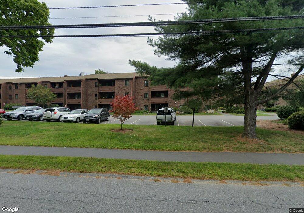
This home is located at 15 Davis Rd Unit C14, Acton, MA 01720 and is currently estimated at $263,242, approximately $422 per square foot. 15 Davis Rd Unit C14 is a home located in Middlesex County with nearby schools including Acton-Boxborough Regional High School, Oak Meadow Montessori School, and Concord Academy.
Ownership History
Date
Name
Owned For
Owner Type
Purchase Details
Closed on
Jan 19, 2012
Sold by
Steger Elliot F
Bought by
2011 Elliot F Steger T
Current Estimated Value
Purchase Details
Closed on
Mar 10, 2011
Sold by
Steger Marlene N and Steger Elliot F
Bought by
Steger Elliot F
Purchase Details
Closed on
May 30, 1991
Sold by
Renbel and Albert-Acton T
Bought by
Steger Elliot F and Steger Marlene N
Home Financials for this Owner
Home Financials are based on the most recent Mortgage that was taken out on this home.
Original Mortgage
$28,700
Interest Rate
9.35%
Mortgage Type
Purchase Money Mortgage
Create a Home Valuation Report for This Property
The Home Valuation Report is an in-depth analysis detailing your home's value as well as a comparison with similar homes in the area
Home Values in the Area
Average Home Value in this Area
Purchase History
| Date | Buyer | Sale Price | Title Company |
|---|---|---|---|
| 2011 Elliot F Steger T | -- | -- | |
| Steger Elliot F | -- | -- | |
| Steger Elliot F | $41,000 | -- |
Source: Public Records
Mortgage History
| Date | Status | Borrower | Loan Amount |
|---|---|---|---|
| Previous Owner | Steger Elliot F | $28,700 |
Source: Public Records
Tax History
| Year | Tax Paid | Tax Assessment Tax Assessment Total Assessment is a certain percentage of the fair market value that is determined by local assessors to be the total taxable value of land and additions on the property. | Land | Improvement |
|---|---|---|---|---|
| 2025 | $3,564 | $207,800 | $0 | $207,800 |
| 2024 | $3,299 | $197,900 | $0 | $197,900 |
| 2023 | $3,040 | $173,100 | $0 | $173,100 |
| 2022 | $3,093 | $159,000 | $0 | $159,000 |
| 2021 | $3,405 | $168,300 | $0 | $168,300 |
| 2020 | $2,899 | $150,700 | $0 | $150,700 |
| 2019 | $2,681 | $138,400 | $0 | $138,400 |
| 2018 | $2,535 | $130,500 | $0 | $130,500 |
| 2017 | $2,346 | $123,100 | $0 | $123,100 |
| 2016 | $2,161 | $112,400 | $0 | $112,400 |
| 2015 | $1,890 | $99,200 | $0 | $99,200 |
| 2014 | $1,725 | $88,700 | $0 | $88,700 |
Source: Public Records
Map
Nearby Homes
- 15 Davis Rd Unit B11
- 15 Davis Rd Unit B-8
- 11 Davis Rd Unit A5
- 11 Davis Rd Unit B8
- 10 Blue Heron Way Unit 10
- 10 Blue Heron Way
- 18 Quail Run Unit 18
- 380 Great Rd Unit B301
- 380A Great Rd Unit 301
- 388 Great Rd Unit A9
- 388 Great Rd Unit B14
- 386 Great Rd Unit A8
- 524 Main St
- 420 Great Rd Unit B3
- 709 Main St
- 134 Pope Rd
- 159 Skyline Dr Unit 159
- 2 Duston Ln
- 5 Samantha Way Unit 5
- 33 Meadowbrook Rd
- 15 Davis Rd Unit C6
- 15 Davis Rd Unit A6
- 15 Davis Rd Unit B8
- 15 Davis Rd Unit B14
- 15 Davis Rd Unit C16
- 15 Davis Rd Unit C15
- 15 Davis Rd Unit C13
- 15 Davis Rd Unit C12
- 15 Davis Rd Unit C11
- 15 Davis Rd Unit C10
- 15 Davis Rd Unit B16
- 15 Davis Rd Unit B15
- 15 Davis Rd Unit B13
- 15 Davis Rd Unit B12
- 15 Davis Rd Unit B11
- 15 Davis Rd Unit B10
- 15 Davis Rd Unit A15
- 15 Davis Rd Unit A14
- 15 Davis Rd Unit A13
- 15 Davis Rd Unit A12
Your Personal Tour Guide
Ask me questions while you tour the home.