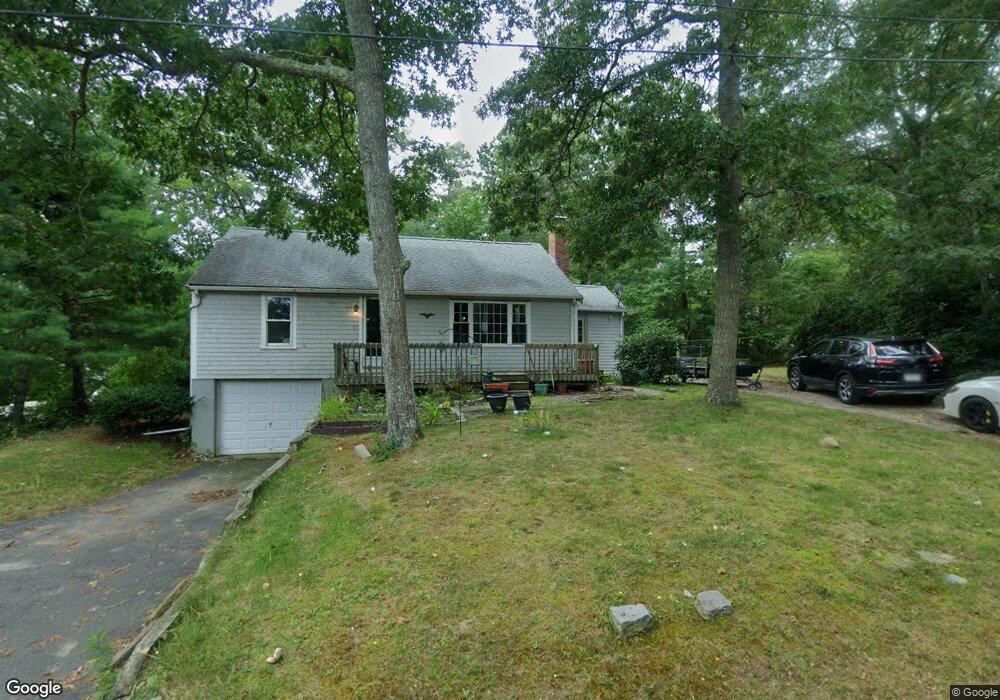
15 Dollins Rd Pocasset, MA 02559
Pocasset NeighborhoodEstimated Value: $484,000 - $556,000
2
Beds
2
Baths
1,080
Sq Ft
$487/Sq Ft
Est. Value
About This Home
This home is located at 15 Dollins Rd, Pocasset, MA 02559 and is currently estimated at $526,164, approximately $487 per square foot. 15 Dollins Rd is a home located in Barnstable County with nearby schools including Bourne High School, Cadence Academy Preschool - Bourne, and St Margaret Regional School.
Ownership History
Date
Name
Owned For
Owner Type
Purchase Details
Closed on
Sep 16, 2021
Sold by
Foley Gail A Est and Derderian
Bought by
Derderian Armand P
Current Estimated Value
Purchase Details
Closed on
Aug 20, 1997
Sold by
Foley William M
Bought by
Foley Gail A
Home Financials for this Owner
Home Financials are based on the most recent Mortgage that was taken out on this home.
Original Mortgage
$50,500
Interest Rate
7.42%
Mortgage Type
Purchase Money Mortgage
Create a Home Valuation Report for This Property
The Home Valuation Report is an in-depth analysis detailing your home's value as well as a comparison with similar homes in the area
Home Values in the Area
Average Home Value in this Area
Purchase History
| Date | Buyer | Sale Price | Title Company |
|---|---|---|---|
| Derderian Armand P | -- | None Available | |
| Derderian Armand P | -- | None Available | |
| Foley Gail A | $22,000 | -- | |
| Foley Gail A | $22,000 | -- |
Source: Public Records
Mortgage History
| Date | Status | Borrower | Loan Amount |
|---|---|---|---|
| Previous Owner | Foley Gail A | $66,000 | |
| Previous Owner | Foley Gail A | $50,500 | |
| Previous Owner | Foley Gail A | $20,000 |
Source: Public Records
Tax History Compared to Growth
Tax History
| Year | Tax Paid | Tax Assessment Tax Assessment Total Assessment is a certain percentage of the fair market value that is determined by local assessors to be the total taxable value of land and additions on the property. | Land | Improvement |
|---|---|---|---|---|
| 2025 | $3,222 | $412,500 | $193,800 | $218,700 |
| 2024 | $3,250 | $405,200 | $201,300 | $203,900 |
| 2023 | $3,068 | $348,200 | $178,200 | $170,000 |
| 2022 | $2,820 | $279,500 | $144,500 | $135,000 |
| 2021 | $2,740 | $254,400 | $131,500 | $122,900 |
| 2020 | $2,650 | $246,700 | $130,300 | $116,400 |
| 2019 | $2,523 | $240,100 | $130,300 | $109,800 |
| 2018 | $2,412 | $228,800 | $129,700 | $99,100 |
| 2017 | $2,334 | $226,600 | $128,500 | $98,100 |
| 2016 | $2,083 | $205,000 | $128,500 | $76,500 |
| 2015 | $1,671 | $165,900 | $89,400 | $76,500 |
Source: Public Records
Map
Nearby Homes
- 7 4th Ave
- 15 1st St
- 174 Barlows Landing Rd
- 7 Portside Dr
- 940 County Rd
- 709 County Rd
- 940 County Rd
- 254 Barlows Landing Rd
- 39 Bennets Neck Dr
- 1094 County Rd
- 171 Bellavista Dr
- 3 Red Brook Pond Dr
- 515 County Rd
- 22 Nairn Rd
- 14 Navajo Rd
- 48 Red Brook Harbor Rd
- 501 County Rd
- 34 Kenwood Rd
- 70 Wings Neck Rd
- 49 Marjorie Ave
- 47 Marjorie Ave
- 12 Horne Ave
- 10 Dollins Rd
- 45 Marjorie Ave
- 15 Horne Ave
- 50 Marjorie Ave
- 46 Marjorie Ave
- 16 Dollins Rd
- 21 Dollins Rd
- 41 Marjorie Ave
- 42 Marjorie Ave
- 112 Williams Ave
- 11 Horne Ave
- 48 Rice Ave
- 116 Williams Ave
- 38 Marjorie Ave
- 120 Williams Ave
- 37 Marjorie Ave
- 120 Williams Ave