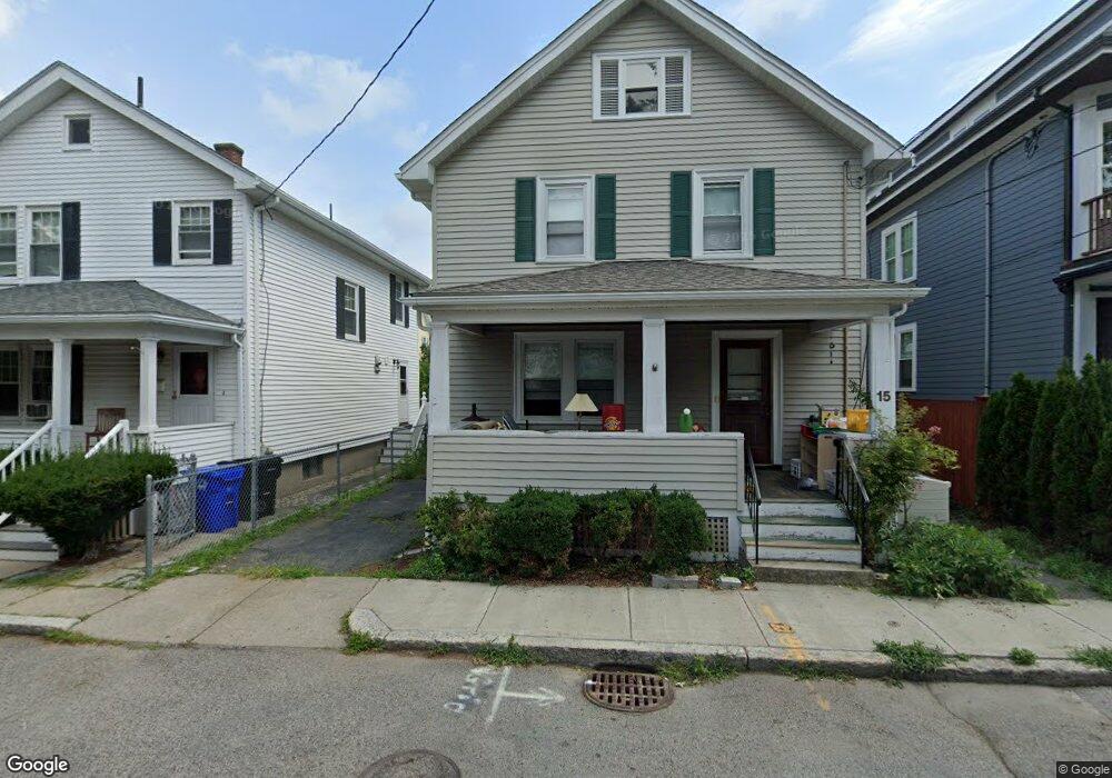
15 Doran Rd Brookline, MA 02445
Chestnut Hill NeighborhoodEstimated Value: $1,233,000 - $1,738,000
3
Beds
1
Bath
1,344
Sq Ft
$1,073/Sq Ft
Est. Value
About This Home
This home is located at 15 Doran Rd, Brookline, MA 02445 and is currently estimated at $1,442,330, approximately $1,073 per square foot. 15 Doran Rd is a home located in Norfolk County with nearby schools including Heath Elementary School, Brookline High School, and Brimmer & May School.
Ownership History
Date
Name
Owned For
Owner Type
Purchase Details
Closed on
Jun 26, 1998
Sold by
Salvatore Joseph W and Salvatore Philip P
Bought by
Odea John G and Odea Margo E
Current Estimated Value
Home Financials for this Owner
Home Financials are based on the most recent Mortgage that was taken out on this home.
Original Mortgage
$145,000
Outstanding Balance
$29,906
Interest Rate
7.09%
Mortgage Type
Purchase Money Mortgage
Estimated Equity
$1,412,424
Create a Home Valuation Report for This Property
The Home Valuation Report is an in-depth analysis detailing your home's value as well as a comparison with similar homes in the area
Home Values in the Area
Average Home Value in this Area
Purchase History
| Date | Buyer | Sale Price | Title Company |
|---|---|---|---|
| Odea John G | $270,000 | -- |
Source: Public Records
Mortgage History
| Date | Status | Borrower | Loan Amount |
|---|---|---|---|
| Open | Odea John G | $145,000 |
Source: Public Records
Tax History Compared to Growth
Tax History
| Year | Tax Paid | Tax Assessment Tax Assessment Total Assessment is a certain percentage of the fair market value that is determined by local assessors to be the total taxable value of land and additions on the property. | Land | Improvement |
|---|---|---|---|---|
| 2025 | $11,111 | $1,125,700 | $686,400 | $439,300 |
| 2024 | $10,543 | $1,079,100 | $660,000 | $419,100 |
| 2023 | $10,076 | $1,010,600 | $598,900 | $411,700 |
| 2022 | $9,807 | $962,400 | $570,300 | $392,100 |
| 2021 | $9,070 | $925,500 | $548,400 | $377,100 |
| 2020 | $8,218 | $869,600 | $498,500 | $371,100 |
| 2019 | $7,760 | $828,200 | $474,800 | $353,400 |
| 2018 | $7,758 | $820,100 | $471,800 | $348,300 |
| 2017 | $7,643 | $773,600 | $445,000 | $328,600 |
| 2016 | $7,534 | $723,000 | $415,900 | $307,100 |
| 2015 | $7,216 | $675,700 | $388,700 | $287,000 |
| 2014 | $7,303 | $641,200 | $353,400 | $287,800 |
Source: Public Records
Map
Nearby Homes
- 59 Ackers Ave Unit 1
- 30 Ackers Ave
- 641 Chestnut Hill Ave
- 55 Reservoir Rd Unit 2
- 540 Chestnut Hill Ave
- 9 Willard Rd
- 120 Seaver St Unit A103
- 120 Seaver St Unit C-102
- 33 Leicester St
- 34 Hyslop Rd
- 40 Heath Hill St
- 120 Cabot St
- 55 Leicester St
- 130 Cabot St
- 2400 Beacon St Unit 112
- 1014 Boylston St
- 17 Strathmore Rd Unit 2
- 8 Strathmore Rd Unit G
- 174 Middlesex Rd
- 2 Sutherland Rd Unit 35
- 9 Doran Rd Unit 2
- 9 Doran Rd Unit 1
- 9 Doran Rd
- 15A Doran Rd
- 15B Doran Rd
- 16 Ackers Terrace
- 12 Ackers Terrace
- 14 Doran Rd
- 20 Ackers Terrace
- 17 Doran Rd
- 17 Doran Rd Unit 2
- 8 Ackers Terrace
- 43 Ackers Ave
- 43 Ackers Ave Unit 2
- 43 Ackers Ave Unit 1
- 41 Ackers Ave Unit 1
- 39 Ackers Ave
- 39 Ackers Ave Unit 1
- 39 Ackers Ave Unit 2
- 18 Doran Rd Unit 20