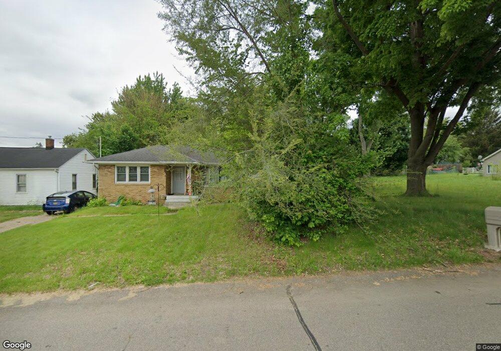
15 Eaton St Battle Creek, MI 49017
Northeast Battle Creek NeighborhoodEstimated Value: $88,000 - $140,000
2
Beds
1
Bath
768
Sq Ft
$139/Sq Ft
Est. Value
About This Home
This home is located at 15 Eaton St, Battle Creek, MI 49017 and is currently estimated at $106,395, approximately $138 per square foot. 15 Eaton St is a home located in Calhoun County with nearby schools including Pennfield Purdy School, Pennfield Dunlap Elementary School, and Pennfield Middle School.
Ownership History
Date
Name
Owned For
Owner Type
Purchase Details
Closed on
Oct 6, 2020
Sold by
Calhoun County Treasurer
Bought by
Serban Zosim and Serban Florina
Current Estimated Value
Purchase Details
Closed on
Jan 25, 2017
Sold by
Royalty Gay
Bought by
Graham Shannon M
Purchase Details
Closed on
Jan 24, 2017
Sold by
Henker Mollie M
Bought by
Royalty Gay
Purchase Details
Closed on
Jan 23, 2017
Sold by
Harlerode Sarah L
Bought by
Royalty Gay
Purchase Details
Closed on
Nov 15, 2014
Sold by
Calhoun County Land Bank Authority
Bought by
Royalty Gay Elizabeth and Henker Mollie M
Purchase Details
Closed on
Dec 14, 2012
Sold by
Calhoun County Treasurer
Bought by
The Calhoun County Land Bank Authority
Purchase Details
Closed on
Mar 10, 2006
Sold by
Watkins Donald D
Bought by
Watkins Tamera Kay
Create a Home Valuation Report for This Property
The Home Valuation Report is an in-depth analysis detailing your home's value as well as a comparison with similar homes in the area
Home Values in the Area
Average Home Value in this Area
Purchase History
| Date | Buyer | Sale Price | Title Company |
|---|---|---|---|
| Serban Zosim | $2,100 | None Available | |
| Graham Shannon M | -- | Title Resource Agency | |
| Royalty Gay | -- | Title Resource Agency | |
| Royalty Gay | -- | Title Resource Agency | |
| Royalty Gay Elizabeth | $200 | None Available | |
| The Calhoun County Land Bank Authority | -- | None Available | |
| Watkins Tamera Kay | $7,500 | None Available |
Source: Public Records
Tax History Compared to Growth
Tax History
| Year | Tax Paid | Tax Assessment Tax Assessment Total Assessment is a certain percentage of the fair market value that is determined by local assessors to be the total taxable value of land and additions on the property. | Land | Improvement |
|---|---|---|---|---|
| 2025 | $499 | $8,700 | $0 | $0 |
| 2024 | $226 | $7,800 | $0 | $0 |
| 2023 | $470 | $7,760 | $0 | $0 |
| 2022 | $225 | $7,760 | $0 | $0 |
| 2021 | $484 | $7,760 | $0 | $0 |
| 2020 | $482 | $7,760 | $0 | $0 |
| 2019 | $498 | $7,760 | $0 | $0 |
| 2018 | $452 | $7,760 | $7,760 | $0 |
| 2017 | -- | $7,760 | $0 | $0 |
| 2016 | -- | $7,760 | $0 | $0 |
| 2015 | -- | $3,210 | $0 | $0 |
| 2014 | -- | $4,913 | $4,913 | $0 |
Source: Public Records
Map
Nearby Homes
- 21 Bradley St
- 0 Hopkins St
- 0 Capital Ave NE
- 731 Roosevelt Ave E
- 758 Roosevelt Ave E
- 52 Thorncroft Ave
- 40 Oxford St
- 1731 Capital Ave NE
- 228 East Ave N
- 561 Garrison Rd
- 0 Pickford Ave
- 174 East Ave N
- 495 Emmett St E
- 146 Maplehurst Blvd
- 292 Hunter St
- 276 Mckinley Ave N
- 179 Bryant St
- 186 Bryant St
- 37 Convis St
- 28 Convis St